DeltaQuad stands at the forefront of innovation in Vertical Takeoff and Landing (VTOL) fixed-wing unmanned aerial vehicles (UAVs), catering to both commercial and professional sectors.
These UAVs are built using premium materials,such as aerospace-grade wiring and military-standard connectors,and undergo extensive testing in challenging environments.

Navigate to Section:
- Overview of DeltaQuad VTOL UAV
- DeltaQuad Pro Series
- DeltaQuad Evo eVTOL UAV
- Applications of DeltaQuad UAVs
Overview of DeltaQuad VTOL UAV
Autonomous Fully-Electric Fixed Wing Drones
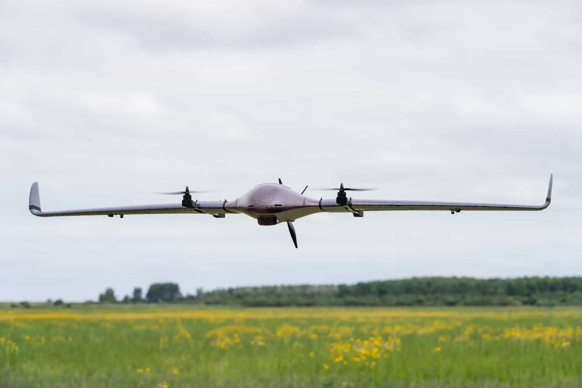
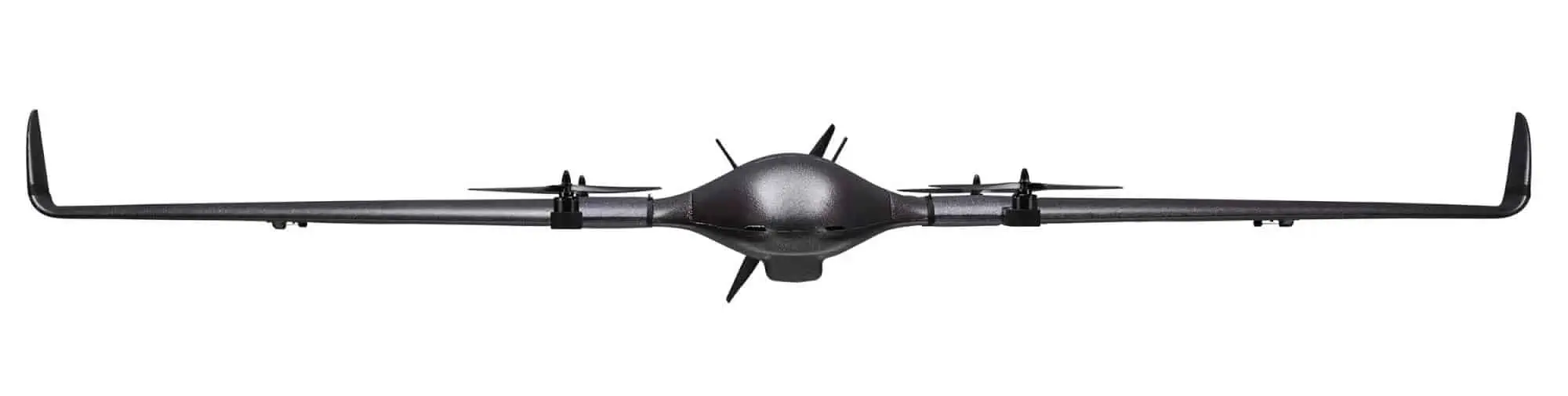
The DeltaQuad pro series features fully electric UAVs that excel in both quadcopter and fixed-wing modes, seamlessly transitioning between the two. These drones offer flight durations of up to 110 minutes and operational ranges reaching 100 km. They operate autonomously from takeoff to landing,with interaction capabilities extending to 50 km via radio,or virtually unlimited range through VPN-secured mobile networks.
Utilizing the open-source PX4 autopilot firmware and the Pixhawk flight controller system, the deltaquad platform is highly adaptable, with avionics that are continuously tested and updated. With a payload capacity of 1.2 kg, the deltaquad Pro can accommodate a diverse range of payloads, including imaging and video equipment, environmental sensors, and custom integrations.


Every DeltaQuad UAV comes equipped with flight simulation software, enabling users to practice potential missions and familiarize themselves with the ground control station prior to actual flights. Additional software tools include an online flight log visualization system and a Mission Validator, which helps pilots ensure that their mission plans adhere to best practices and safety protocols.


Learn More: DeltaQuad VTOL UAV
DeltaQuad Series Models
DeltaQuad Pro #CARGO
Adaptable Cargo VTOL UAV for Transport and Custom Solutions

The DeltaQuad Pro #CARGO is a robust VTOL fixed-wing UAV tailored for cargo delivery and the integration of specialized payloads. It features a spacious payload compartment located directly over the aircraft’s center of gravity, constructed from durable EPO plastic foam for enhanced impact resistance.
This innovative payload bay mechanism allows for cargo release with or without parachutes, programmable as part of an autonomous flight plan or controlled remotely via the ground control station. The bay accommodates packages measuring up to 15 x 10 x 9 cm and weighing a maximum of 1 kg.
Learn More: DeltaQuad Pro #CARGO
DeltaQuad Pro #MAP
VTOL Mapping UAV for Agriculture, Mining, and Construction

The DeltaQuad Pro #MAP is a commercial-grade VTOL fixed-wing mapping UAV equipped with a fully integrated payload mount compatible with various high-quality cameras from top manufacturers like Sony and Micasense.
This aircraft features a reinforced Asahi Dragontail glass window in the payload bay’s base,safeguarding camera equipment from dust and damage during takeoff and landing. Capable of covering up to 1200 hectares in a single flight, the DeltaQuad Pro #MAP achieves a resolution of 3cm/px, with centimeter-level accuracy available through a PPK payload option.
Learn More: DeltaQuad Pro #MAP
DeltaQuad Pro #VIEW
VTOL UAS for Surveillance Operations

The DeltaQuad Pro #VIEW is a high-performance VTOL fixed-wing UAV designed for advanced surveillance tasks, offering a range of payload options from static RGB cameras to controllable EO/IR gimbals, all paired with a carefully selected video transmission system for superior quality and range.
this UAV can operate autonomously or be controlled remotely, boasting a flight endurance of up to 110 minutes and the capability to cover distances of up to 100 km in a single flight.

Three distinct surveillance payload options are available,each offering unique features and capabilities:
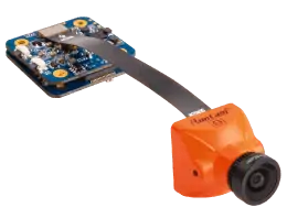
Static Nose Camera Solution
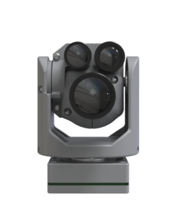
NextVision X80 Long-Range EO Stabilized Camera
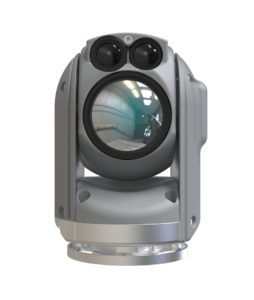
NextVision Nighthawk2-V EO-IR Stabilized Camera
Learn More: DeltaQuad Pro #VIEW
DeltaQuad Evo
Next-Generation eVTOL UAV

The latest addition to DeltaQuad’s lineup is the Evo—a cutting-edge eVTOL UAV. Tailored for governmental and commercial use, the Evo excels in two key areas: payload versatility and flight endurance. It can accommodate up to two single or one double payload, enabling the combination of various sensors for multiple applications in a single flight or even the option to carry an additional battery for extended flight times of up to 4.5 hours.
Learn More: DeltaQuad Evo
APPLICATIONS
Agriculture & Forestry
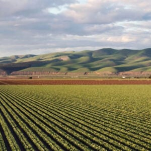
The DeltaQuad Pro #MAP VTOL UAS serves as an extraordinary tool for agriculture and forestry, utilizing advanced sensors to gather data that can lead to actionable insights. it can generate orthomosaic maps and 3D models using cameras with resolutions up to 61 MP, while the Micasense RedEdge MX offers multispectral imaging for detailed assessments of plant health.
Learn More: Mapping Drones for Agriculture & Forestry
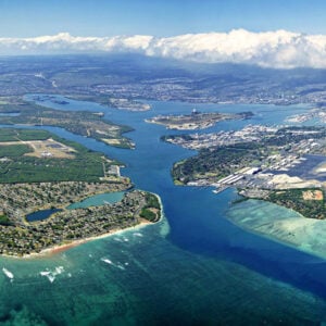
Geospatial
The DeltaQuad Pro #MAP provides centimeter-level accurate, high-resolution geospatial data. It allows for the acquisition of GIS data and imagery through a comprehensive UAV solution that can cover extensive areas and autonomously take off and land. The DeltaQuad pro #MAP can autonomously survey designated areas and return for landing.
Learn More: Surveying Drones for Geospatial
Oil & Gas
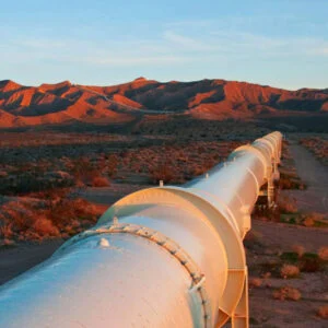
The DeltaQuad Pro #VIEW can autonomously inspect up to 100 km of pipeline and monitor remote locations from distances of up to 50 km, identifying defects, leaks, corrosion, and hazards using high-resolution thermal and RGB video. The system is capable of flying predefined corridors while automatically adjusting to terrain.
Learn More: Drone Solutions for Oil and Gas
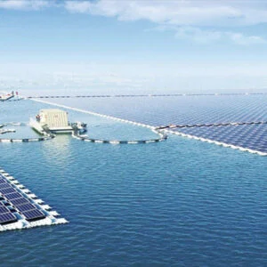
Utilities & Infrastructure
In a single flight, the DeltaQuad Pro #VIEW can survey up to 100 km of power lines, water pipelines, railways, or roads, or monitor up to 1000 hectares of solar panels, providing remote oversight from distances of up to 50 km. Its combined thermal and RGB video capabilities enable the detection of damage, faults, and hazards, as well as monitoring for water leaks and vegetation growth.
Learn More: Fixed Wing VTOL Drones for Utilities Inspections
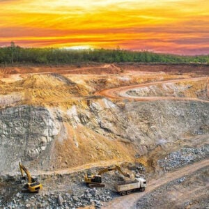
Mining & Construction
The DeltaQuad Pro #MAP offers numerous benefits for mining and construction projects, delivering high-resolution geospatial data with centimeter-level accuracy. This data can be utilized to create orthomosaic maps, 3D models of quarries, and calculate stockpile volumes, among other applications.
Learn More: VTOL drones for Mining and construction
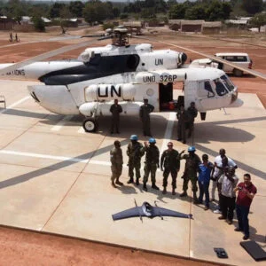
security & Defense
The DeltaQuad pro #VIEW is exceptionally suited for aerial reconnaissance, providing real-time thermal and HD RGB video with a transmission range of up to 30 km, or unlimited range when utilizing a mobile network. Its VTOL capabilities enable deployment in virtually any habitat, with a setup time of just two minutes.
Learn More: Surveillance Drones for Defense and Security
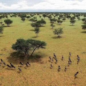
Humanitarian Deliveries & Wildlife Monitoring
The DeltaQuad Pro #CARGO is capable of delivering goods to remote locations, with the ability to take off and land in confined spaces. With a payload capacity of 1.2 kg, it can transport essential items such as medical supplies, blood samples, and nutritional aid.
The DeltaQuad Pro #VIEW offers a range of critical functionalities for wildlife rangers and conservationists. Its RGB and thermal imaging capabilities can be employed for anti-poaching efforts, wildfire detection, animal tracking, and aerial reconnaissance in hazardous areas.
Learn More: Drones for Humanitarian and Wildlife