Kongsberg Geospatial stands at the forefront of developing essential software solutions that enhance mapping functionalities, geospatial data portrayal, and situational awareness for UAVs (unmanned aerial vehicles) and other uncrewed systems.
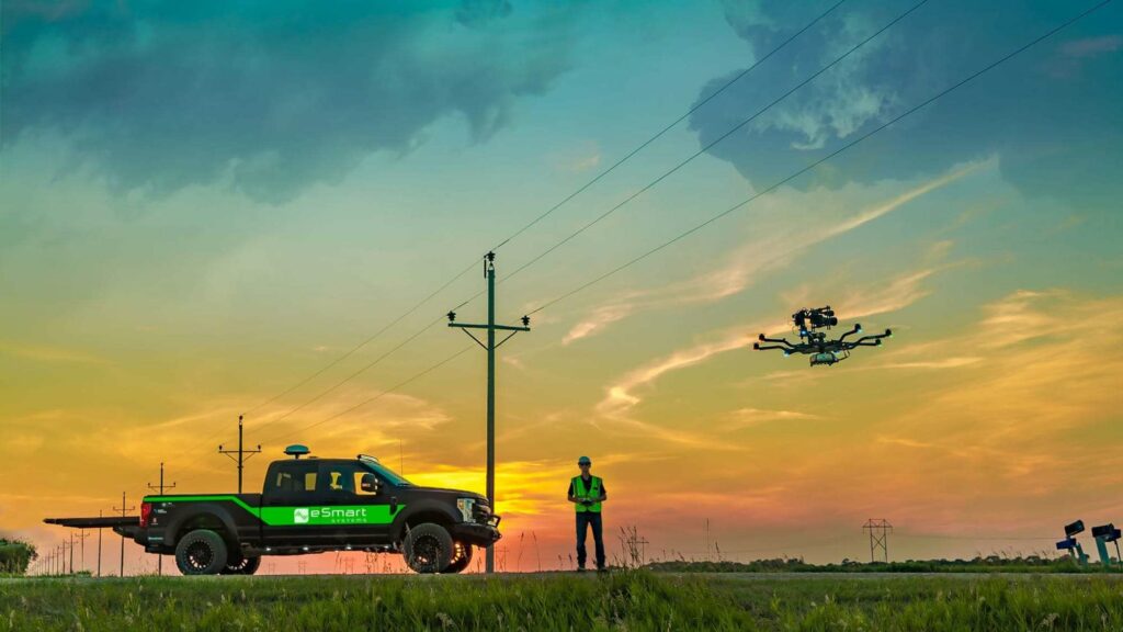
Our advanced geospatial solutions empower the future of both civilian and military BVLOS (beyond visual line of sight) drone operations, while also facilitating UTM (unmanned traffic management) and airspace awareness, crucial for the seamless integration of UAVs into civilian airspace.
Explore:
- IRIS Terminal – Comprehensive airspace visualization
- IRIS GCS – ground control software for BVLOS UAS fleets
- TerraLens – Geospatial software development toolkit
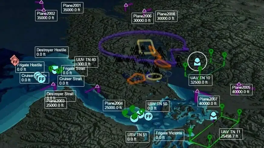
IRIS Terminal
Comprehensive Airspace Visualization for BVLOS UAS Operators
IRIS Terminal serves as a real-time airspace visualization tool tailored for enterprise UAS operators and testing sites engaged in BVLOS operations. By leveraging real-time data from both cooperative and non-cooperative sources such as ADS-B, RADAR, EOIR sensors, TASA sensors, AIS sensors, and telemetry, IRIS Terminal delivers a comprehensive view of the operational airspace in a unified interface.

Additionally, our collision avoidance feature calculates the anticipated flight paths of all detected aircraft, identifies duplicate tracks, and notifies the operator of any potential airspace conflicts or separation issues. An optional web-based component (IRIS Webviewer) enables operators to share live updates and tracks with field teams using LTE-enabled tablets.
For further details: IRIS Terminal
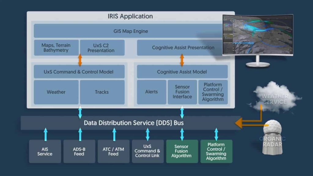
IRIS GCS
Ground Control Software for BVLOS UAS Fleets
IRIS GCS is a comprehensive ground control station software suite that enhances real-time situational awareness for UAVs operating beyond visual line of sight (BVLOS), and is equally suitable for usvs (unmanned surface vessels) and UUVs (unmanned underwater vehicles).
IRIS GCS allows for the simultaneous tracking of multiple vehicles in real-time, integrating 2D and 3D mapping and terrain data, aeronautical facts, sensor data, camera feeds, and drone telemetry, along with ATM/UTM (air/unmanned traffic management) data streams.
For more information: IRIS GCS
TerraLens
Geospatial Software Development Toolkit
TerraLens is a robust software development kit (SDK) that empowers users to effortlessly create real-time 2D and 3D GIS (geographic information system) mapping and geospatial data visualization applications. This toolkit enables developers to overlay map data with various geospatial data sources, including live data feeds, databases, maps, and images.
Offering essential features and functionalities without the necessity of building a new display framework from the ground up, TerraLens supports deployment across a diverse range of platforms, operating systems, and device types.
For additional details: TerraLens – Geospatial Data Visualization Platform

