CHC navigation (CHCNAV) offers state-of-the-art navigation, positioning, and mapping solutions tailored for various industries, including geospatial, construction, navigation, and agriculture. Our extensive offerings encompass terrestrial, marine, and aerial surveying, GNSS systems, 3D LiDAR reality capture, precision agriculture technologies, unmanned navigation, robotics, and real-time GNSS infrastructure.

With a workforce exceeding 1,900 and a presence in over 130 countries, we prioritize strong customer relationships to meet the changing demands of dynamic environments. Our global reach guarantees prompt and customized solutions to address specific challenges.
CHC Navigation stands out in technology integration, providing holistic solutions that range from ground to aerial mapping, GNSS surveying, 3D mobile mapping, machine control, and agricultural auto-steering. Our real-time GNSS augmentation services substantially improve accuracy and dependability across all platforms, transforming measurement and navigation capabilities. CHCNAV’s dedication to innovation is reflected in our substantial investments in research, focusing on advanced positioning algorithms, LiDAR and GNSS technologies, cloud solutions, and streamlined workflows.

Navigate to:
- Mobile mapping Solutions
- Portable Laser Scanners
- lidar Data Processing Software
- UAV Mapping Solutions
- Aerial Surveying Cameras
- Navigation and Positioning Sensors
- Unmanned Surface Vehicles
- Partnership opportunities
Mobile Mapping Solutions
Professional LiDAR Scanning Systems for Mapping and Surveying
CHCNAV’s advanced LiDAR scanning solutions integrate precision laser scanners with cutting-edge GNSS and IMU technologies, facilitating rapid and accurate data collection for UAV and mobile mapping applications.
Our diverse product range offers various options for altitude, range, data acquisition rates, and accuracy, ensuring you find the perfect solution for your mapping and surveying needs.
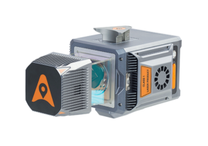
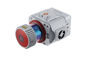
AlphaAir 10 A combined LiDAR and RGB camera system for aerial mapping and surveying
AlphaAir 15 A lightweight and high-density aerial LiDAR scanner
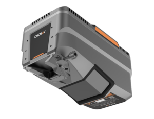
AlphaAir 450 A UAV LiDAR scanner designed for 3D mapping and surveying
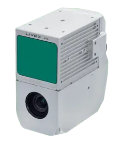
AU20 MMS An advanced mobile mapping system for vehicle-mounted geospatial data collection
AlphaUni 20 A versatile LiDAR solution for mapping and geospatial applications
AlphaUni 1300 A high-precision, long-range multi-platform LiDAR solution
Discover More About Mobile Mapping Solutions
Portable laser Scanners
Advanced SLAM Scanner with Integrated GNSS
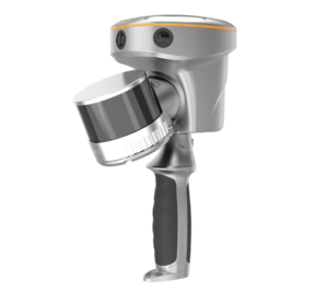
We offer high-performance handheld laser scanners designed for reality capture and measurement tasks. Our innovative CHCNAV scanners uniquely merge advanced GNSS capabilities with the latest SLAM technology, providing exceptional versatility and efficiency that surpass traditional SLAM scanners. These highly effective devices empower professionals to create precise 3D point clouds with remarkable ease, making them suitable for a variety of applications, including building documentation, construction verification, and infrastructure inspection.
Explore More About Handheld Laser Scanners
LiDAR Data Processing Software
CoPre
Fast and Efficient Processing of UAV and Mobile Mapping Data
is a robust and user-friendly software suite designed for the rapid processing of geospatial data collected by UAVs and mobile mapping systems. compatible with all our LiDAR scanners, it offers immediate access to raw data and features automated workflows for enhanced efficiency.
the software includes a range of valuable functionalities such as precise trajectory processing, point cloud and image georeferencing, point cloud colorization, filtering, and digital ortho model (DOM) generation.
CoProcess
Advanced Post-processing Software for Large Point Cloud Datasets
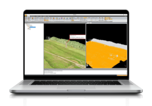
is a complex software solution tailored for the post-processing of extensive point cloud datasets.It offers both automatic and manual extraction and classification of features such as ground, vegetation, buildings, roads, power lines, and more, converting raw data captured by UAVs and mobile mapping vehicles into various multi-format deliverables.
the software boasts a comprehensive suite of capabilities, including DEM and DTM creation, volume calculations, and output to DAT or DXF formats for seamless integration with leading software like AutoCAD and ArcGIS.
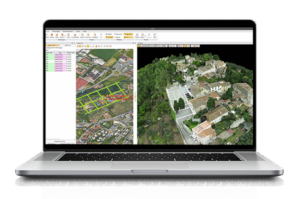
CoCloud
Cloud-Based 3D Data Processing and Management Software
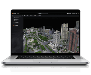
is a cloud-based platform designed for 3D data processing and management, specifically for survey-grade applications that require high-quality photogrammetric outputs without dependence on local hardware. This platform streamlines complex workflows and supports the processing and visualization of multi-source data, including DOMs, dense point clouds, and OSGB models. Advanced photogrammetry engines ensure centimeter-level accuracy in orthophotos and textured 3D meshes,enabling drone mapping teams and geospatial professionals to maintain consistent precision across extensive survey missions.
With one-click workflows and real-time collaboration features, CoCloud replaces traditional desktop GIS tools with a flexible, web-based experience tailored for UAV-derived data. Whether for urban planning, volumetric analysis, or asset inspection, CoCloud provides a unified surroundings for 3D data acquisition, interpretation, and deployment.
Discover More About LiDAR Data Processing Software
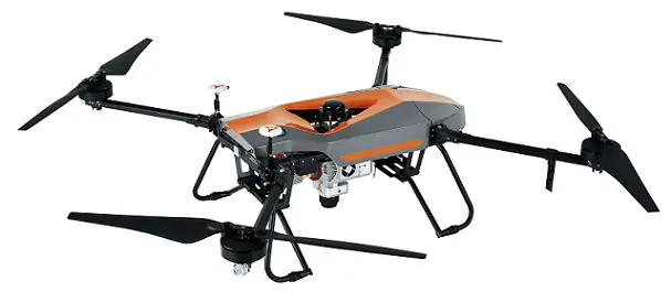
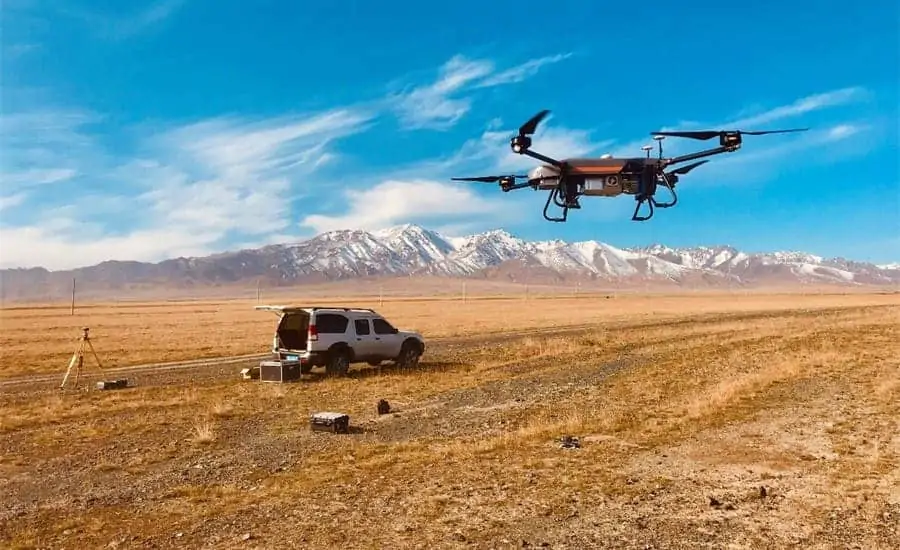
UAV Mapping Solutions
Multirotor Drone Platforms for Mapping and Surveying
We provide high-performance multirotor UAV platforms designed for professional and industrial imaging tasks. These highly efficient and adaptable UAVs can be outfitted with a variety of payloads, including lidar scanners for generating high-accuracy 3D point clouds, orthophoto cameras, and both half-frame and full-frame oblique cameras for 3D photogrammetry.
X500 Multirotor Drone A professional-grade drone designed for exceptional payload capacity and endurance
BB4 A versatile drone mapping UAV
BB4 – LiDAR mapping Drone
State-of-the-art UAV designed for LiDAR and photogrammetry applications.
Discover UAV Mapping Technologies
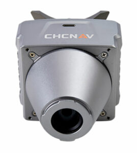
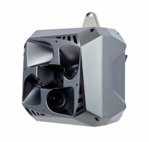
Aerial Survey Cameras
Orthographic and oblique imaging solutions for drone photogrammetry
Our aerial survey cameras are designed to be lightweight and compact, allowing seamless integration with various fixed-wing and multirotor drone systems without compromising their performance. These cameras can operate independently on RTK-enabled drones for high-resolution photogrammetry or can be paired with CHCNAV’s LiDAR systems to produce colorized point cloud data.
C5 Aerial Survey Camera
Orthographic full-frame, fixed-focus camera system.
C30 Aerial Survey Camera
High-performance oblique photogrammetry system.
Explore More About aerial Survey Cameras
Navigation and Positioning sensors
GNSS, INS, and Hybrid Technologies for Autonomous Vehicles
CHC Navigation leads the way in developing cutting-edge technologies, including hybrid GNSS+INS sensors, IMU modules, and GNSS antennas tailored for unmanned systems, robotics, and autonomous driving applications. Our automotive-grade ISO 26262 advancement processes ensure that you receive cost-effective positioning and navigation solutions with unparalleled accuracy and reliability.
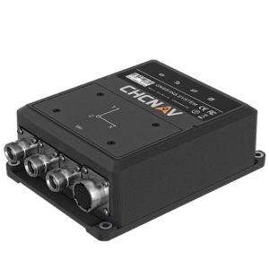
CGI-830 GNSS/INS Integrated Receiver
High-performance ground truth GNSS+INS system.
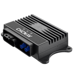
CGI-230 Combined Inertial Guidance Sensor
Tightly coupled automotive-grade GNSS/INS system.
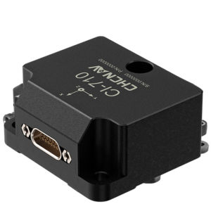
CI-710 High-Performance IMU Sensor
High-precision MEMS inertial measurement unit.
Discover Our Navigation and Positioning Solutions
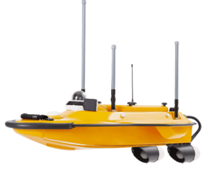
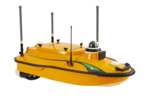
Unmanned Surface Vessels
USVs for Hydrographic, Bathymetric, and Hydrological Surveys
Our compact and lightweight USVs are perfect for a variety of marine survey applications, equipped with high-performance sensors such as single and multi-beam echosounders, LiDAR scanners, and ADCPs. These robust vessels feature integrated inertial navigation and RTK GNSS capabilities, ensuring high-accuracy measurements and navigation even in challenging environments.
APACHE3
Bathymetric survey USV with single-beam echosounder.
APACHE3 Pro
Professional survey USV with autonomous obstacle avoidance.
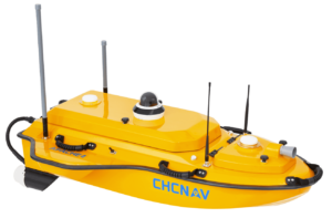
APACHE4
Autonomous surface vehicle for ADCP surveys.
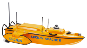
APACHE6
Autonomous USV optimized for multibeam echosounders.
Learn More About Our Unmanned Surface Vessels
Dealership Opportunities

Become a Dealer for Marine Survey Solutions
Our Marine Division produces Unmanned Surface Vessels suitable for hydrographic and bathymetric surveys across various water bodies, including coastal areas, ports, and inland lakes. Our USVs can be equipped with instruments like single or multibeam echosounders and GNSS RTK receivers.
To support the expansion of our Marine Division,we are offering dealership opportunities to marine survey professionals in multiple regions.
Mobile Mapping Dealership opportunities
We are also seeking to expand our dealership network to mobile mapping solution providers, offering the adaptability to provide one or more of our mobile mapping products based on the specific needs of clients in your area.
Diverse Uses of Geospatial Technology
Geospatial technology has a wide range of applications that enhance various sectors. These include mapping roadways and highway corridors, modeling facades and heritage sites, capturing natural surfaces, inspecting power lines, creating digital terrain models (DTM), and developing 3D city models, among others.
Innovative Applications in Geospatial Technology
From urban planning to environmental monitoring, the versatility of geospatial technology is evident. As an example, in urban development, 3D city modeling allows planners to visualize projects in a realistic context, facilitating better decision-making. Similarly, digital terrain modeling is crucial for understanding landforms and managing natural resources effectively.
Current Trends and Statistics
As of 2023, the global geospatial analytics market is projected to reach $100 billion, reflecting a growing reliance on spatial data across industries. This surge is driven by advancements in technology and an increasing need for precise data in decision-making processes.


