
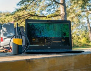
YellowScan stands at the forefront of developing advanced integrated UAV (unmanned aerial vehicle) LiDAR solutions tailored for surveying.
Our LiDAR sensor systems, designed for both fixed-wing and multirotor drones, cater to the needs of mappers, surveyors, UAV service providers, and drone manufacturers.

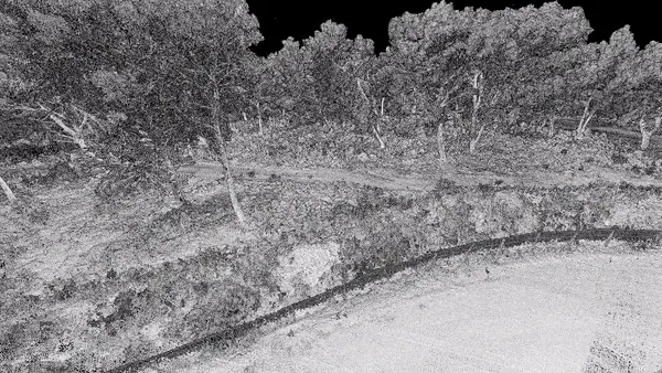
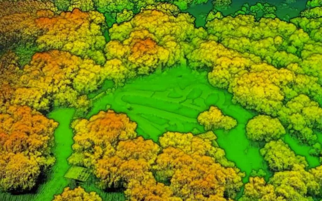
Our lightweight, survey-grade LiDAR technology is versatile, finding applications in various fields such as civil engineering, forestry, environmental studies, mining, and archaeology.
For personalized assistance in selecting the right LiDAR solution,reach out to our educated team,who can provide a tailored proof of concept to meet your specific needs.
Explore Sections:
-
- Comprehensive Drone LiDAR Mapping Solutions
- Comparison of LiDAR Hardware Systems
- LiDAR Mapping Technologies
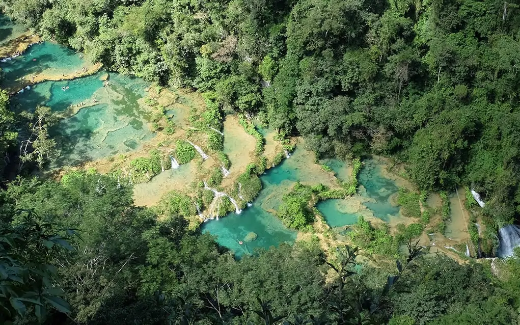
- bathymetric & Topographic LiDAR
- Software Solutions
- Applications of UAV LiDAR
Comprehensive Drone LiDAR Mapping Solutions

Our range of fully-integrated drone LiDAR packages includes:
Advanced Integrated Hardware – cutting-edge LiDAR systems featuring a laser scanner, IMU, GPS, onboard processing, batteries, and data storage all in one unit.
YellowScan CloudStation – User-pleasant LiDAR point cloud processing software that allows for georeferenced point cloud visualization and generation in your preferred projection (output formats available in .LAS or .TXT).
YellowScan LiveStation – Real-time in-flight LiDAR monitoring software,crafted by surveyors for surveyors,ideal for complex and extended operations.
Flight Trajectory Correction
Extensive Customer Support Services – Including system calibration, on-site training, remote health checks, upgrades, warranties, and global support.
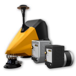
Comparison of LiDAR Hardware Systems
Our lightweight, high-precision LiDAR hardware solutions are fully integrated, featuring embedded batteries.
Explore our fully integrated LiDAR hardware solutions >
Voyager
Extended-range UAV LiDAR with a broad field of view
the YellowScan Voyager is a robust UAV LiDAR scanning solution engineered to capture intricate and vertical targets. With a data acquisition rate reaching up to 1800 kHz, it is perfect for applications demanding the highest point density.
With a wide field of view, all 1.5 million points per second are directed towards the ground, ensuring all points are fully usable.The ability to detect and process up to 15 echoes per laser pulse offers unmatched penetration through vegetation.
The Voyager represents our longest-range UAV LiDAR solution, adaptable to various platforms and mission specifications.

For more details: voyager long-range LiDAR solution
explorer
Long-range multi-platform LiDAR solution
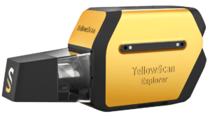
The YellowScan Explorer is a flexible LiDAR solution designed for various UAV platforms, including multirotors, unmanned helicopters, and fixed-wing drones.
equipped with an Applanix APX-20UAV GNSS-inertial system, the YellowScan Explorer provides high-accuracy scanning at altitudes up to 300m AGL and ranges reaching 600m.
Balancing size, range, accuracy, and weight, this system is perfect for a wide array of LiDAR scanning tasks, including surveying, forestry, environmental studies, archaeology, industrial inspections, civil engineering, and mining.


For more details: Explorer long-range LiDAR solution
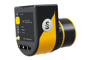
Mapper+
Compact, high-performance UAV LiDAR solution
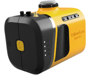
The YellowScan Mapper+ is a compact UAV LiDAR solution that integrates a Livox AVIA laser scanner with a high-performance GNSS-aided inertial navigation system.
This versatile system can be mounted on nearly any UAV and offers three power options: DJI skyport/Gremsy gimbal port, an external UAV power source, or the included field-swappable battery. An RGB camera can also be attached concurrently with the laser scanner for dual-sensor functionality.
The user-friendly Mapper+ features single-button operation and allows for easy data storage and retrieval via USB stick,with a single stick capable of storing data from a 3-hour LiDAR survey.


For more details: Mapper+ UAV LiDAR
Mapper
Next-generation integrated UAV LiDAR mapping
The YellowScan Mapper is a state-of-the-art UAV LiDAR solution utilizing the Livox Horizon laser scanner. With extraordinary point density, this system can be operated at altitudes of 70m AGL with a 120m swath.
The self-powered unit is easily integrable into nearly any UAV, including multirotor, fixed-wing, and helicopter drones. Batteries can be swiftly replaced in the field, enhancing productivity.
The YellowScan Mapper boasts an IPW55 rating, allowing for mission launches even under uncertain whether conditions, and ensuring safe return in case of rain.


More Details: Mapper UAV LiDAR
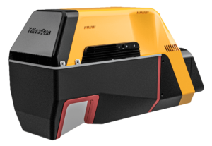
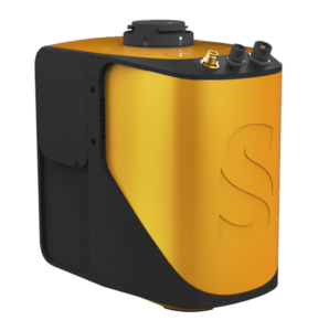
Surveyor ultra
Advanced UAV LiDAR Solution with high Density and Extended Range
The Surveyor Ultra is a cutting-edge UAV LiDAR mapping system that features a Hesai XT32M2X LiDAR sensor and an Applanix APX-15 UAV GNSS-inertial system, ensuring precise positioning and orientation.This system is perfectly suited for high-speed VTOL drones and unmanned helicopters, enabling swift and fully autonomous data collection with optimized range.
Its compact and lightweight design delivers sub-decimetre accuracy and exceptional data density, making it ideal for rigorous mapping and surveying tasks.
More Information: Surveyor Ultra UAV LiDAR
Vx15-100
High-Precision UAV LiDAR Mapping Solution with Long Range
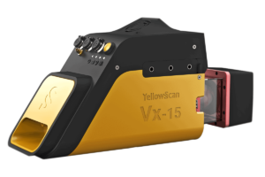
The YellowScan Vx15-100 is a sophisticated UAV lidar mapping solution that integrates a Riegl Mini-VUX-1UAV LiDAR sensor along with an Applanix APX-15 UAV GNSS-Inertial system, ensuring high-quality point cloud generation.
This system is designed for VTOL UAVs and unmanned helicopters, offering a fully integrated, user-friendly experience for rapid and autonomous data collection with minimal processing time.
Its lightweight and compact design guarantees survey-grade precision, even in challenging mapping scenarios involving uneven terrain and dense vegetation.
More Information: VX15-100 UAV LiDAR
Vx15-300
High-Precision Drone LiDAR System Featuring the miniVUX-3UAV
The YellowScan Vx15-300 is the most advanced model in the Vx15 series, offering the same exceptional precision while upgrading to a riegl Mini-VUX-3UAV LiDAR sensor, which provides three scanning frequency options and the highest point cloud density available.
This LiDAR system can be easily mounted on various multirotor drones and unmanned helicopters, operating at altitudes of up to 100m while maintaining accuracy across the point cloud.
Its lightweight and long-range design is perfect for high-altitude UAV mapping and surveying projects that demand sharp, high-accuracy details. More Information: VX15-300 Long Range LiDAR for UAV
Vx20-100
Highly Accurate UAV LiDAR Solution
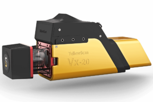
The YellowScan Vx20-100 represents our most precise mobile mapping system, featuring a riegl Mini-VUX-1UAV LiDAR sensor and an Applanix APX-20 UAV GNSS-Inertial system for producing highly accurate point clouds.
this system is designed for easy mounting on VTOL UAVs and unmanned helicopters, allowing operation at altitudes of up to 100m while ensuring accuracy throughout the point cloud.
The compact and lightweight LiDAR package delivers sharp, precise details for demanding mapping and surveying tasks, including uneven terrains and dense vegetation.


More Information: VX20-100 UAV LiDAR
Vx20-300
High-Precision LiDAR System with miniVUX-3UAV Integration
The YellowScan Vx20-300 is the most advanced model in the Vx20 series, maintaining the same exceptional accuracy while upgrading to a Riegl Mini-VUX-3UAV LiDAR sensor, which offers three scanning frequency options and the highest point cloud density.
This system can be easily mounted on quadcopters, multirotor drones, and unmanned helicopters, allowing for fully autonomous mapping and surveying at altitudes of up to 100m.
The lightweight and long-range LiDAR package is designed for high-altitude UAV mapping and surveying projects that require sharp, high-accuracy details, even in challenging environments. More Information: VX20-300 high accuracy UAV LiDAR
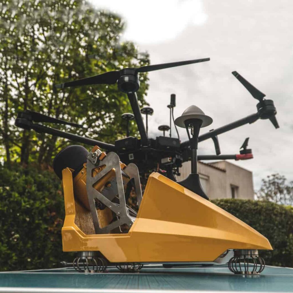
Fly & Drive
Multi-Platform LiDAR for Comprehensive Geospatial Surveying
The yellowscan Fly & Drive is a versatile geospatial LiDAR surveying solution that allows for fast transitions between aerial and ground-based scanning in under five minutes.
Utilizing either the Surveyor or Surveyor Ultra lightweight integrated LiDAR systems, the fly & Drive car pod can be easily mounted on any land vehicle. The sensors are compatible with a variety of multicopter, fixed-wing, and VTOL UAVs.
This adaptable solution combines high-resolution laser scanning with precise positioning, enabling highly accurate geo-referenced point cloud measurements for a wide range of applications.


Discover more about the Fly & Drive system.
Navigator
Integrated bathymetric and Topographic LiDAR Survey Solution
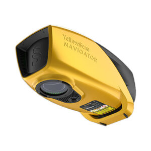
The YellowScan Navigator is a versatile solution that facilitates simultaneous surveying of both land and aquatic environments. Specifically designed for UAV applications, it can be seamlessly integrated with various drone platforms.
This system features a sophisticated laser scanner,a high-precision SBG Quanta Micro IMU,and an integrated RGB camera for enhanced colorization.It is indeed particularly effective for bathymetric measurements in shallow waters, ensuring a smooth transition between underwater and terrestrial data.
With a mission duration of up to 45 minutes on a single charge, the YellowScan Navigator is ideal for extensive underwater data collection across diverse marine settings.
For further details, visit the Navigator bathymetric & topographic survey solution page.
CloudStation
CloudStation: LiDAR Point Cloud Processing Software
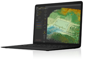
CloudStation is a cutting-edge software solution that simplifies the generation and visualization of point clouds from UAV LiDAR data. Its intuitive interface allows users to process and display data promptly after a flight.
With just a few clicks, users can auto-generate strips and create LAS files, streamlining workflows and boosting productivity. Advanced visualization features include 3D viewing, EDL filtering, and vertical slicing.
CloudStation also offers optional modules such as:
- Strip Adjustment – a user-friendly toolbox for enhancing point clouds and seamlessly adjusting strips.
- Terrain – export classified point clouds to create DSMs, DTMs, and DHMs.
- Colorization – export colorized point clouds from simultaneous LiDAR and camera data.
For more information, check out CloudStation.
LiveStation
Real-Time Monitoring for UAV LiDAR Missions
The YellowScan LiveStation is a software tool designed for professional drone surveyors, enabling real-time monitoring of data quality and validity during complex LiDAR scanning missions.
Compatible with YellowScan LiDAR systems, it provides a 3D visualization of the collected point cloud during flight, allowing users to zoom, pan, and rotate the view. The user-friendly interface offers a comprehensive status overview, including speed, altitude, IMU, GNSS data, and radio signal strength.
For additional details, visit LiveStation.
Applications of UAV LiDAR Technology
Archaeology
Our UAV LiDAR solutions facilitate rapid and precise 3D archaeological surveys, effectively penetrating vegetation and accessing hard-to-reach areas. These systems have been instrumental in mapping ancient settlements and historical battlefields.
Learn more about our applications in Archaeology.
Civil Engineering
The real-time aerial imagery from our lightweight UAV surveying solutions enables construction and engineering professionals to swiftly gather essential data for feasibility studies, earthwork planning, volumetric calculations, and Building Information Modeling (BIM).
Explore more about our offerings in Civil Engineering.
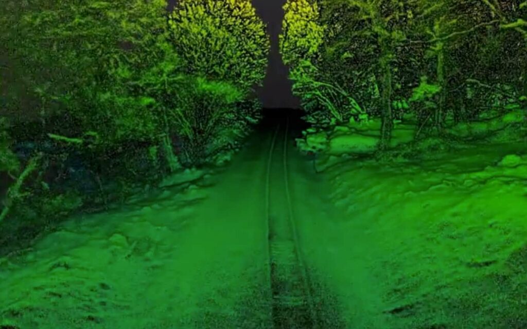
Corridor Mapping
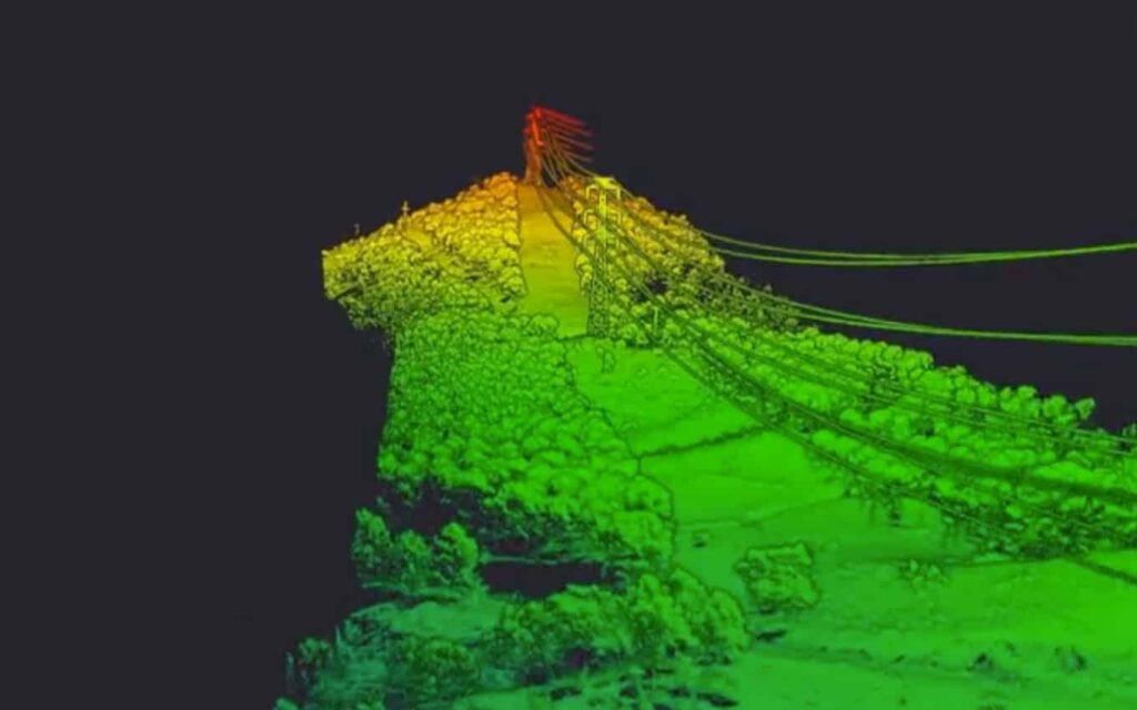
Our UAV LiDAR solutions are perfectly suited for the rapid surveying of power lines and other linear infrastructures, even in challenging terrains or areas with dense vegetation.
Find out more about our capabilities in Corridor Mapping.
Environmental Research
Airborne LiDAR surveys are invaluable for various environmental and climate change research applications, including tree canopy mapping and the creation of digital terrain models.
Learn more about our contributions to Environmental Research.
Forestry
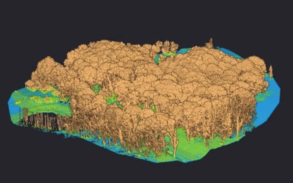
Our systems excel in penetrating vegetation and can operate at lower altitudes and slower speeds than customary airborne LiDAR systems, resulting in superior tree classification, more accurate canopy layer modeling, and improved biomass estimation.
Discover more about our applications in Forestry.
Mining
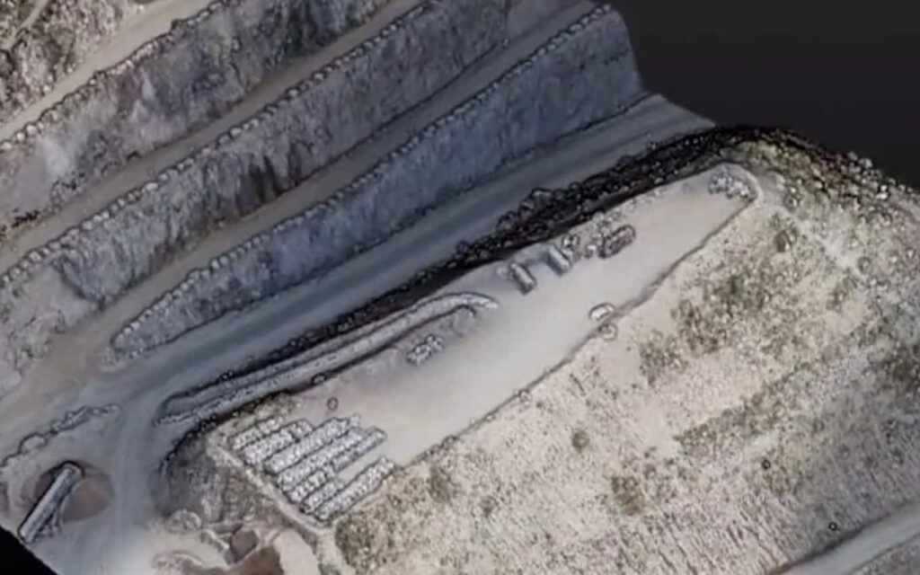
YellowScan’s UAV LiDAR mapping and surveying solutions facilitate effective planning and decision-making in the mining sector,delivering accurate inventory data,precise pit models,and contour maps while minimizing risks to personnel and the environment.
For more information, visit our section on Mining.


