VectorNav stands at the forefront of advanced inertial navigation systems (INS) tailored for unmanned platforms.
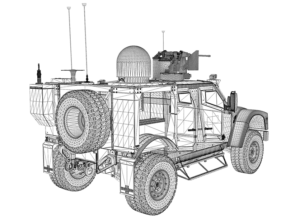
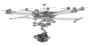
Our tactical and industrial-grade GNSS INS sensors offer unmatched performance and capabilities for UAVs (unmanned aerial vehicles), UGVs (unmanned ground vehicles), UUVs (unmanned underwater vehicles), and various robotic systems.
Our MEMS-based inertial navigation systems ensure extraordinary accuracy and dependability, even in the moast challenging and dynamic environments. With robust performance in compact, SWaP-optimized packages, our inertial systems are perfectly suited for integration into innovative and mission-critical technologies.
Navigate to Section:
- IMU / AHRS
- GNSS / INS
- Dual GNSS / INS
- Inertial Navigation Basics
- Applications of Inertial Sensors
IMU / AHRS
Our Inertial Measurement Units (IMUs) provide high-frequency, low-noise data from accelerometers, gyroscopes, and magnetometers, all calibrated across a temperature range of -40 °C to +85 °C. each unit features an integrated Attitude and Heading Reference system (AHRS) algorithm for real-time, continuous 360° attitude output, ensuring optimal heading estimates even in difficult magnetic conditions.
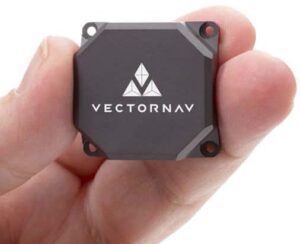
VN-100 – Industrial-Grade AHRS IMU
The VN-100 is a compact industrial-grade IMU/AHRS that integrates 3-axis accelerometers, gyroscopes, and magnetometers with a barometric pressure sensor and a 32-bit processor, all individually calibrated across the full operating temperature range.
Offered in SMD or rugged enclosed configurations, it provides a real-time 3D attitude solution that remains continuous over 360 degrees of motion.
- Heading: 2.0° RMS
- Pitch/Roll: 0.5° RMS
- Gyro In-Run Bias (typ.): 5-7°/hr
- Accel In-Run Bias: 40 µg
Discover more: VN-100 – miniature AHRS IMU
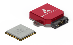
VN-110 – Tactical-Grade IMU/AHRS
the VN-110 is a compact tactical-grade IMU/AHRS that merges cutting-edge MEMS inertial sensor technology with advanced proprietary filtering algorithms to achieve top-tier performance.
In addition to calibrated sensor outputs, the VN-110 computes and provides real-time 3D orientation continuously over 360 degrees of motion.
Available in a miniature embedded board-mount or rugged IP-rated enclosures, the VN-110 facilitates miniaturization and cost-efficiency in unmanned systems and payloads, achieving an exceptional level of SWaP optimization.
- Static Pitch/Roll: < 0.05˚
- Gyroscope In-Run Bias: < 1°/hr
- Accelerometer In-Run Bias: < 10 µg
- Accelerometer Range: ±15 g
Discover more: VN-110
GNSS INS
VectorNav’s GNSS-Aided Inertial Navigation Systems, equipped with industry-leading inertial navigation algorithms, provide superior accuracy and dynamic performance compared to standalone GNSS or INS. By outputting data from accelerometers, gyroscopes, and magnetometers, along with attitude (yaw, pitch, roll), position, velocity, and timing, our GNSS/INS systems exceed the capabilities typically expected from their size and weight.
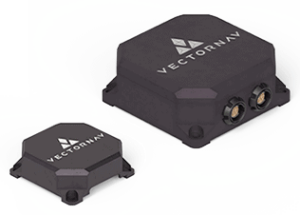
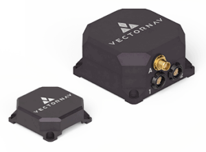
VN-200 – Industrial-Grade GNSS/INS
The VN-200 is a compact industrial-grade GNSS/INS that integrates 3-axis gyros, accelerometers, and magnetometers with a high-sensitivity 72-channel GNSS receiver and advanced Kalman filtering to deliver optimal estimates of position, velocity, and attitude.
It is indeed available in a rugged clamshell enclosure or a surface mount package.
- Dynamic Heading Accuracy: 0.2°
- Dynamic Pitch/Roll Accuracy: 0.03°
- Gyro In-Run Bias: 5-7°/hr
- INS Output: 400 Hz
Discover more: VN-200
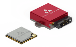
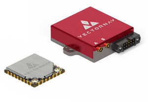
VN-210 – Tactical-Grade GNSS/INS
The VN-210 is a compact GNSS/INS that features the latest MEMS inertial sensor technology, a multiband GNSS receiver, and aerospace-grade Extended Kalman Filter algorithms.
Providing high-accuracy, low-latency position, velocity, and attitude measurements, it is available in rugged DO-160G-rated enclosures or miniature embedded board-mount configurations.
The VN-210 is perfect for gimballed ISR payloads, SATCOM antennas, and other unmanned systems and subsystems. It also supports external SAASM GNSS for defense applications in ISR, electronic warfare, munitions, and UAV navigation.
- Dynamic Heading: 0.05˚-0.1˚
- Dynamic Pitch/Roll: 0.015˚
- Gyroscope In-Run Bias: < 1°/hr
- Accelerometer In-Run Bias: < 10 µg
Discover more: VN-210
Dual GNSS / INS
Our dual GNSS-aided INS solutions leverage tightly-coupled MEMS inertial sensors and high-sensitivity GNSS receivers to deliver a robust inertial navigation solution for both static and dynamic applications. These dual GNSS-INS systems provide seamless estimates of heading,pitch,and roll,ensuring superior performance in challenging operational conditions without relying on a magnetometer.
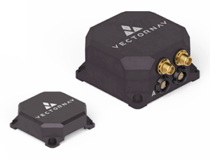
VN-300 – Dual Antenna GNSS/INS
The VN-300 is a compact industrial-grade dual-antenna GNSS/INS that combines advanced MEMS inertial sensors with two high-sensitivity GNSS receivers.
Providing highly accurate estimates of position, velocity, and orientation, the VN-300 operates independently of vehicle dynamics or magnetic sensors, delivering exceptional performance in both static and dynamic scenarios.
The surface mount option can be directly integrated into a user’s electronics, while the rugged enclosed “plug and play” version offers enhanced protection for internal sensors, receivers, and electronics.
- GNSS-Compass Heading: 0.3°
- Dynamic Heading: 0.2°
- Dynamic Pitch/Roll: 0.03°
- Gyroscope In-Run Bias: < 1°/hr
Discover more: VN-300
VN-310 – Tactical-Grade Dual Antenna GNSS/INS
the VN-310 is a compact tactical-grade dual-antenna GNSS/INS that utilizes the latest MEMS inertial technology and two 72-channel multiband GNSS receivers. It provides high-accuracy position, velocity, and attitude data under both static and dynamic conditions.
Available as a compact embedded board-mount module or a rugged aluminum enclosure, the VN-310 is ideal for high-precision pointing, stabilization, and direct georeferencing. The unit also supports external SAASM GNSS for defense applications in ISR, electronic warfare, munitions, and UAV navigation.
- GNSS-Compass Heading: 0.3°
- Dynamic Heading: 0.05˚-0.1˚
- Dynamic Pitch/Roll: 0.03°
- Gyro In-Run Bias (typ.): 5-7°/hr
Discover more: VN-310
Inertial navigation Basics
We have created a detailed educational guide on the principles of inertial navigation. Our Inertial Navigation Basics covers:
- operational Theory (GNSS, MEMS Sensors, AHRS, GNSS/INS)
- Mathematical Fundamentals (Reference Frames, Attitude, Filtering, Feedback)
- Specifications & Error Budgets (IMU Specifications & calibration, INS Error Budget, GNSS Error Budget)
- Hardware (Asynchronous & Synchronous Serial, RF, EMI).
The VectorNav Library is your gateway to understanding Inertial Navigation.
Applications of inertial Sensors

EO/IR Surveillance – Gimbal Pointing
Gimballed payload systems are crucial for gathering real-time intelligence, surveillance, and reconnaissance (ISR) data, enabling precise pointing of the payload independent of the vehicleS attitude.
Our INS navigation products can provide geo-referenced position data for EO/IR sensor suites and other payloads.
Case Study: octopus ISR Achieves Precision Geo-Lock
Delivering reliable and accurate navigation data with the VN-200 MEMS inertial navigation system for a stabilized dual-sensor UAV gimbal. Read it here >
Learn more about GNSS INS solutions for precision open-loop pointing
SATCOM On-the-Move – Antenna Pointing
Satellite communications (SATCOM) and SATCOM on-the-move (SOTM) products and services enable continuous mobile communications from virtually anywhere.
A significant challenge for any SATCOM system is maintaining a line-of-sight (LOS) connection with the target satellite – our GNSS/INS solutions provide the high-accuracy pointing necessary for transmitting large volumes of data without interference from adjacent satellites.
Case Study: high-Precision Antenna Pointing
Providing critical position and attitude data with the VN-200 INS Nav for SATCOM on-the-move terminals. Read it here >
Learn more about precise stabilization and pointing for SATCOM on-the-move
LiDAR Mapping – Georeferencing LiDAR Data
high-precision position and attitude are critical for UAV LiDAR mapping systems that produce accurate georeferenced point cloud data. We offer high-precision MEMS INS solutions that facilitate rapid and reliable mobile mapping systems.


Case Study: Next-Generation Aerial lidar mapping
LidarUSA’s ScanLook Revolution mapping system featuring an integrated VN-300 Dual-Antenna MEMS inertial navigation system.Read it here >
Learn more about georeferencing for high-accuracy LiDAR mapping and surveying systems
Aerial Photogrammetry – Direct Georeferencing
Survey-grade UAV photogrammetry employs high-precision GNSS/INS in conjunction with powerful post-processing software to produce precise outputs such as orthomosaics, Digital Surface Models, and 3D point clouds.
Our direct georeferencing solutions facilitate highly efficient aerial mapping with minimal or no requirement for ground control points (GCPs).
Case Study: A New Approach to Precision Aerial Photography
Overwatch Imaging’s TK-series camera systems utilize the VN-200 for accurate georeferencing. Read it here >
Learn more about GNSS/INS sensors and system integration for directly georeferenced UAV mapping
Additional Case Studies
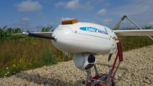
Hydra Technology Takes Flight
The Hydra S45 medium-range UAV employs the VN-200 for its primary navigation. Read it here >
Neya Systems Navigates to Success
Providing navigation and attitude data with the VN-200 GPS/INS for an unmanned systems autonomy module. Read it here >
Red Bull Air Race Pursuit of Perfection
Utilizing the VN-300 to drive an augmented reality solution and deliver high-accuracy data for judging. Read it here >
Aerial Triangulation Report Summary
Independent validation of the performance specifications for the VN-200 and VN-210 INS sensors. Read it here >


