Terra drone has harnessed the cutting-edge Direct Georeferencing (DG) technology from Trimble Applanix, integrating the APX-15 UAV with POSPac® UAV Cloud Software to create the innovative Terra lidar One.
The APX-15 UAV from Trimble Applanix is a lightweight, energy-efficient GNSS-inertial solution specifically engineered for unmanned aerial vehicles. Its data is processed through Applanix’s POSPac UAV Cloud software, which seamlessly produces the most accurate trajectory (position and orientation) in a cloud environment.
Additionally, the system incorporates the POSPac lidar QC Tools module, which facilitates automatic boresighting and trajectory adjustments based on LiDAR data.
Introducing Terra LiDAR One
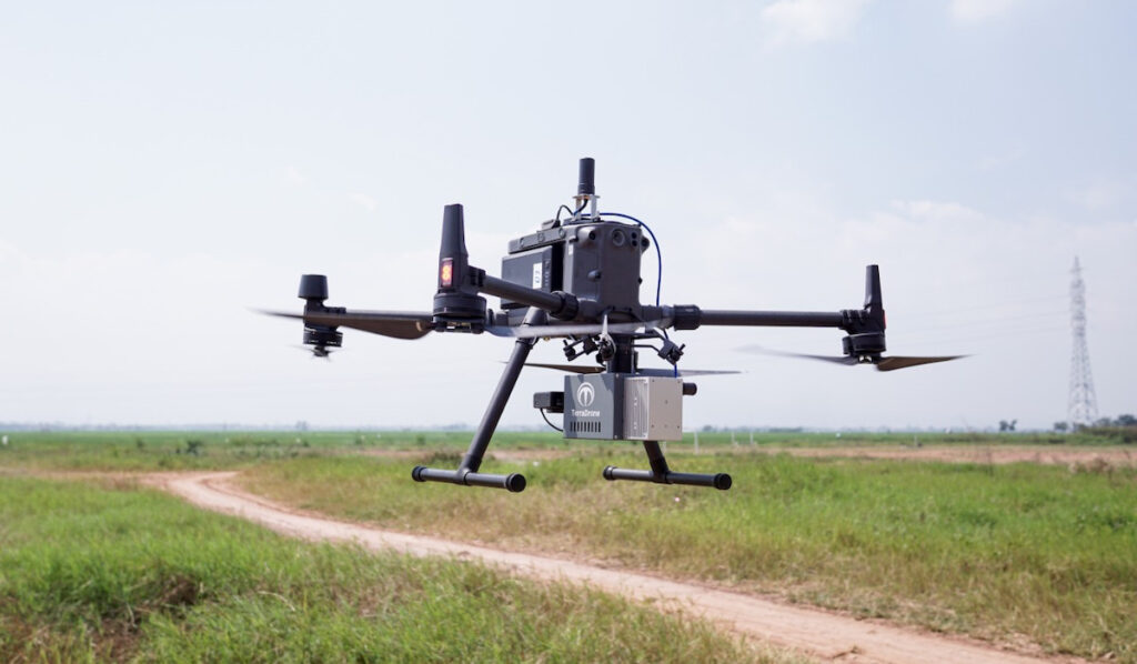
In a bid to deliver tailored drone solutions for various projects, Terra Drone embarked on the development of a specialized UAV payload that integrates a laser scanner and camera, forming a high-precision solution.

Terra LiDAR One
To achieve both precision and efficiency, Terra Drone sought a DG solution that was compact and lightweight for UAV applications while maintaining high reliability and automated processing capabilities.
By integrating Trimble Applanix’s DG solutions,Terra Drone successfully developed a lightweight LiDAR and camera payload.This innovative solution produces an accurate, georeferenced map of the surveyed area, ensuring that all sensor data is positioned with centimeter-level accuracy.
the result is the Terra LiDAR One,a drone solution designed for high-accuracy mapping that can operate in diverse environments,including densely vegetated areas and hard-to-reach locations. This system combines the UAV, payload, and cloud-based processing software to effortlessly create final mapping products.
With Trimble Applanix Direct Georeferencing, Terra LiDAR One stands out as an intuitive, cost-effective, and highly precise drone mapping solution, addressing the challenges of an aging workforce and the increasing demand for surveying aging global infrastructure.
The Trimble APX-15 UAV, in conjunction with POSPac UAV Cloud Software, offers a complete GNSS-Inertial Direct Georeferencing solution for UAVs, with POSPac UAV Cloud post-processing available as a service.

Benefits of Utilizing Survey Drones
The use of drone technology for surveying and mapping has seen a remarkable increase in recent years, primarily due to substantial cost and time savings, along with its user-amiable nature and convenience.
survey drones enable the rapid generation of high-resolution survey data, including orthomosaic images, LiDAR point clouds, and intricate 3D models, for regions where data may be outdated or nonexistent.
These precise maps and models are produced swiftly, even in complex or hard-to-access environments, considerably reducing the costs associated with traditional ground or manned aerial data collection methods.
Read the original article >>


