Revolutionizing Aerial Mapping: The alphaair 10 System
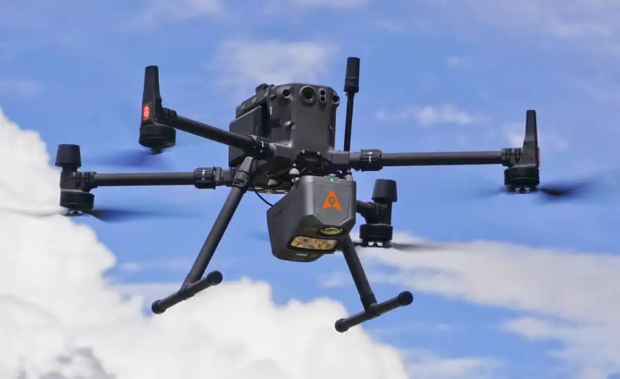
CHC Navigation (CHCNAV) has unveiled the AlphaAir 10 (AA10), an innovative airborne mapping solution designed for drones. This system integrates cutting-edge LiDAR technology, precise GNSS positioning, IMU orientation, and a robust full-frame orthophoto camera. The AA10 is compatible with various UAV platforms, boasting a lightweight and compact design, along with advanced multi-target capabilities that enable it to detect up to eight echoes. This feature substantially enhances its ability to penetrate dense foliage and accurately capture ground surfaces.
Unmatched Precision and Efficiency
The AA10 employs a complex navigation algorithm that collaborates with CHCNAVS LiDAR to achieve a remarkable 5 mm repeatability and outstanding absolute precision within a range of 2 to 5 cm, even in challenging environments. it can perform long-range measurements of up to 800 meters and scan at an extraordinary rate of 500,000 points per second. The system’s continuously rotating mirror allows for scanning speeds of 250 scans per second, thereby improving the detail captured during aerial mapping operations.
Simultaneous Data Acquisition
By merging LiDAR technology with a 45MP full-frame orthographic internal camera, the AA10 facilitates the simultaneous collection of point cloud data and numerous high-resolution images in a single flight. This integration significantly boosts mapping and surveying efficiency compared to traditional methods, which often require multiple flights to gather data separately from LiDAR and cameras.
Streamlined Post-Processing
The CoPre and CoProcess software suite complements the AA10 by simplifying post-processing and feature extraction through an intuitive and efficient data workflow. the high-quality point cloud data generated is utilized to create a mesh model, followed by effective 3D model reconstruction that incorporates realistic colorization using high-resolution image textures.
Lightweight and Durable Design
Weighing just 1.55 kg,the AA10 is designed for extended flight times,offering up to 30 minutes of operation when paired with drones like the DJI M350. Additionally, the system is rated IP64, ensuring its durability and reliable performance across various operating conditions.
Expert Insights
Andrei gorb, product Manager at CHC Navigation, stated, “The AlphaAir 10 Airborne LiDAR + RGB system marks a significant advancement in aerial surveying technology. Its precision, advanced scanning capabilities, efficient data acquisition, and user-kind design reflect CHCNAV’s dedication to delivering innovative 3D reality capture solutions that empower geospatial professionals. When combined with CHCNAV’s point cloud and image fusion modeling software, the AA10 offers a cost-effective and efficient method for airborne 3D data collection and processing.”


