RIEGL, a frontrunner in 3D LiDAR innovation, has introduced groundbreaking products at INTERGEO 2024 in Stuttgart, Germany.
The newly launched RIEGL VUX-10025 UAV LiDAR sensor and the RiLOC-F IMU/GNSS solution promise to significantly advance the unmanned aerial industry with their extraordinary capabilities in extensive terrain mapping and accurate drone orientation. This introduction further solidifies RIEGL’s standing in the drone surveying sector,addressing a diverse array of applications within the unmanned aerial systems (UAS) domain.
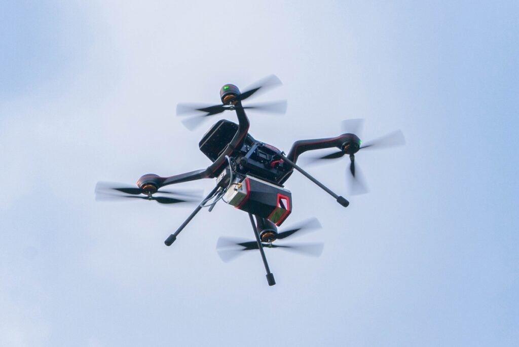
The RIEGL VUX-10025 is a compact UAV LiDAR sensor engineered for effective wide-area mapping. Featuring an notable 160-degree field of view and a pulse repetition rate reaching 1,500 kHz, it excels in mapping intricate terrains, including narrow canyons, with remarkable accuracy.
Highlighted Features
- Extensive field of View: 160-degree coverage, perfect for terrain mapping.
- Rapid Pulse Repetition Rate: Up to 1,500 kHz, ensuring dense data acquisition.
- Lightweight Construction: Weighing just 2.36 kg, suitable for drones and small crewed aircraft.
- versatile Integration: Can be utilized as a standalone sensor or combined with IMU/GNSS systems and optional cameras.
For tailored system solutions by expert integrators, a custom OEM version of the RIEGL VUX-10025 is available, offering specific interfaces and reduced weight.
This sensor can deliver up to 1.3 million measurements per second with a scanning speed of 200 lines per second, supporting flight altitudes of up to 360 m (1,200 feet). Its lightweight design facilitates seamless integration with various drone types, including multirotors, fixed-wing, and VTOL platforms.
The RiLOC-F system enhances orientation and localization through its MEMS-based IMU and GNSS unit, fully integrated into RIEGL’s software workflow for efficient data processing.
Introducing RiLOC-F
Precision IMU/GNSS Solution for VUX-Series Laser Scanners
also launched at INTERGEO, the RiLOC-F is a fully integrated subsystem for localization and orientation, building on the success of the RiLOC-E product, wich has garnered positive feedback from the industry. Designed to attach directly to RIEGL VUX-series laser scanners, RiLOC-F is an optimal solution for small-scale LiDAR surveying using drones.
The RIEGL RiLOC-F IMU/GNSS solution is compatible with the following VUX-series laser scanners:
- RIEGL VUX-12023
- RIEGL VUX-10025
This comprehensive solution integrates a high-precision Micro-Electromechanical System (MEMS) Inertial Measurement Unit (IMU), a GNSS unit, and RIEGL-developed software, streamlining the user experience.
Post-processing of trajectory and scan data occurs entirely within RIEGL’s RiPROCESS, negating the need for third-party software and resulting in accurately aligned and consistent point clouds. enclosed within a robust housing, this entry-level and cost-effective solution is especially suited for applications involving uncrewed platforms, such as multirotor, fixed-wing, or VTOL drones.
Additional Releases from RIEGL at INTERGEO 2024
moreover,RIEGL has introduced the VQ-1560 III-S dual-channel airborne LiDAR system and the VZ-4000i-25 long-range terrestrial scanner,enhancing their offerings for various airborne and terrestrial mapping needs.
RIEGL VQ-1560 III-S
Dual-Channel Waveform Processing Airborne LiDAR Scanning System
The RIEGL VQ-1560 III-S is a state-of-the-art dual-channel airborne LiDAR scanner,capable of mapping extensive areas with exceptional point density. As the latest addition to RIEGL’s established dual-channel laser scanning system series, it is suitable for a broad range of airborne mapping applications.
The well-known “cross-fire” scanning pattern provides both forward and backward views at the edges of the swath, along with a nadir view in the center, ensuring optimal point distribution for effective target sampling. High pulse repetition rates of up to 4.4 MHz enable operational flying altitudes of up to 1,600 m AGL, or up to 3,900 m AGL at a pulse repetition rate of 560 kHz (all values based on 20% target reflectance).
A high-performance IMU/GNSS unit and one or two optional high-resolution RGB/NIR cameras are seamlessly integrated into the compact,user-pleasant housing.
The excellent scanning pattern and extensive operational range position this instrument as one of the most versatile airborne laser scanners available today. it is perfectly suited for a variety of applications, from ultra-dense corridor mapping at low altitudes to high-resolution city mapping with minimal shadowing effects in narrow street canyons, and large-scale wide-area mapping at remarkable efficiency of up to 1,130 km² per hour at a density of 4 points per square meter.
RIEGL VZ-4000i25
Long-Range 3D Terrestrial Laser Scanner
The RIEGL VZ-4000i25 is a long-range terrestrial LiDAR scanner designed for enhanced productivity and adaptability. With a range of up to 4,600 meters, this system excels in applications such as mining, topography, and cultural heritage documentation. Its connectivity features, including integrated WiFi, cloud synchronization, and support for custom applications, make it a highly flexible tool for various surveying tasks.
The VZ-4000i25 boasts an impressive 4,600-meter range and is rated IP64 for durability in challenging environments. Real-time GNSS/IMU registration and one-touch operation simplify data acquisition and processing workflows.
Connect with the RIEGL team at INTERGEO 2024 at Booth H1.024 in Hall 1


