
CHC Navigation (CHCNAV) explores how LiDAR technology enhances operational efficiency and precision, considerably minimizing delays and bolstering safety in mining operations.
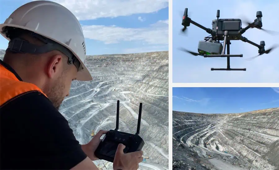
Unmanned Aerial Vehicles (uavs) outfitted with LiDAR technology can swiftly survey extensive areas,delivering real-time insights essential for strategic decision-making. This capability accelerates the surveying process while also reducing the risk too personnel by limiting their exposure to possibly hazardous environments.
Enhanced Operational Efficiency
UAVs equipped with LiDAR can gather millions of accurate data points every second, generating intricate 3D representations of mining sites. This innovative approach greatly surpasses customary surveying methods, allowing for rapid coverage of vast areas with fewer personnel, thus optimizing survey operations and cutting down on time and labor expenses.
Exceptional Precision
lidar technology offers high-resolution data that facilitates more precise and informed decision-making. By producing highly accurate 3D models,LiDAR allows for exact volume calculations,stockpile assessments,and slope evaluations.
Enhanced Safety Measures
A meaningful advancement brought by LiDAR is its role in improving the safety of surveyors.Conventional surveying often requires personnel to work in hazardous conditions, such as near active blasting sites or unstable ground.By reducing the necessity for human presence in these risky areas, aerial LiDAR surveys greatly enhance the safety of surveying teams.
The extensive article “LiDAR Mapping in Open-Pit Mining: Leading the Way in Efficiency and safety” by CHCNAV introduces the submission of lidar in mining, highlighting the crucial role of surveyors in open-pit mining and the challenges associated with traditional surveying methods.
it further details the LiDAR-based surveying workflow and illustrates how the CHCNAV AlphaUni 20 can optimize this process. This system is vital for efficient operations, featuring compatible sensors, UAV platforms, and software for both flight planning and post-processing. CHCNAV’s solutions create a fully integrated ecosystem, ensuring seamless compatibility and workflow efficiency throughout the surveying process.
The article elaborates on:
- Flight Planning Techniques
- Data Acquisition Methods
- Data Processing Techniques
- Applications of Data
Additionally, it examines CHCNAV’s advanced CoProcess software, which delivers unparalleled accuracy and efficiency in modeling and analysis, supporting:
- Volume Calculations
- Stockpile Evaluations
- Slope Assessments
For a deeper understanding of how to select the appropriate LiDAR systems for open-pit mining, and why CHCNAV’s AlphaUni 20 stands out as a premier choice for mining surveyors—combining high precision, operational versatility, and user-friendliness—read the full article.


