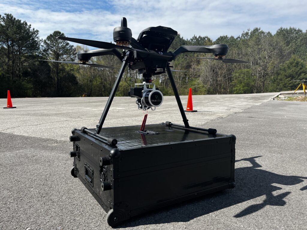
Acecore Zoe integrated with the TrueView 515.
Acecore and GeoCue: A new Era in aerial Data Collection
Acecore Technologies has officially become a recognized partner of GeoCue, enhancing the integration of TrueView 3D Imaging Sensors into their drone offerings.
Expanding Aerial Data Capabilities in Europe
This collaboration is poised to revolutionize aerial data acquisition across Europe, providing innovative solutions for various industries.
Custom Solutions for unique Challenges
the partnership between Acecore and GeoCue stands out due to their shared commitment to tailored solutions. Acecore utilizes its established drone platforms to support additional hardware and features,catering to specific client needs. Meanwhile, GeoCue excels in adapting and integrating LiDAR technology with refined sensors, ensuring that software is customized for optimal results.
this alliance elevates the concept of customization, as trueview payloads are now effectively integrated with Acecore’s drone systems. This synergy allows clients to tackle aerial surveying obstacles more efficiently, significantly improving their ability to gather accurate aerial data. Additionally,both companies actively seek client input to enhance functionality based on unique project requirements.
diverse Drone fleet for Varied Applications
Acecore’s lineup includes three primary drone models: Zoe, Noa, and Neo. Each model is designed with unique specifications regarding size, cost, and configuration, making them suitable for a broad spectrum of applications—from extensive mapping initiatives to detailed inspections and creative projects. Acecore’s drones are engineered to deliver adaptable solutions tailored to diverse user needs.
Performance and Reliability in Challenging Conditions
Out of the box, Acecore drones are built for high performance even in demanding environments, thanks to their robust propulsion systems that feature motor redundancy across all platforms. Real-time flight capabilities are further enhanced by F9P L1/L2 GPS receivers, with an option for dual GPS setups to ensure precise heading corrections. The TrueView 3D Imaging Sensors are securely mounted on Acecore’s industry-standard payload bay, which provides optimal vibration isolation for the sensitive IMU of TrueView.
Commitment to Quality and Innovation
“At Acecore, we are dedicated to delivering top-tier industrial UAV solutions,” stated Jorrit Linders, CEO of Acecore Technologies. “Our drones are meticulously crafted in the Netherlands, utilizing only premium materials. With our roots in high-end cinematography, we focus on creating the most stable platforms, leaving no room for error.”
Vincent Legrand, Vice President of global Sales at GeoCue, remarked: “The integration of Acecore’s drone platforms with TrueView 3D Imaging systems allows us to provide our European clients with unparalleled options for aerial surveys, mapping, and data collection.”
He further emphasized, “GeoCue is committed to collaborating with leading drone manufacturers like acecore to equip our customers with state-of-the-art technologies and solutions. Adding Acecore to our roster of approved drone providers underscores our dedication to delivering the most complete and innovative drone mapping solutions available.”


