Innovative Urban Drone Operations in Canada: A New Era
DeTect Inc., a frontrunner in radar and remote sensing technologies, has partnered with IN-FLIGHT Data to showcase the capabilities of advanced radar systems in managing drone operations beyond the pilot’s visual range (BVLOS), notably in densely populated urban settings.
Enhancing Airspace Safety with Advanced Technology
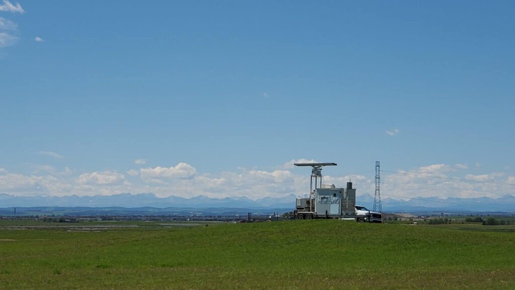
DeTect focuses on cutting-edge radar and remote sensing solutions aimed at safeguarding airspace around critical infrastructures from aerial threats. Their technology is pivotal for drone operators, enabling BVLOS flights while ensuring extensive airspace awareness. This radar system is recognized by regulatory bodies and the industry as a reliable method for monitoring other airspace users,especially at distances beyond human sight.
Pioneering Urban Drone Mapping
IN-FLIGHT data has made history as the first North American drone operator to execute a large-scale urban project aimed at mapping cellular and radio networks. This intricate mission leveraged advanced technologies to achieve its objectives successfully.
Addressing Environmental Concerns
The project faced challenges related to migratory birds, necessitating careful drone operations in park areas near sensitive avian populations. To enhance safety and situational awareness, radar technology was employed to monitor both compliant and non-compliant airspace users, including birds and general aviation traffic. This radar system is already operational in various regions across Canada.
Ensuring Safety in Complex Airspace
“Operating in urban settings, especially when the aircraft is out of the pilot’s line of sight, is inherently stressful. It demands complete focus and situational awareness from the pilot and crew. The airspace was bustling with air traffic control communications and various airspace users. The integrated Unmanned Traffic Management (UTM) system and radar tools were invaluable,not only for mission safety but also for alleviating the stress on our air crew in such a busy metropolitan airspace,” stated Chris Healy,president of IN-FLIGHT Data.
Comprehensive Airspace Surveillance
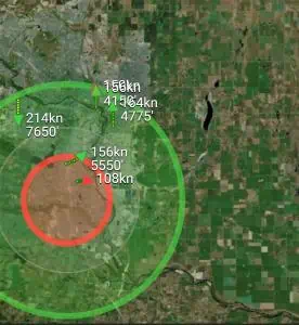
The combined system provided approximately 15 nautical miles (28 kilometers) of airspace monitoring and remote reporting throughout the project area and across Calgary. The visibility around the mission zone at altitudes above 150 feet AGL was remarkable, with complete airspace coverage within 3 nautical miles of the operations. Even extending to 5 nautical miles, the surveillance maintained over 90% coverage in all directions. During July and August 2022, the operational area spanned around 9,000 hectares (approximately 22,000 acres) within Calgary, which has a population of about 1.34 million residents.
Future of Urban Air Mobility
Demonstrating the effectiveness of advanced surveillance technology in a large metropolitan area was crucial for the project’s success. james MacFarlane, General Manager of Canada, emphasized, “Initiatives like the Calgary Project illustrate that for cities to facilitate and expand the future of urban air mobility (UAM), they must first establish and promote networks that qualified air operators can utilize while keeping operational expenses manageable.”
This insight into network performance is essential for fostering future advancements in aviation and evaluating how UAM, drones, and infrastructure can leverage these high-performance networks to drive innovation for urban environments and their inhabitants.


