CHC Navigation (CHCNAV) integrates its state-of-the-art unmanned aerial vehicles (UAVs) with cutting-edge LiDAR technology to significantly enhance the efficiency of aerial mapping. This combination of robust flight capabilities and advanced scanning technology empowers professionals to achieve superior data accuracy, extensive coverage, and streamlined workflow management.
The collaboration between the CHCNAV X500 UAV and the AlphaAir 15 (AA15) LiDAR forms a formidable aerial mapping system, meticulously designed for high-precision data collection across diverse environments. The following sections explore how each element—the X500 UAV and AA15 LiDAR—contributes to improved efficiency and accuracy in aerial mapping.
Maximizing Efficiency with the X500 UAV
The CHCNAV X500 UAV is a high-performance rotor drone specifically engineered for precise aerial mapping tasks.Its complex flight capabilities and significant payload capacity make it ideal for LiDAR-based surveying and geospatial data gathering.
- Substantial Payload Capacity – With the ability to support up to 5 kg, the X500 can carry the 2.5 kg AA15 LiDAR system along with additional equipment like high-resolution RGB cameras. This adaptability allows users to tailor the UAV for various applications while ensuring optimal performance.
- extended Flight Duration – When paired with the AA15 LiDAR,the X500 can achieve flight times of up to 52 minutes. Its dual hot-swappable batteries and clever charging system minimize downtime, facilitating uninterrupted operations.
- Durability in Challenging Conditions – Rated IP55 for dust and water resistance,the X500 operates effectively in winds of up to 12 m/s and endures temperatures from -20°C to 50°C. It is equipped with millimeter-wave radar for obstacle detection up to 80 meters and a visual SLAM system for accurate landings, even on moving surfaces.
- Intelligent Flight Management – CHCNAV’s SmartGo software enhances mission planning with various flight path options, including rectangular, strip, polygonal, and façade routes.It also provides real-time monitoring of the drone and its environment,ensuring safe and efficient beyond-visual-line-of-sight (BVLOS) operations.
AA15 LiDAR: Speed and Precision in Data Collection
The CHCNAV AA15 lidar is a lightweight, high-performance sensor designed for aerial 3D mapping. Weighing only 2.5 kg, it integrates seamlessly with the X500 UAV, optimizing data collection efficiency while ensuring high accuracy.
- High-Density Data Acquisition – With an extraordinary pulse rate of 2 million points per second, the AA15 generates detailed point clouds over extensive areas. Its maximum range of 1,800 meters and operational altitude of 700 meters make it ideal for corridor mapping, urban planning, and topographic surveys.
- Superior Vegetation Penetration – Capable of capturing up to 16 returns per pulse, the AA15 effectively gathers ground elevation data beneath dense foliage. This capability ensures comprehensive datasets for forestry management, floodplain modeling, and environmental monitoring, while reducing the number of required flights.
- Streamlined Workflow Integration – The AA15 works in conjunction with CHCNAV’s SmartGo software for automated data capture and real-time mission tracking.After flights, the CoPre and CoProcess software suite simplifies processing tasks such as georeferencing, feature extraction, and 3D modeling, expediting the transformation of raw data into actionable insights.
A Comprehensive Solution for Aerial Mapping Challenges
The combination of the CHCNAV X500 UAV and AA15 LiDAR system is designed to enhance efficiency, accuracy, and reliability in aerial mapping. Unlike traditional multi-rotor drones that often have limited payload capacities and shorter flight times, the X500’s 5 kg payload support and extended endurance enable longer missions and the integration of high-performance sensors without sacrificing stability.
in contrast to fixed-wing UAVs, which require larger takeoff areas and lack hovering capabilities, the X500 offers precise maneuverability for complex terrains and corridor mapping.
LiDAR systems vary in terms of density, range, and penetration capabilities.The AA15’s 2 million pulses per second and 16-return functionality ensure exceptional point cloud density and ground penetration, minimizing the number of flight passes needed for complete coverage. While some competing LiDAR systems may match its pulse rate, they frequently enough come with heavier payloads, limiting UAV compatibility and overall efficiency.
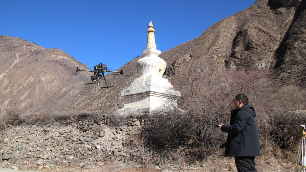
Case Study: CHCNAV X500 & AA15 in High-Altitude Powerline Survey
the Challenge
A 135 km, 220 kV powerline survey in the sichuan Plateau posed significant operational challenges. The survey area featured elevation changes exceeding 1,476 meters, rugged terrain with mountains and rivers, and temperatures dropping to -10°C. Additionally,the presence of high-voltage infrastructure necessitated a system capable of acquiring precise data while maintaining flight stability in unpredictable conditions.
The Solution
the team utilized the CHCNAV X500 UAV, AA15 LiDAR, C5 orthographic camera, and CoPre and CoProcess software. The X500 enabled long-endurance flights across varying altitudes, while the AA15 lidar ensured high-density point cloud acquisition through dense vegetation. The CoPre and coprocess software streamlined data processing, producing high-precision point clouds, digital elevation models (DEMs), and contour lines for powerline analysis.
The Results
- Tripled Efficiency – The X500 UAV and AA15 LiDAR collected 5-6 km of data per flight, achieving three times the efficiency of previous methods.
- High-Quality Data – The AA15’s 2 million pulses per second and 16-return capability ensured accurate ground elevation mapping with point cloud thickness under 5 cm.
- Precision Performance – Testing confirmed a vertical accuracy of 2.5 cm, meeting stringent project specifications even in challenging conditions.
- Operational Reliability – The X500 consistently performed in high-altitude environments, with its smart battery system facilitating continuous operations with minimal downtime.
Essential Insights for UAV-LiDAR Aerial Mapping
Optimizing UAV-based mapping involves balancing data quality, operational reliability, and workflow efficiency. The CHCNAV X500 UAV and AA15 LiDAR exemplify this balance, offering extended endurance, high payload capacity, and precise LiDAR scanning.
This integrated approach guarantees accurate data collection with minimal operational overhead, making it a cost-effective and high-performance solution for aerial surveying professionals.


