
Transformative Partnership in Commercial Drone Technology
At the 2024 Commercial UAV Expo in Las Vegas, YellowScan and WISPR announced a groundbreaking collaboration that merges their expertise, setting the stage for advanced solutions in the commercial drone sector.
Revolutionizing Aerial Data Collection
This strategic partnership aims to significantly enhance industries that rely on precise aerial data, such as infrastructure assessment, land surveying, agriculture, mining, and environmental monitoring.
By integrating YellowScan’s cutting-edge LiDAR technology with WISPR’s innovative UAV systems, this collaboration is poised to elevate the performance and efficiency of commercial drone operations to unprecedented levels.
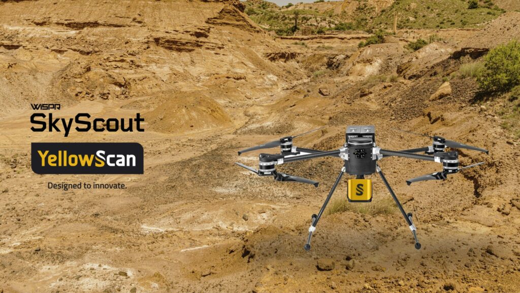
Enhanced Capabilities Through Integration
The alliance capitalizes on YellowScan’s renowned LiDAR systems, celebrated for their ability to capture intricate 3D data, alongside WISPR’s robust drones, wich are distinguished by their durability, adaptability, and autonomous features. This synergy will empower users to obtain high-resolution data with enhanced ease,precision,and cost-effectiveness.
Showcasing Innovation at CUAV Expo 2024
The new integrated system was officially introduced at the CUAV Expo 2024, where attendees were encouraged to visit YellowScan’s Booth 1131. Ther, they could explore the system’s functionalities and engage with technical experts from both companies.
Representatives shared valuable insights into how this integrated solution is set to transform data acquisition, mapping, and analysis for various commercial applications.
Expert Insights on the Collaboration
Joseph Dannemiller, Managing director at YellowScan Inc., expressed enthusiasm about the partnership, stating, “We are excited to collaborate with WISPR as they launch their new SkyScout. The integration of the SkyScout with YellowScan LiDAR effectively meets the needs of the C2 class, which has been largely overlooked in europe.”
“Our LiDAR technology, known for its precision and dependability, complements WISPR’s platforms seamlessly. Together, we are developing a robust solution that will foster innovation in data collection and aerial mapping across North America and Europe.”


