
assessing the Laser Velocity Sensor (LVS) in GNSS-Denied Conditions
Advanced Navigation has conducted an evaluation of its Laser Velocity Sensor (LVS), a cutting-edge technology that employs infrared lasers to accurately gauge a vehicle’s three-dimensional velocity relative to the ground, as detailed in their article titled ‘Laser Velocity Sensor (LVS): A high-Accuracy Velocity Aid for GNSS-Denied Navigation’.
Understanding the Technology Behind LVS
The LVS operates on the principle of laser Doppler velocimetry, which allows it to determine velocity by analyzing the frequency changes in infrared laser beams that bounce off surfaces like land or water. This technology is versatile, making it suitable for various environments, including both terrestrial and aerial platforms, provided that there is a clear line of sight to the surface below.
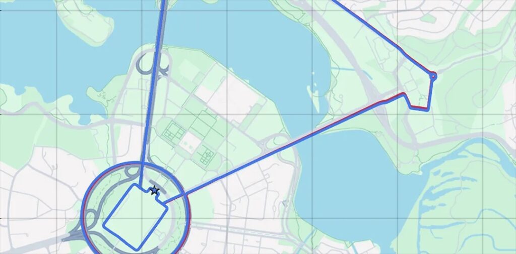
Performance Evaluation in Challenging Conditions
To assess the LVS’s capabilities, a pre-production unit was combined with an Advanced Navigation Boreas D90 fiber-optic gyroscope (FOG) inertial navigation system (INS). This integration was crucial for demonstrating effective navigation in scenarios were GNSS signals are absent. Advanced Navigation highlights the necessity of aligning the reference frames of the LVS and INS to ensure precise velocity measurement translation.
Insights from the Advancement Journey
The article provides a comprehensive overview of the LVS’s evolution, tracing its journey from initial prototypes to real-world testing. Authored by experts Dr. David McManus, Patrick Wiltshire, Mark Gibson, and Dr.Lyle Roberts, it delves into the operational mechanics of the LVS, its integration with navigation systems, and presents empirical data showcasing its ability to maintain navigation accuracy even when GNSS signals are compromised or fully unavailable.
For a deeper understanding, read the complete article >>


