Credit: NOAA
Scientists from NOAA’s Atlantic Oceanographic & Meteorological Laboratory (AOML) and the University of Miami’s Cooperative Institute for Marine & Atmospheric Studies deployed the Black Swift S0 drone during a series of NOAA Hurricane Hunter missions.
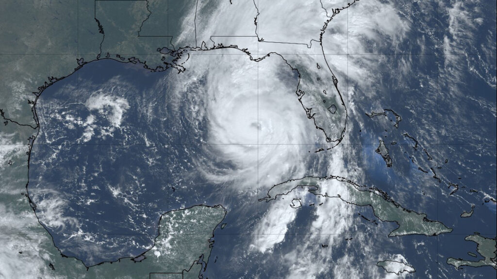
As Hurricane Helene gained strength in the Gulf of Mexico, thes researchers gathered vital data from both aerial and marine sources, aiming to deepen the understanding of tropical cyclones and assist forecasters at the National Hurricane Center.
This immediate data collection offers meteorologists enhanced insights into the storm’s structure and surrounding environment,thereby minimizing forecasting uncertainties.
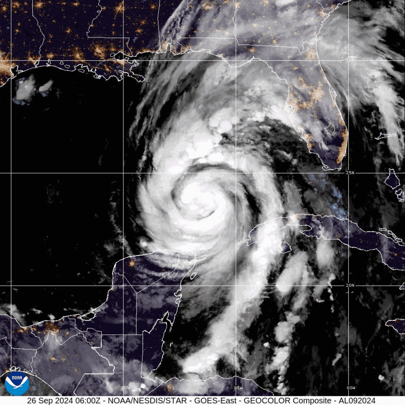
Satellite imagery captures Hurricane Helene as it moves northward from the Yucatan Peninsula into the Gulf of Mexico. Credit: NOAA
Importance of the Black Swift S0
utilized in conjunction with operational radar and dropsonde data, the Black Swift S0 is a compact uncrewed aircraft system (sUAS) specifically designed to gather atmospheric data from the storm’s lower levels, which have previously been difficult to access.
This robust platform is built to withstand extreme atmospheric conditions and is equipped with a sophisticated sensor suite capable of measuring various parameters, including air temperature, wind speed and direction, dew point, and atmospheric pressure.
The black Swift S0 is launched from the underside of a P-3 aircraft and is remotely operated as it penetrates the storm’s lower layers, enabling scientists to investigate the boundary layer—an area where the atmosphere interacts with the ocean, frequently enough too turbulent for manned aircraft.
During its missions into Hurricane Helene, the Black Swift S0 set new records for flight duration and interaction range. After deployment, it remained airborne for 105 minutes and traveled a maximum distance of 169 nautical miles, continuously relaying data back to researchers.
These extended flight times and greater range facilitate prolonged data collection and access to challenging areas within the storm, allowing scientists to gather more extensive data, thus improving the accuracy and scope of their analyses.
Marine Data Acquisition
The data collection efforts during Hurricane Helene extended beyond aerial observations; oceanic data was also gathered using drifters, gliders, and buoys as the storm progressed.
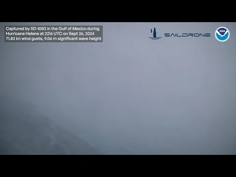
The ocean is pivotal in the formation and evolution of hurricanes, making it a focal point for storms like Helene. while the S0 collected data from above, researchers at AOML and NOAA’s Pacific Marine Environmental Laboratory directed two Saildrone uncrewed surface vehicles directly into Helene’s path.
These vehicles collected data from just above and below the ocean surface, recording peak wind gusts of 95 knots (109 mph) and significant wave heights reaching 9.5 meters (31 feet) within approximately 20 miles of the storm’s center.
In a collaborative initiative, AOML and the Scripps Institution of Oceanography also executed an aerial deployment of drifting buoys—known as drifters—directly into Helene’s path to assess upper ocean conditions, recording wave heights exceeding 8 meters (26 feet).
Discover more about the Black Swift S0 >>


