
CHC Navigation (CHCNAV) has launched CoCloud, its comprehensive cloud-native platform designed for 3D data processing, management, and collaborative analysis.
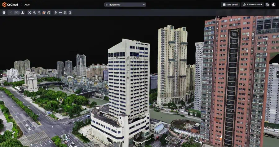
CoCloud offers robust tools for handling multi-source 3D data, facilitating streamlined workflows from data acquisition to deliverable creation without requiring local hardware investment. It features an advanced photogrammetry engine that efficiently processes multi-source data, such as aerial imagery and LiDAR scans. The platform generates high-quality digital orthophotos, point clouds, and OSGB models with professional-grade precision.
Designed to foster teamwork, CoCloud provides tools for online data visualization, sharing, and real-time collaboration on tasks like volume calculations and point cloud editing. Its intuitive, user-friendly interface makes sophisticated 3D data operations accessible without extensive specialized training, supporting efficient project execution. The platform supports various data formats and offers functionalities like dataset and timeline management.
CoCloud is built for adaptability, offering API access and private deployment options. This flexibility allows for integration into existing client systems and supports customized workflows, from initial data collection through to final application delivery, ensuring that organizations can tailor the platform to their specific operational requirements.
Simon Wu, Director of Geospatial Software at CHC Navigation, commented, “CoCloud represents a significant advancement in how professionals handle 3D spatial data. By moving complex processing operations to the cloud, we’ve created a solution that not only reduces hardware requirements but also streamlines workflows and enhances team collaboration across multiple projects and locations.”
CHCNAV’s distributed data center infrastructure in Germany and Ireland enables localized storage and processing of user data. Both facilities strictly comply with the EU’s General Data Protection Regulation (GDPR), ensuring full lifecycle compliance from data collection and transmission to storage.


