
CoCloud Software City 3D Modeling by CHCNAV.
CHC Navigation Introduces CoCloud: A Revolutionary Platform for 3D Data Management
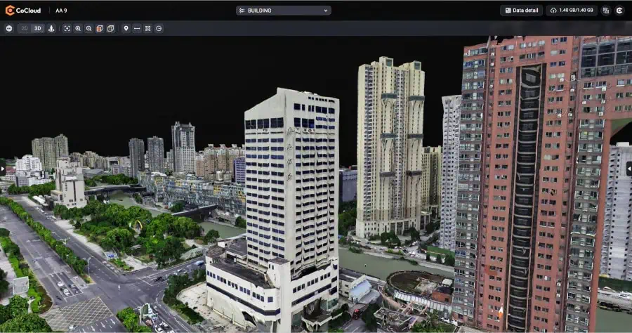
CHC Navigation (CHCNAV) has unveiled CoCloud, an innovative cloud-based platform tailored for the processing, management, and collaborative analysis of 3D data.
Streamlined 3D Data Processing
cocloud is equipped with powerful tools that facilitate the handling of diverse 3D data sources, enabling seamless workflows from data collection to the creation of deliverables without the need for important local hardware investments. The platform boasts a sophisticated photogrammetry engine that adeptly processes various data types, including aerial imagery and LiDAR scans, producing high-quality digital orthophotos, point clouds, and OSGB models with exceptional accuracy.
Enhancing Team Collaboration
Designed with collaboration in mind, CoCloud offers features for online data visualization, sharing, and real-time teamwork on tasks such as volume calculations and point cloud modifications. Its intuitive interface allows users to perform complex 3D data operations without requiring extensive training, thereby promoting efficient project execution. The platform supports multiple data formats and includes functionalities for managing datasets and timelines.
Flexible and Adaptable Solutions
CoCloud is engineered for flexibility, providing API access and options for private deployment. This adaptability allows for seamless integration into existing client systems and supports customized workflows, from initial data gathering to final submission delivery, ensuring organizations can modify the platform to meet their unique operational needs.
Expert Insights
simon Wu, the Director of Geospatial Software at CHC Navigation, stated, “CoCloud signifies a major leap forward in the management of 3D spatial data. By transitioning complex processing tasks to the cloud, we have developed a solution that minimizes hardware demands while optimizing workflows and enhancing collaboration among teams across various projects and locations.”
Data Security and Compliance
CHCNAV’s distributed data center infrastructure, located in Germany and Ireland, ensures localized storage and processing of user data. Both facilities adhere strictly to the EU’s general Data Protection Regulation (GDPR), guaranteeing comprehensive compliance throughout the entire data lifecycle, from collection and transmission to storage.


