News / CHC Navigation /

Compact Single-Beam Echosounder for USV Surveying

chcnav logo.webp

GNSS Positioning & Navigation Systems, Mobile Mapping UAV LiDAR & Unmanned Surface Vehicles

Compact Single-Beam Echosounder for USV Surveying

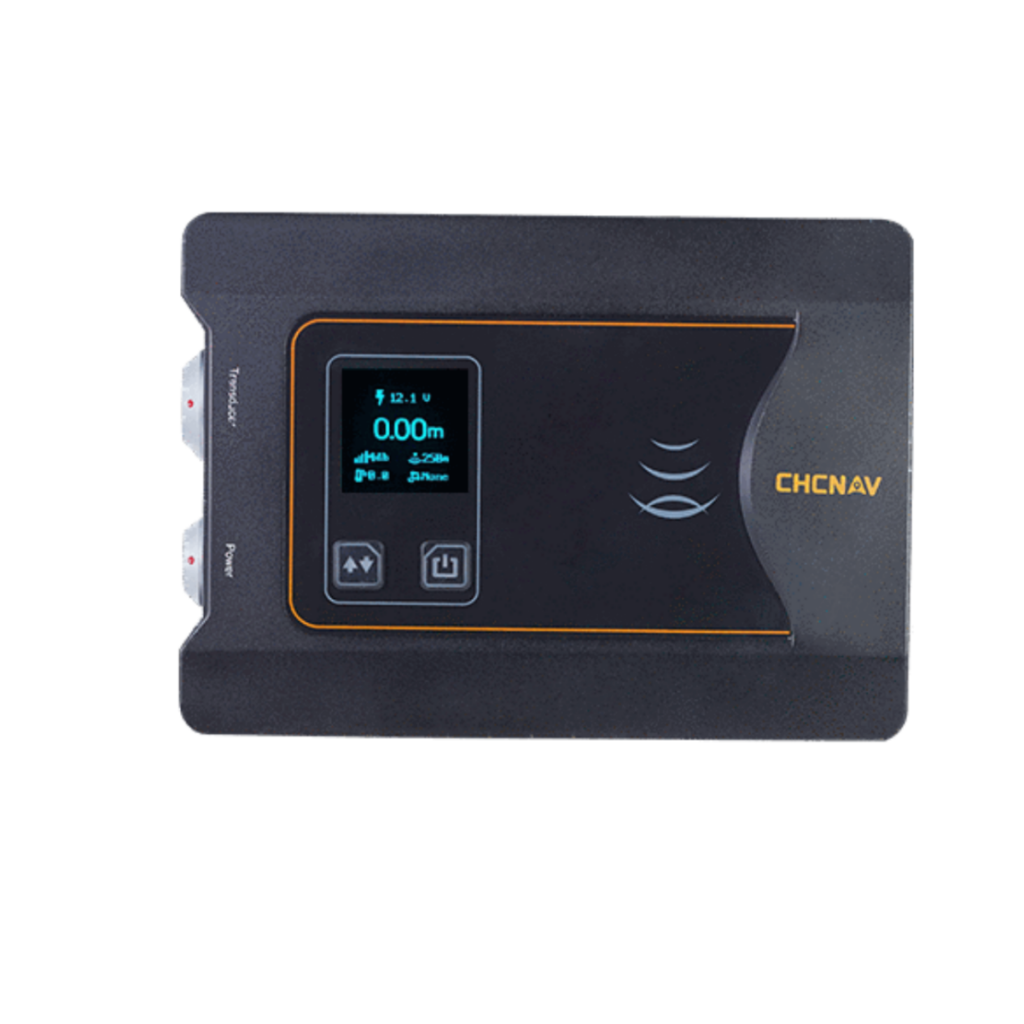
The D270 features a built-in temperature sensor for real-time sound velocity correction

CHC Navigation (CHCNAV) has released the D270, a new single-beam echosounder designed for reliable depth measurement in a range of marine environments. With a 200 kHz frequency and a built-in temperature sensor for real-time sound velocity correction, the D270 echosounder is ideal for a variety of USV (uncrewed surface vessel) applications, including river cross-section measurements, reservoir capacity assessments, environmental monitoring, and dredging volume analyses.

The D270 adapts to changing water conditions while minimizing acoustic interference for reliable data collection. Its built-in temperature sensor enables real-time sound velocity correction, significantly improving measurement accuracy. With 8GB of onboard storage, the unit securely captures large volumes of survey data, and its embedded Linux system supports web-based parameter configuration and chart plotting. Data can also be transferred wirelessly to other devices using Wi-Fi and Bluetooth for improved workflow efficiency.

The D230 features a rugged IP67-rated waterproof and dustproof design. Operators are alerted to shallow water and data anomalies, ensuring safe operation and reliable survey results even in challenging environments.

Taxiya Wang, Product Manager at CHC Navigation, commented: “The D270 provides surveyors with an optimal balance of performance, portability, and value. Its rugged, IP67-rated design, easy-to-use wireless connectivity, and highly efficient workflow give users precise echo-sounding capabilities in a lightweight solution.”

chcnav.webp
GNSS Positioning & Navigation Systems, Mobile Mapping UAV LiDAR & Unmanned Surface Vehicles

577 Songying Road, Qingpu, Shanghai 201703

Send Message

Supplier's Products

RTK GNSS positioning and navigation for robotics and unmanned systems
Precision GNSS navigation system for autonomous vehicles
Long-range LiDAR scanning for UAVs and UGVs
Advanced mapping and survey UAV for LiDAR or photogrammetry
AA450: Airborne LiDAR system with built-in IMU, GNSS, 3D scanner, and camera
USV with integrated ADCP and echosounder
Cost-effective single beam marine drone
USV with Norbit multibeam echosounder
Quick and efficient processing of UAV & mobile mapping data
Orthographic and oblique cameras for drone photogrammetry
Android tablet with RTK GNSS for mapping & surveying
Multi-platform LiDAR solution for mapping & geospatial applications
Professional Airborne LiDAR + RGB System
Professional survey USV with autonomous obstacle avoidance
Versatile single-beam echosounder for bathymetric survey
Advanced post-processing software for massive point cloud datasets
Handheld Slam 3D Laser Scanner + GNSS RTK System
Lightweight, long-range and high-density UAV LiDAR solution
Mobile Long-Range Slope And Monitoring System Monitoring
High performance ground truth GNSS+INS system

More News from CHC Navigation