RIEGL stands at the forefront of innovation,specializing in advanced solutions for UAV (Unmanned Aerial Vehicle) and drone-based LiDAR surveying.
Our cutting-edge LiDAR sensors and laser scanning technologies deliver precise, high-quality data applicable across various sectors, including forestry, construction, mining, topography, corridor mapping, and hydrographic surveys.
Navigate to Section:
- UAV LiDAR Sensors & Corridor Mapping
- Laser Scanners for Topo-Bathymetric Uses
- IMU/GNSS Systems for miniVUX LiDAR Scanners
UAV LiDAR Sensors & Corridor Mapping
INTRODUCING
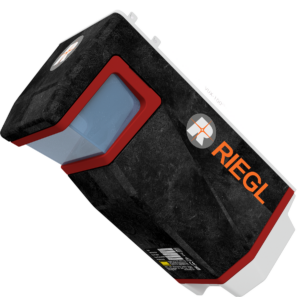
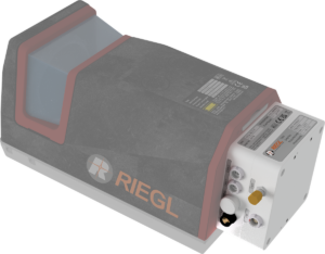
RIEGL VUX-10025
UAV LiDAR sensor designed for extensive area coverage
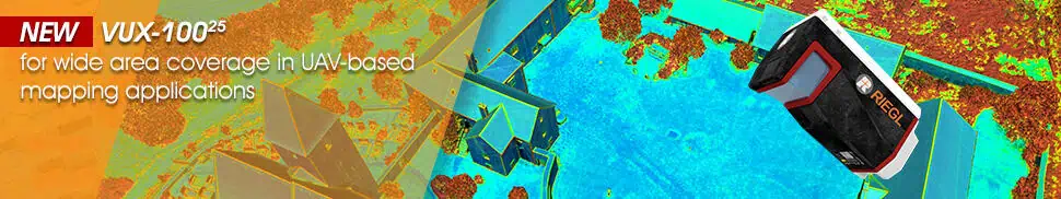
The VUX-10025 is a lightweight UAV LiDAR scanner featuring an extraordinary 160-degree field of view, making it ideal for mapping intricate terrains and narrow canyons. Weighing only 2.36 kg, it can be seamlessly integrated into various drone platforms.
The VUX-10025 boasts a high laser pulse repetition rate of up to 1500 kHz and a scanning speed of 200 lines per second, enabling it to achieve up to 1.3 million measurements per second. It can operate at altitudes reaching 360 meters (1,200 feet).
This scanner is available in both a standard enclosed model and a lightweight OEM version, and can be paired with the RiLOC-F inertial system for improved localization and orientation.
Discover more: RIEGL VUX-10025 – Versatile UAV laser scanner
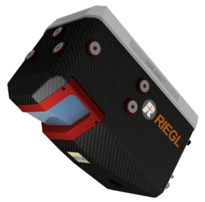
RIEGL VUX-24024
Lightweight Laser scanner for high-altitude UAV operations
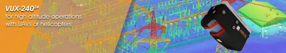
The RIEGL VUX-24024 is a lightweight airborne laser scanner tailored for fixed-wing and multirotor UAVs, as well as unmanned helicopters. With scanning speeds of up to 600 lines per second, this system efficiently covers vast areas, even from fast-moving UAVs.
With a 75-degree field of view and an ultra-fast data acquisition rate of up to 2.4 MHz,this sensor is perfectly suited for high point density corridor mapping tasks.
RIEGL’s advanced Waveform-LiDAR technology offers echo digitization, real-time waveform processing, and multi-target capabilities, allowing it to penetrate dense foliage effectively.
Learn more: RIEGL VUX-24024 – Lightweight UAV Laser Scanner
RIEGL VUX-18024
LiDAR scanner optimized for high-speed surveying with VTOL UAVs
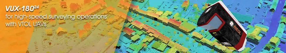
The RIEGL VUX-18024 is a lightweight UAV LiDAR scanner featuring a 75-degree field of view, a pulse repetition rate of up to 2.4 mhz, and a scanning speed of up to 800 lines per second. Thes remarkable specifications make it ideal for high-speed surveys and corridor mapping, and also other applications requiring optimal line and point distribution.
This versatile scanner offers 2 TB of internal data storage and a removable CFast card, along with interfaces for connecting up to five optional external cameras and external GNSS/inertial sensors. It can be utilized as a standalone unit or as part of several fully-integrated UAV scanning solutions.
Learn more: RIEGL VUX-18024 UAV LiDAR scanner
RIEGL VUX-160²³
High-density laser scanner for UAV operations
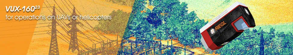
The RIEGL VUX-160²³ is a highly adaptable UAV LiDAR scanner with a 100-degree field of view and an exceptional data acquisition rate of up to 2.4 MHz.It can deliver up to 400 scan lines and 2 million effective measurements per second on the ground, making it perfect for corridor mapping with fixed-wing UAVs.
The scanner’s measuring beam scans in three distinct directions—strictly vertical down, +10° forward oblique, and -10° backward oblique—ensuring thorough data capture, even in challenging environments with vertical surfaces and narrow canyons. with a multi-target capability of up to 32 targets per pulse, it can penetrate dense vegetation effectively.
Learn more: RIEGL VUX-160²³ UAV laser scanner
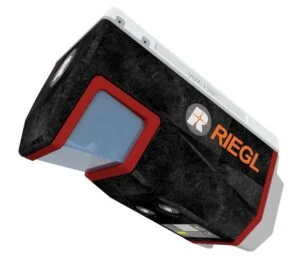
RIEGL VUX-120²³
Laser scanner for UAV surveying at low to medium altitudes
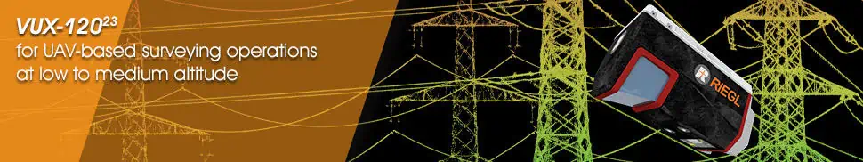
The RIEGL VUX-120²³ is a versatile UAV LiDAR scanner with a 100-degree field of view and an impressive data acquisition rate of up to 2.4 MHz. it can achieve up to 400 scan lines and 2 million effective measurements per second on the ground, making it ideal for corridor mapping with fixed-wing UAVs.
The scanner’s measuring beam scans in three different directions—strictly vertical down, +10° forward oblique, and -10° backward oblique—ensuring comprehensive data capture, even in challenging environments with vertical surfaces and narrow canyons.With a multi-target capability of up to 32 targets per pulse, it can penetrate dense vegetation effectively.
Learn more: RIEGL VUX-120²³ UAV Laser Scanner for Corridor mapping
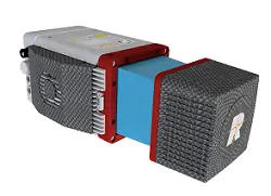
RIEGL miniVUX-3UAV
Miniaturized UAV LiDAR sensor with high measurement rates
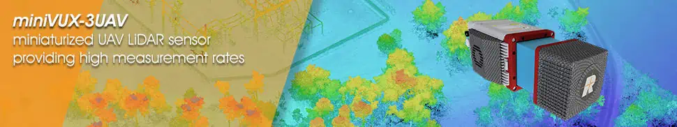
The RIEGL miniVUX-3UAV is a compact, lightweight laser scanner designed to meet the SWaP requirements of UAVs. With a selectable pulse repetition rate of up to 300 kHz, a field of view of up to 360°, and up to 200,000 measurements per second, it provides a high-density point pattern for capturing intricate details.
Utilizing unique Waveform-LiDAR technology, it enables echo digitization and real-time waveform processing, with multi-target resolution for penetrating dense foliage. The miniVUX-3UAV’s wavelength is optimized for measuring snowy and icy terrains.
learn more: RIEGL miniVUX-3UAV – Miniaturized UAV LiDAR scanner
RIEGL miniVUX-1UAV
Miniaturized LiDAR sensor for UAV laser scanning
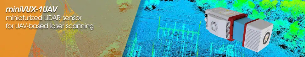
The RIEGL miniVUX-1UAV is an ultra-lightweight laser scanner designed for UAV integration. With a robust aluminum housing, it has a compact footprint, making it perfect for unmanned platforms with limited layouts or payload capacities.
This sensor can achieve up to 100,000 measurements per second and up to 100 scans per second with a 360-degree field of view. RIEGL’s innovative Waveform-LiDAR technology allows for echo digitization and real-time waveform processing, with multi-target resolution for penetrating dense foliage. The miniVUX-1UAV is also optimized for measuring snowy and icy terrains.
Learn more: RIEGL miniVUX-1UAV – Miniaturized UAV LiDAR Sensor
RIEGL VUX-1UAV
22
Versatile, Survey-Grade UAV lidar Sensor
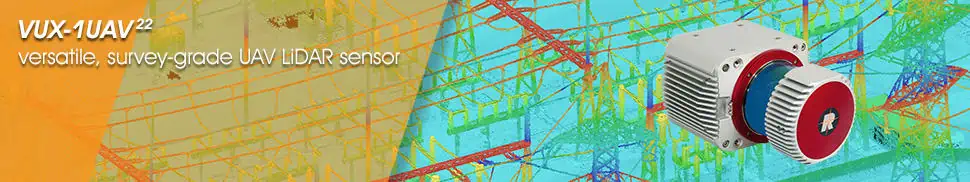
The RIEGL VUX-1UAV
22
is a survey-grade LiDAR sensor with a rugged, compact design that allows for easy mounting on UAVs in any orientation, even under stringent SWaP constraints.
With a measurement rate of up to 1200 kHz and a 360-degree field of view, it offers exceptional measurement performance and virtually unrestricted data acquisition.
Along with the standalone LiDAR sensor, RIEGL provides the RIEGL VUX-SYS, a comprehensive airborne laser scanning system that includes the RIEGL VUX-1UAV22, an appropriate IMU/GNSS unit, a dedicated control unit, and up to four digital cameras. This user-friendly, application-oriented solution is ready for flexible use in UAS/UAV/RPAS, helicopters, gyrocopters, and ultra-light aircraft.
Learn more: RIEGL VUX-1UAV
22
– Survey-Grade UAV LiDAR Sensor
Laser Scanners for Topo-Bathymetric Applications
RIEGL VQ-840-GL
High-performance Topo-Bathymetric Airborne Laser Scanner
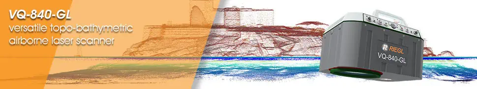
The RIEGL VQ-840-GL is a high-performance scanner designed for combined airborne topographic and bathymetric surveying. Constructed from lightweight materials, it weighs less than 10 kg (22 lbs), making it ideal for UAV integration.
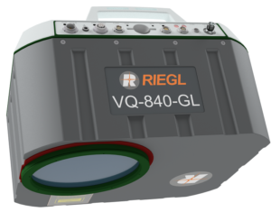
The scanner utilizes a visible green laser capable of penetrating water, allowing for the measurement of submerged targets. Digitized echo waveforms can be stored on a removable data card for later full waveform analysis,enabling users to capture targets with complex multiple-echo signals. The unit can also be integrated with an inertial navigation sensor and a high-resolution digital camera for enhanced accuracy and functionality.
The RIEGL VQ-840-GL is suitable for various applications, including coastline mapping, shallow-water surveys, and engineering assessments.
Learn more: RIEGL VQ-840-GL – Combined topographic and bathymetric LiDAR scanner
RIEGL VQ-840-G
Compact Topo-Bathymetric Airborne Laser Scanner
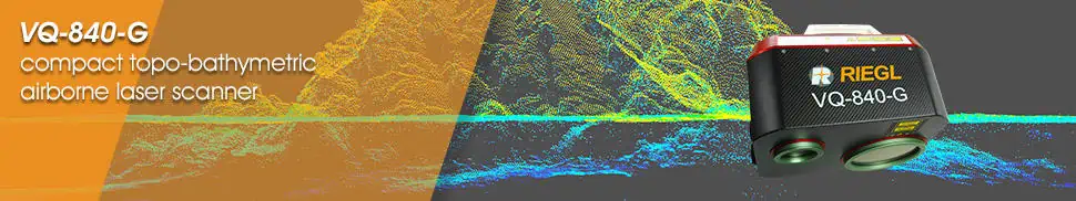
The RIEGL VQ-840-G is a compact and lightweight scanner designed for combined bathymetric and topographic surveying. It can be equipped with an optionally integrated and factory-calibrated GNSS/IMU system and can be complemented with an optional camera or IR rangefinder. The VQ-840-G can be mounted on various platforms, including UAVs.
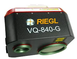
Utilizing a visible green laser, it allows for high-resolution surveying of underwater topography and measurement of submerged targets. With a measurement rate of up to 200 kHz and a high scanning speed of 100 scans/sec, it provides superior spatial resolution, and the system offers concurrent full waveform storage of all measurements for subsequent analysis.
The VQ-840-G is ideal for a wide range of applications, including coastline mapping, hydraulic engineering surveys, and hydro-archaeological assessments.
Learn more: RIEGL VQ-840-G – Compact Topo-Bathymetric airborne Laser Scanner
RIEGL VQ-860-G
Airborne laser scanner with enhanced depth performance
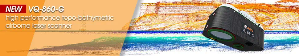
The RIEGL VQ-860-G airborne laser scanner is engineered for high-resolution surveying of inland and near-shore waters, capable of penetrating up to 3 Secchi depths at an altitude of 75 meters. The system includes a digital RGB camera for colorization and an optional fully-integrated IMU/GNSS.
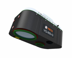
The compact unit weighs 15 kg, making it suitable for larger drone platforms.It features a rugged mechanical structure and a dust- and splash-proof enclosure for long-term operation in challenging environments.
The RIEGL VQ-860-G is perfect for a variety of applications, including coastline mapping, river surveys, hydraulic engineering assessments, and hydroarchaeology.
Learn more: RIEGL VQ-860-G airborne laser scanner
RIEGL VQ-840-GE
Fully integrated laser scanner for combined topographic & bathymetric surveys
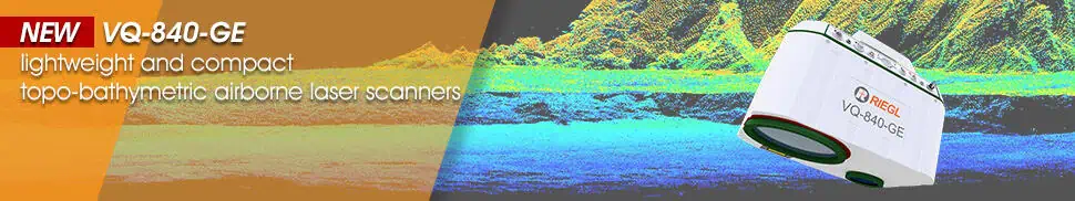
The RIEGL VQ-840-GE airborne laser scanner is a lightweight and compact unit designed for UAV-based combined topographic and bathymetric surveying, capable of penetrating up to 2 Secchi depths at an altitude of 75 meters. The system employs a narrow visible green laser beam for measuring submerged targets and can be optionally equipped with a digital RGB camera for colorization, as well as a fully-integrated IMU/GNSS.
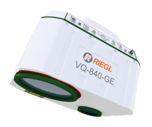
the robust unit weighs just 9.5 kg and is designed with a rugged mechanical structure and a dust- and splash-proof enclosure for long-term operation in challenging environments.
The RIEGL VQ-840-GE is ideal for a variety of applications, including coastline mapping, reservoir surveys, and river hydrology.
Learn more: RIEGL VQ-840-GE airborne laser scanner
IMU/GNSS Systems for miniVUX LiDAR Scanners
RiLOC-E
Entry-level IMU/GNSS solution for miniVUX LiDAR scanners
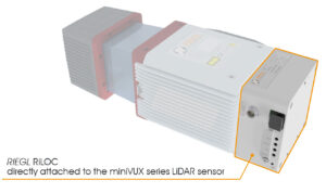
RiLOC-E is a fully integrated IMU/GNSS solution designed to provide location and orientation data for the miniVUX series of laser scanners.The unit houses a MEMS IMU and GNSS receiver within a lightweight and compact enclosure, and can be directly attached to the laser scanner.
Learn more: RiLOC-E IMU/GNSS solution
RiLOC-F
High-precision IMU/GNSS solution for VUX laser scanners
The RiLOC-F is a high-precision IMU/GNSS add-on designed to integrate seamlessly with the VUX-10025 and VUX-12023 UAV laser scanners, enhancing accuracy for georeferencing collected data.
this unit tightly couples IMU, GNSS, and LiDAR data, with a workflow that includes post-processing of both trajectory and scan data fully within RIEGL’s RiPROCESS software.
Learn more: RiLOC-F IMU/GNSS solution
Join our Webinar Series to explore more about RIEGL products and technology.


