Exail stands at the forefront of high-tech innovation, specializing in the design and production of state-of-the-art robotics, aerospace, subsea, and marine navigation technologies. The company is committed to delivering remarkable performance, dependability, and safety to its civil, defense, and maritime clients operating in challenging environments. From the depths of the ocean to the vastness of space,Exail enhances its offerings with a comprehensive array of robust,in-house manufactured components and systems,including inertial navigation,acoustic subsea positioning,imaging,and autonomous technologies. With a global workforce of 1,800, Exail operates in over 80 countries, leveraging its international presence. Its products are perfectly suited for various unmanned systems utilized in geoscientific, maritime, defense, and oil and gas sectors, encompassing AUVs (autonomous underwater vehicles), ROVs (remotely operated vehicles), and USVs (unmanned surface vessels). Established in 2022 thru the merger of ECA group and iXblue, Exail is a subsidiary of Exail Technologies, a family-owned enterprise dedicated to high-technology solutions.
Innovative Solutions for Civil Sectors
Exail offers both surface and subsea solutions tailored for the oil and gas, offshore energy, and geosciences sectors. Our inertial navigation sensors, USBL and LBL systems, along with unmanned surface vessels, are perfectly suited for surveying, monitoring, and construction tasks, ranging from shallow waters to the deep sea, and support a variety of scientific initiatives, from subsea geological data gathering to marine environmental assessments.
Advanced inertial Navigation Solutions
We provide a diverse array of high-precision inertial navigation solutions designed for geosciences and other civil applications, catering to unmanned systems across all domains.
Inertial Navigation for Surface Vessels
Our fiber-optic-based Attitude and Heading Reference Systems (AHRS) and Inertial Navigation Systems (INS) deliver precise and dependable navigation data in all conditions, including environments where GNSS signals are unavailable.

Quadrans Surface gyrocompass and AHRS
Heading accuracy: 0.23 deg RMS Roll & Pitch accuracy: 0.1 deg RMS settling time: <30 min

Octans Surface gyrocompass & motion sensor
Heading accuracy: 0.1 deg RMS Roll & Pitch accuracy: 0.01 deg RMS Heave: 5 cm or 5% RMS

Hydrins High-performance INS for hydrographic and multibeam surveys
Heading accuracy: 0.01 deg RMS Roll & Pitch accuracy: 0.01 deg RMS Heave: 5 cm or 5% RMS

Phins Surface Multipurpose high-performance INS
Heading accuracy: 0.01 deg RMS Roll & Pitch accuracy: 0.01 deg RMS Heave: 2.5 cm or 2.5% RMS
Inertial Navigation for ROVs and AUVs
We offer a comprehensive suite of Fiber Optic Gyroscope-based high-grade AHRS and subsea INS for remotely operated vehicles (ROVs) and autonomous underwater vehicles (AUVs).
For ROVs

Octans Subsea Survey-grade gyrocompass and AHRS
Heading accuracy: 0.1 deg RMS Roll & Pitch accuracy: 0.01 deg RMS depth rating: 3000m

Rovins Nano Compact navigation-grade INS
Heading accuracy: 0.1 deg RMS Roll & pitch accuracy: 0.05 deg RMS Depth rating: 4000m DVL-aided position accuracy: 0.04 %TD

Rovins High-accuracy INS for offshore survey and construction
Heading accuracy: 0.04 deg RMS Roll & Pitch accuracy: 0.01 deg RMS DVL-aided position accuracy: 0.02 %TD Depth rating: 3000m

Phins Subsea High-performance INS for deep-water operations
Heading accuracy: 0.01 deg RMS Roll & Pitch accuracy: 0.01 deg RMS Depth rating: 6000m

Phins Compact Series – A Versatile Range of Compact Inertial Navigation Systems
Heading precision: 0.01 – 0.15 degrees; Roll & Pitch precision: 0.01 – 0.05 degrees; DVL-assisted positional accuracy: 0.01 – 0.2 %TD (CEP 50).
Inertial Navigation for Terrestrial and Aerial Vehicles
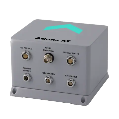
The Atlans Series offers a flexible range of Inertial Navigation Systems (INS) tailored for mobile mapping in land and aerial applications. These systems utilize Fiber-Optic Gyroscope (FOG) technology, ensuring high-performance mapping and surveying for various platforms, including UAVs, UGVs, aircraft, and helicopters. Designed for straightforward installation and operation, they guarantee precise positioning even in environments where GNSS signals are unavailable.
Key Features and Advantages:
- Effortless integration with a compact housing and a single GNSS antenna setup
- Predefined operational modes for different vehicles: aerial, terrestrial, and rail
- North orientation capability in GNSS-denied settings
- Dynamic alignment with GNSS systems
- Smart coupling of INS and GNSS
- compatible with Exail Delph INS post-processing software
- ROS driver support available
- 24/7 global technical support
- ITAR-compliant
|
|
|
|
| Model | Atlans A3 | atlans A7 |
| Heading Accuracy (RTK) | 0.05 degrees | 0.015 degrees |
| Heading Accuracy (PPK) | 0.035 degrees | 0.012 degrees |
| Position Drift for Land Applications (RTK) | 1.5m | 0.4m |
| Position Drift for Land Applications (PPK) | 0.4m | 0.08m |
INS Post-Processing Software
Delph INS is the dedicated post-processing software for iXblue’s subsea navigation systems, including the Phins Subsea, Rovins, Rovins Nano, and the Phins Compact Series. It facilitates real-time monitoring and integration of iXblue navigation systems alongside other sensors such as GPS, USBLs, LBLs, DVLs, and pressure sensors.
Delph INS offers robust post-processing capabilities,including INS/DVL post-mission calibration,generation of QA/QC reports,2D vehicle trajectory visualization,and customizable map projections.

Acoustic Positioning & Communications
Ultra-Short Baseline USBL Positioning
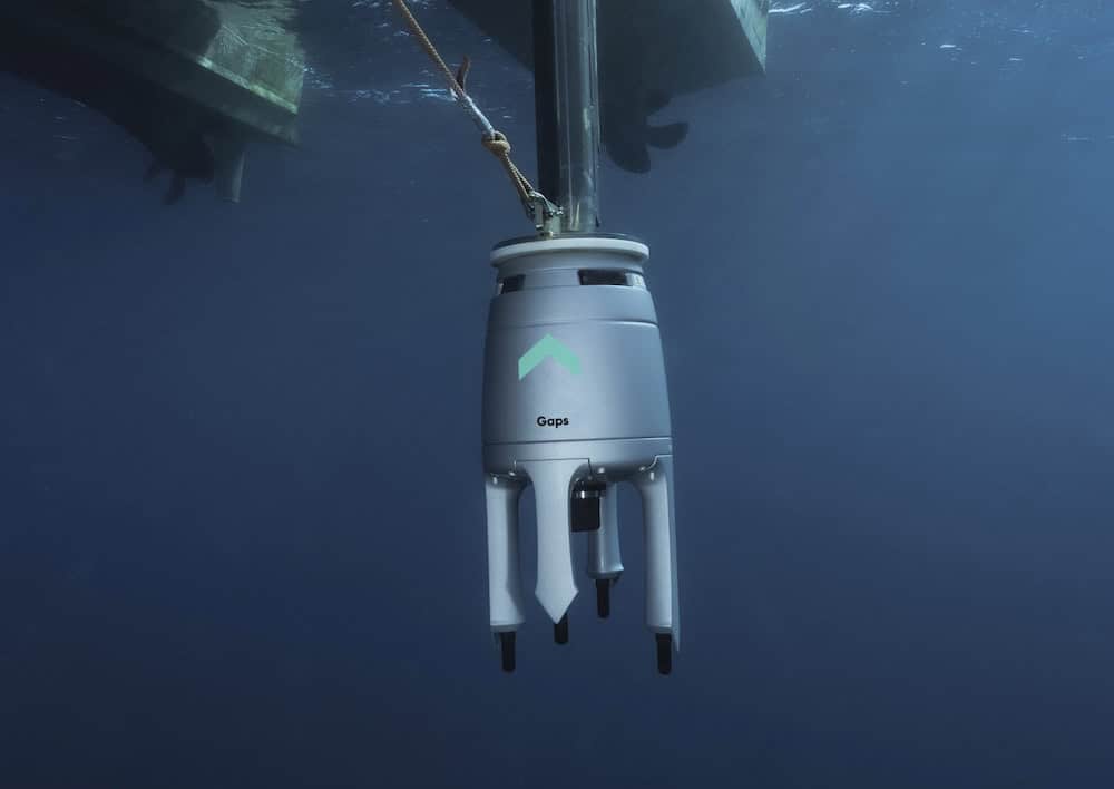
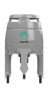
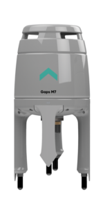
Gaps Series – High-precision ultra-short baseline acoustic positioning systems designed for medium to deep-sea operations.

The Gaps Series is engineered to accurately locate, position, and track subsea assets such as ROVs and AUVs, from ultra-shallow to deep-water depths.It incorporates a FOG-based subsea motion sensor for enhanced vessel positioning redundancy and subsea telemetry, and is compatible with third-party equipment.

Equipped with an integrated gyro and a 3D acoustic antenna configuration, both Gaps models are omnidirectional and do not require specific orientation.The 200° acoustic aperture enables effective horizontal tracking and operational accuracy in ultra-shallow waters.
|
Gaps M5 |
Gaps M7 |
|
| Absolute Accuracy | <0.5% | up to 0.06% |
| Range | 995 m | 4000 m |
| Heading Accuracy | 0.5° | 0.01° |
| Roll & Pitch Accuracy | 0.1° | 0.01° |
| Coverage | 200° | 200° |
Posidonia – A highly precise and ultra-long-range USBL positioning system.

Range: 10,000m; Accuracy: 0.1%; Antenna aperture: 70/100 degrees; Operating frequency: 8 – 18 kHz.
LBL Positioning
Long Baseline Acoustic Positioning
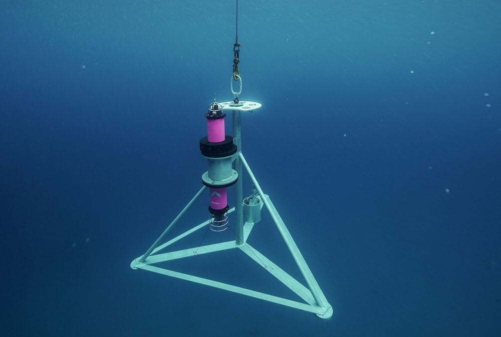
Our high-precision LBL (Long Baseline) transceivers and transponders can be integrated with a subsea INS to enable sparse-LBL navigation, minimizing the number of required transponders while maintaining high performance.

Ramses – An clever transceiver with versatile deployment options.
Position accuracy: <0.1m; Range precision: >0.01m (1 sigma); Maximum range: 4000m; Depth rating: 6000m.

canopus – An intelligent transponder suitable for seabed or AUV applications.
Accuracy: < 0.01m; Data telemetry: 500 bps; depth rating: 4000m.
Supervision Software
Delph Subsea Positioning Technology – A comprehensive software suite for seamless setup,operation,and post-processing of iXblue subsea positioning systems.
Delph Subsea Positioning is compatible with the entire range of our subsea systems and includes four powerful modules:

LBL Array Planning – Import CAD designs and sound velocity profiles, arrange transponders, and dynamically compute visibility maps.

Navigation simulation – Simulate navigation scenarios for enhanced operational planning.
Navigation Simulation Tools
experience the capabilities of INS/DVL and LBL/Sparse LBL performance simulations. Customize sensor configurations and define vehicle paths effectively.
Operational Management
Oversee projects, set up equipment, and manage data logging and visualization seamlessly.
Data Post-Processing
Facilitate data import/export,visualize through graphs and maps,and generate quality assurance and control reports efficiently.
Unmanned Surface Vehicles (USVs)
DriX H-8 / H-9: Medium and Long-Range USVs
Highly Adaptable Autonomous Surface Vessels for Data Collection
With over 10,000 operational hours globally in the last three years, Exail’s DriX USV, paired with its effective launch and recovery system, stands out in the realm of supervised autonomy. This vessel can perform both remote-controlled and supervised autonomous missions, excelling in seakeeping and speed. it accommodates various payloads, ensuring optimal data collection in diverse water depths.
DriX O-16: Transoceanic range USV
Exceptional Speed, Endurance, and Payload Capacity
the DriX O-16 boasts an impressive autonomy of 3,500 nautical miles and a unique design that withstands harsh oceanic conditions. Designed for extended missions lasting up to 30 days, it can deploy multiple payloads and subsea assets. Building on the success of its predecessor, the DriX series has accumulated over 150,000 operational hours across 19 countries since its launch in 2017.
Specifications Comparison
| DriX H-8 | DriX H-9 | DriX O-16 | |
| Length | 7.71 m | 9 m | 15.75 m |
| Displacement | 1.6 t | 2.1 t | 10.5 t |
| Endurance | < 10 days | < 20 days | < 30 days |
| Speed | < 14 kts | < 13 kts | < 16 kts |
| fuel Capacity | 250 L | 550 L | 2,300 L (dual hybrid propulsion) |
| Range | 1,000 nm | 2,000 nm | 3,500 nm |
| Communications | Wifi, 4G, Satellite, UHF | Wifi, 4G, Satellite, UHF | Wifi, 4G, Satellite, UHF |
| Towing/Launch & Recovery | ROTVs towing capabilities | ROTVs towing capabilities | ROTVs, Inspection Class ROVs, 1,000 m rated AUVs |
| Station Keeping | Hovering | Hovering | Dynamic Positioning |
| MBES Capacity | 3,000 m depth | 3,000 m depth | Full ocean depth |
| Transportation | 1x 40’ High cube container | 1x 40’ High Cube container | 2x 40’ high Cube containers |
| Additional Features | Launch & Recovery system | Customizable stern section for extra payload integration |
Seabed Mapping Technologies
3D multibeam Sonars
SeapiX-R: Advanced 3D Multibeam Sonar
The SeapiX-R is a compact 3D multibeam sonar designed for precise water column coverage, biomass evaluation, and seabed mapping, ideal for fisheries, scientific research, and marine environmental monitoring. It features a dual Mills Cross multibeam sonar transducer and multiple advanced modulation modes for enhanced detection performance, even in challenging environments.
- aperture: 120°x120° angular
- Beam Resolution: 1.6° angular
- Frequency: 145 – 155 kHz
Synthetic Aperture Mapping Sonars
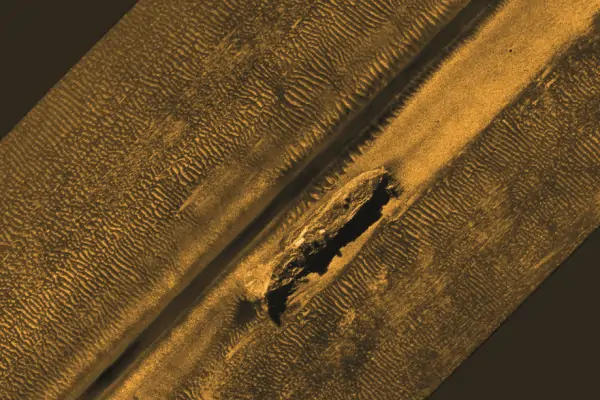
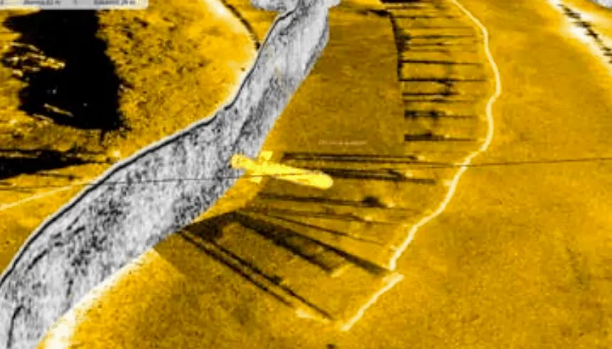
SAMS Series: synthetic aperture Sonars
The SAMS Series offers synthetic aperture sonars with integrated positioning and navigation capabilities, delivering exceptional georeferenced imaging for hydrographic surveys. These sonars can be utilized as towfish platforms or integrated into AUVs and ROVs.
| Model | SAMS-150 | SAMS-50 |
| Central Frequency | 150 kHz | 55 kHz |
| Bandwidth | 30 kHz | 15 kHz |
| Swath | 500m | 1600m |
| Resolution | 6cm x 2.5cm | 50cm x 5cm |
| Depth Capability | Versions for 1000m and 6000m | 6000 m |
Sub-Bottom Profilers
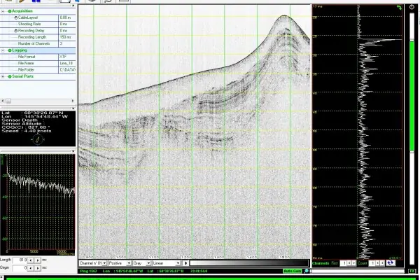
echoes Series: Sub-Bottom Profilers
The Echoes series provides a comprehensive range of sub-bottom profilers designed for acquiring, processing, and interpreting high-quality geological data. With low distortion power amplifiers and proprietary transducer designs,these compact systems cover a wide frequency range,making them suitable for geosciences,archaeology,and offshore energy applications.
| Model | Echoes Compact | Echoes 5000 | Echoes 3500 T1 |
|---|---|---|---|
| Frequency (kHz) | 5 – 15 | 1.7 – 8.5 | 1.8 – 6.2 |
| Mean Acoustic Level (dB ref 1μPa@1m) | 194 | 180 | 195 |
| Transmission Power (kVA) | 1 | 1 | 1 |
| Resolution (cm) | 7.5 | 11 | 17 |
| Digital Data Format (bit raw data) | 24 | 24 | 24 |
| Aperture (°) | 30 | Omnidirectional | 45 |
| Compatible Autonomous Platforms | USV | AUV | USV |
Geophysical Software Solutions
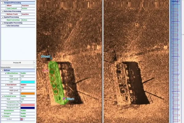
Delph Sonar
Delph Sonar is a comprehensive software suite for the acquisition, processing, and interpretation of side-scan sonar (SSS) data. It supports a variety of both analog and digital SSS systems, offering 2D profile views and 3D geographic data visualizations, along with batch processing and global quality control features.
Delph SAS
Delph SAS enhances the Delph Sonar software by incorporating advanced synthetic aperture sonar processing capabilities. It integrates smoothly into existing workflows, featuring precise real-time positioning, full-resolution INS-based navigation, and effective motion compensation for sonar data.
delph Seismic
Delph Seismic is a robust software solution for the acquisition, processing, and interpretation of data from high-resolution seismic systems and sub-bottom profilers. It features intuitive workflows,2D profile views,and 3D geographic data visualizations,enhancing efficiency for geologists and geophysicists.
Delph RoadMap
Delph RoadMap offers advanced real-time and offline data visualization for all Delph software packages within a powerful 2D/3D cartographic environment.It supports nearly all geodetic systems and can connect to multiple positioning sensors, facilitating easy project management.
Delph Mag
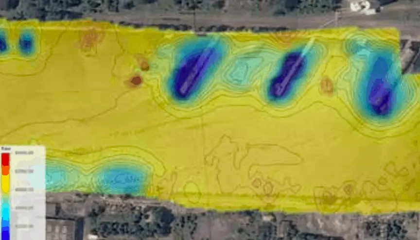
Delph Mag creates precise 2D and 3D magnetic anomaly maps for identifying and mapping magnetic sources and buried objects. It can be integrated into a multi-sensor interpretation framework alongside side-scan sonar, sub-bottom, and bathymetric data.
Naval Defense Solutions
We specialize in developing high-performance navigation, positioning, and imaging solutions tailored for naval defense forces, ensuring exceptional accuracy and reliability for critical missions across various platforms.
inertial Navigation Systems
With our products utilized by over 40 navies globally, we are recognized as the leading provider of inertial systems for naval defense in Europe. Our extensive range of inertial navigation solutions caters to both manned and unmanned vessels, whether surface or underwater.
marins Series – Military-Grade INS
The Marins Series comprises cutting-edge strategic-grade FOG inertial navigation systems, engineered to meet stringent naval performance standards. These systems are ideal for stealth navigation in submarines and unmanned underwater vehicles, as well as surface vessels operating in GNSS-denied environments.
| M3 | M5 | M7 | M8 | M9 | M11 | |
|---|---|---|---|---|---|---|
| Position Accuracy | 1/12 nm/h | 1/24 nm/h | 1/72 nm/h | 1/96 nm/h | 1/120 nm/h | 1/360 nm/h |
| Velocity (RMS) | 0.6 knots | 0.6 knots | 0.4 knots | 0.4 knots | 0.4 knots | 0.4 knots |
| Heading Accuracy | 0.01 deg | 0.01 deg | 0.01 deg | 0.01 deg | 0.01 deg | 0.01 deg |
| Roll & Pitch Accuracy | 0.01 deg | 0.01 deg | 0.01 deg | 0.01 deg | 0.01 deg | 0.01 deg |
Phins Surface – High-Performance Surface INS
Heading Accuracy: 0.01 deg RMS | Roll & Pitch Accuracy: 0.01 deg RMS | heave: 2.5 cm or 2.5% RMS
Octans – All-in-One AHRS for High-Speed Vessels
Heading Accuracy: 0.1 deg RMS | Roll & Pitch Accuracy: 0.01 deg RMS | Heave: 5 cm or 5% RMS
Quadrans – Compact FOG AHRS for Demanding Navigation
Heading Accuracy: 0.23 deg RMS | roll & Pitch Accuracy: 0.1 deg RMS | Settling Time: <30 min
Phins Compact Series – Scalable and Compact Subsea INS for AUVs
Heading accuracy: 0.01 – 0.15 deg | Roll & Pitch Accuracy: 0.01 – 0.05 deg | DVL-Aided Position Accuracy: 0.01 – 0.2 %TD (CEP 50)
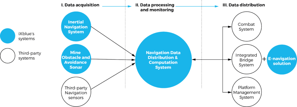
Navigation Data Distribution & Computation system (NDDCS)
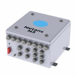
Netans Series – Navigation Data Distribution Systems
The Netans Series provides a centralized control and processing unit for all navigation sensor data aboard a vessel, serving as a consistent reference system. It ensures data validity, integrity, and coherence, while also incorporating advanced cyber-attack protection features.
|
|
|
|
|
|
| Model | Netans N1 | Netans N3 | Netans N5 | Netans N7 |
| Ethernet Ports | 2 | 6 | 24 | 48 |
| I/O Modules | 2 | 6 | 11 | 22 |
| Time Clock | External | External | Optional | Optional |
| UPS | External | External | Included | Included |
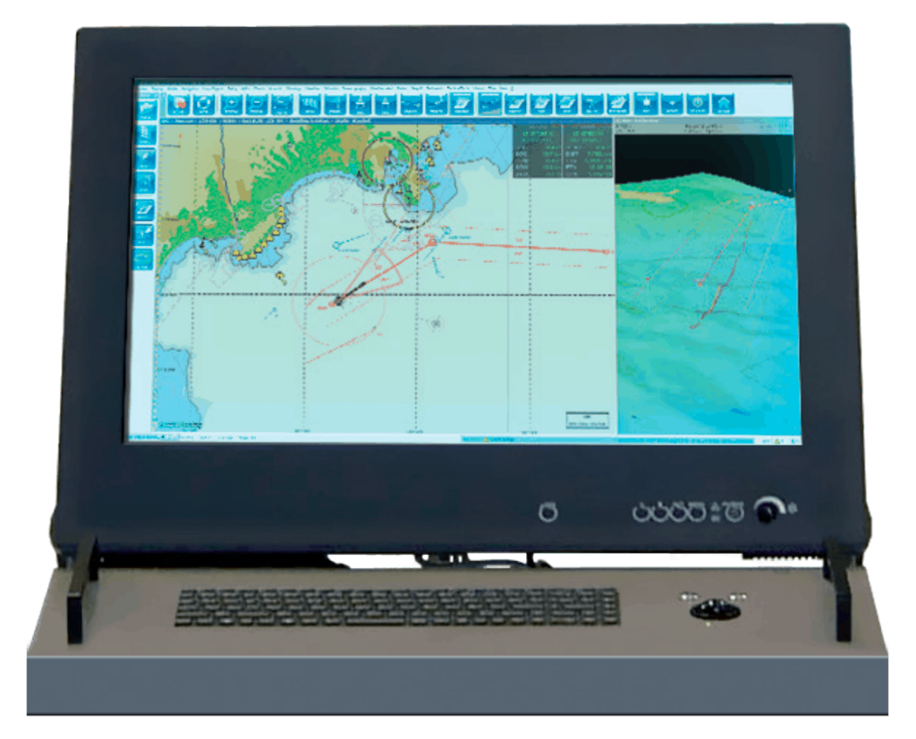
Warship Electronic Chart display and Data System (WECDIS)
the Gecdis-W system offers a user-friendly interface for naval fleet navigation, route planning, and collision avoidance for submarines, along with weapons coverage. It integrates data from various sources, including bathymetric, radar, and optronic sensors.
Subsea Positioning Technology
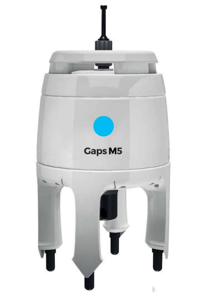
Gaps M5 is a high-precision medium-depth USBL system designed for tracking AUVs and divers, offering an absolute accuracy of less than 0.5% with a range of 995 meters.
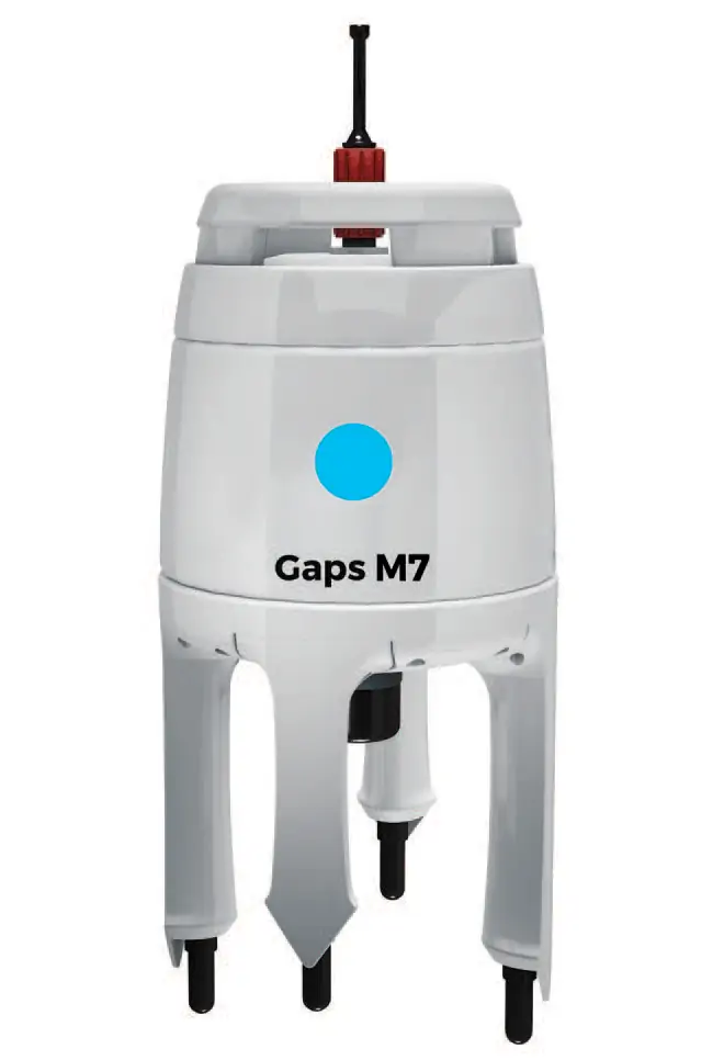
Gaps M7 provides high-accuracy deep-sea USBL tracking for AUVs and mine countermeasures, achieving an absolute accuracy of up to 0.06% with a range of 4000 meters.
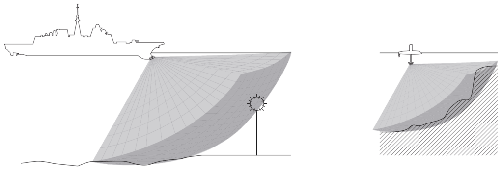
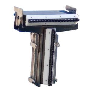
Forward Looking Sonar (FLS)
The FLS Series features a 3D multi-beam sonar system designed for obstacle detection from the surface to the seabed. It includes two models: the compact FLS150 for smaller vessels and the FLS60 for larger ships and unmanned underwater vehicles.
|
|
|
|
| Detection ranges | FLS 150 | FLS 60 |
| Anchored targets (-15 DB) | >330m | >650m |
| Drifting targets (-15 DB) | >330m | >350m |
| Bottom targets (-15 DB) | >300m | >350m |
| low TS targets (-25 DB) | >250m | >520m |
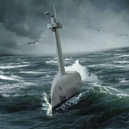
Unmanned Surface Vehicles
DriX is a long-endurance autonomous surface vessel designed for a variety of coastal and offshore hydrographic missions,offering both manual and autonomous operation modes.
- Length: 7.7m
- Displacement: 1.4 tons
- Endurance: Up to 7 days
- Maximum speed: > 10 knots
Solutions for Land Defense
Our advanced navigation and positioning systems are designed to ensure reliable and continuous operation in land defense and security applications.
Inertial Navigation Solutions
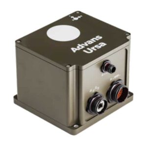
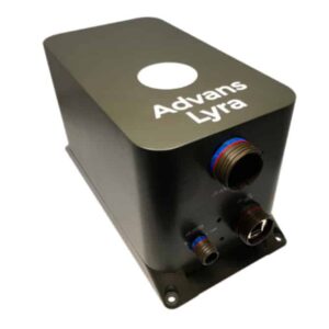
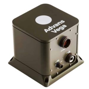
Advans Series of inertial navigation systems are ITAR-free and provide high-accuracy continuous positioning, heading, and attitude information for unmanned ground vehicles (UGVs) and land robotics, including tactical navigation and weapon system targeting.
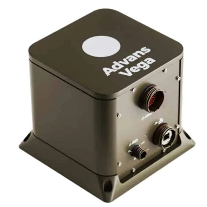
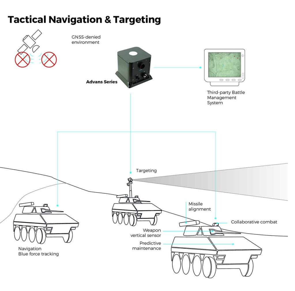
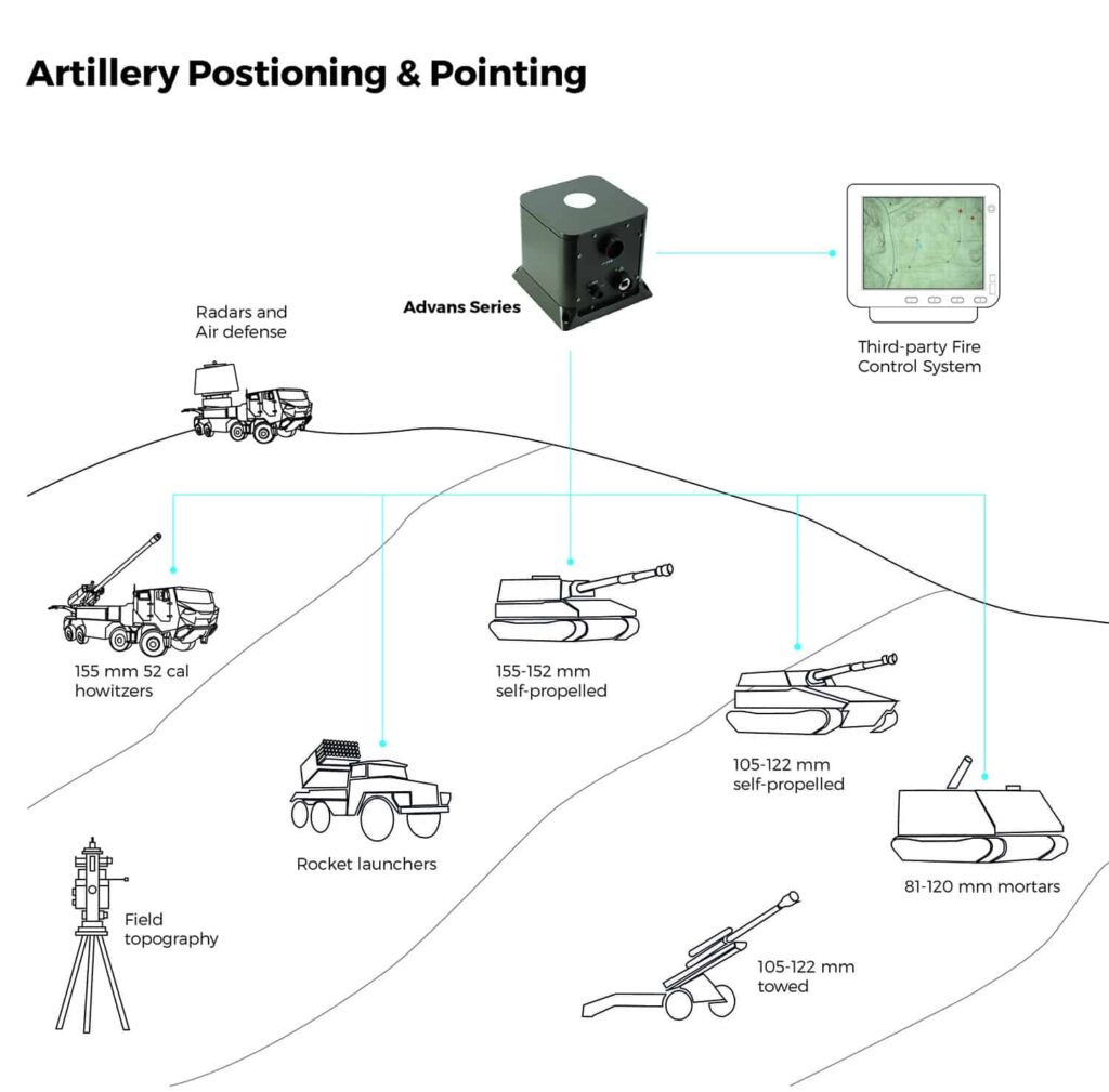
All models share a common framework and software, allowing for flexibility across various dialog standards, and they come equipped with a user-friendly web-based interface.
|
|
|
|
|
| Ursa U5 | Lyra L7 | Vega | |
| Horizontal Position Accuracy (without GNSS) | 0.4% DT | 0.2% DT | 0.1% DT |
| Heading Accuracy | 4 mils | 1 mils | 0.5 mils |
| Roll & Pitch Accuracy | 1 mils | 0.5 mils | 0.2 mils |