
Laser scanning technology currently stands out as one of the fastest and most accurate ways to gather specific geographic information.
SatLab Geosolutions’ unmanned aerial vehicle (UAV) LiDAR systems are capable of capturing extensive, high-efficiency, and high-precision point cloud data. SLAM-based laser scanning technology, which does not rely on GNSS, can rapidly and accurately collect high-resolution point cloud data.
Large-scale topographic surveys often cover vast areas, encounter complex environments, and demand high mapping precision. Traditional single-point surveying methods can be time-intensive and may fall short in meeting the required precision and efficiency for accurate topographic mapping.
The case study below demonstrates how integrating two LiDAR-based technologies enables fast acquisition of high-resolution spatial data and improves data integrity when compared to single-method measurements.
Project Requirements
In this large-scale topographic survey, the area spanned approximately 1.5 square kilometers, with a height variation of 30 meters, roughly 60% vegetation cover, and included villages with rows of houses interconnected by side walls and cluttered with village facilities, including numerous tin shacks.
Mapping results demanded an elevation error margin of less than 5 cm and no data gaps in sheltered areas, such as those beneath tin shacks and eaves.
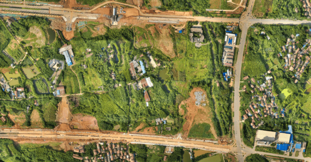
Aerial view of the survey area
Challenges
Collecting precise and detailed topographic data in areas with dense vegetation using photogrammetry is challenging due to the survey area’s complex environment.
Traditional surveying methods, such as total station and RTK operations, are time-consuming and may struggle to cover large or difficult-to-access areas effectively.
Solution
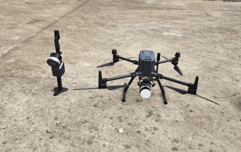
During data acquisition, the mission faced challenges, including densely forested zones and rugged terrain. To effectively scan the extensive area, the APUS LiDAR system was paired with a DJI M350RTK. This setup proved highly effective in collecting accurate and detailed data, even in hard-to-reach locations.
In addition to the APUS LiDAR system, the Lixel X1 SLAM scanner was used to enhance data capture, especially in instances where parts of the terrain were obstructed by structures like tin shacks or roofs. This addition enabled a more complete and detailed scan of the entire survey area.
To confirm data accuracy, several RTK checkpoints were established throughout the survey area. These checkpoints were used to verify the fused point cloud data, ensuring that the final dataset was as accurate and precise as possible.
Project Specifications
Equipment
- Lixel X1 SLAM scanner with RTK module
- APUS LiDAR system
- DJI M350RTK
- SatLab SL900 GNSS receiver
- CORS network
Software
- Lixel Studio
- Sat-LiDAR
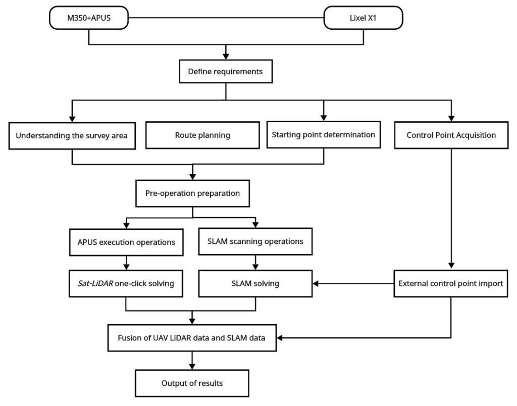
Technical Process
Results
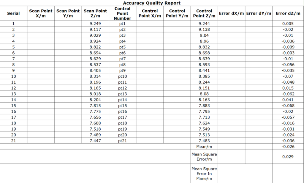
The two point cloud types were aligned within a unified coordinate system and seamlessly merged—yielding an average dZ of -0.026 and a root mean square of 0.029 (GCP).
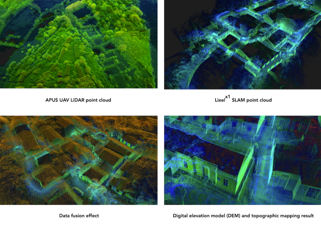
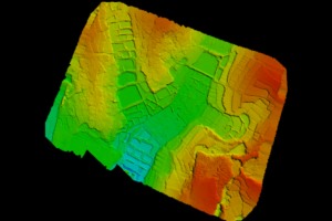
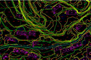
The high-integrity, centimeter-resolution point cloud was processed with Sat-LiDAR software to classify ground points. This allowed for the extraction of clear ground information in sheltered areas, resulting in highly accurate digital elevation models (DEM) and digital line graphics (DLG).
Conclusion
The combination of UAV LiDAR and SLAM scanner technologies provides a robust method for enhancing the precision and reliability of survey data. UAV LiDAR can generate highly detailed 3D maps of terrain and underlying features, while SLAM scanning enables accurate positioning and tracking of the UAV during surveys.
Together, these technologies create comprehensive, precise survey data, supporting applications in urban planning, construction site monitoring, and natural resource management. This technology is becoming increasingly popular across industries due to its ability to deliver precise, extensive survey data, offering significant value to professionals across various fields.
Read the original article >>


