
Strategic Alliance for Underwater Terrain Mapping
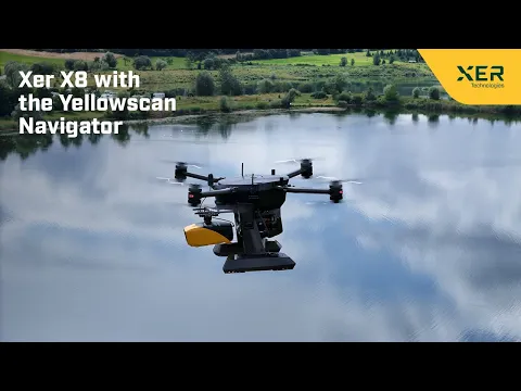
Xer Technologies has joined forces with YellowScan to enhance long-range bathymetric surveys by integrating the YellowScan Navigator bathymetric system into Xer Technologies’ drone fleet.
The Importance of Bathymetric Studies
Bathymetry, which involves analyzing underwater landscapes, plays a vital role in sectors such as environmental assessment, coastal management, and infrastructure planning.
Innovative Technology Integration
With the incorporation of YellowScan’s state-of-the-art green laser LiDAR technology into Xer Technologies’ robust drone platform, this partnership offers a groundbreaking solution for mapping underwater topography.
Overcoming operational Challenges
Bathymetric LiDAR operations often necessitate launching from distant locations, such as boats or shorelines, which can be far removed from the target area.Conventional electric drones frequently face limitations in flight duration when equipped with advanced payloads like the Navigator.
to address these challenges, the Xer X8 drone stands out as a pivotal solution, boasting a flight time exceeding two hours. This extended capability ensures dependable, user-amiable, and efficient performance in demanding environments, making it especially suitable for bathymetric LiDAR applications.
Key Features of the Integrated System
- Enhanced Bathymetric Functionality: Delivers high-resolution and precise bathymetric data, even in complex aquatic conditions.
- Prolonged Flight Duration: Xer Technologies’ drones can conduct missions lasting over two hours,considerably improving survey efficiency by covering larger areas in a single flight.
- Thorough Data Acquisition: facilitates seamless data gathering,processing,and analysis,equipping users with reliable and actionable insights.
Expert insights on the Collaboration
Gökmen Çetin, the International Sales Manager at Xer Technologies, stated, “The integration of YellowScan’s Navigator bathymetric system into our drone platforms signifies a major advancement for Xer Technologies, introducing innovative capabilities to the market.”
“Our dedication to advancing drone technology aligns seamlessly with YellowScan’s expertise in UAV LiDAR solutions. This partnership enables us to provide a highly effective solution for underwater topography mapping, catering to the diverse needs of various industries with improved accuracy and efficiency.”
Roberto Casini, OEM Business Unit Manager at YellowScan, expressed, “We are excited to collaborate with Xer Technologies to incorporate our YellowScan Navigator system into their complex drone platform. this partnership represents a notable leap in our goal to deliver state-of-the-art UAV LiDAR solutions.”
“By merging our proficiency in high-resolution bathymetric LiDAR technology with Xer’s innovative drone capabilities, we are offering a powerful tool for underwater terrain mapping. This combined offering will enhance the efficiency and precision of bathymetric surveys, supporting essential applications in environmental monitoring, coastal management, and infrastructure development.”


