Triumphant Phase 1 Trials of Martin UAV V-BAT for Canadian Coast Guard
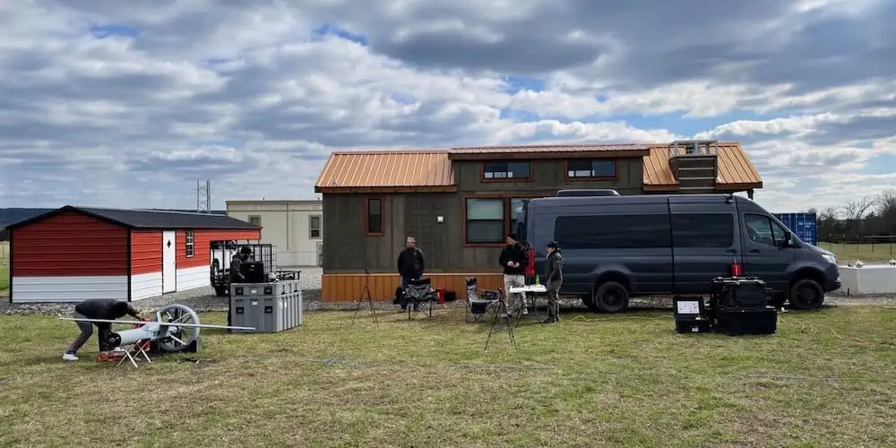
Kongsberg Geospatial has completed the initial phase of testing the Martin UAV V-BAT on behalf of the Canadian Coast Guard.These trials took place at a UAS testing facility managed by the Choctaw Indian Nation in southeastern Oklahoma.
Funding and Objectives of the Trials
The trials are financially supported by Defense research and Development Canada (DRDC), aiming to identify a new long-endurance UAV surveillance system suitable for deployment on Canadian Coast Guard vessels.
Why the Martin UAV V-BAT?
The Martin UAV V-BAT was chosen for these trials due to its unique capability to take off and land in limited spaces aboard ships,while also offering the endurance of a fixed-wing aircraft and the ability to carry various sensors.
Adapting to Challenges
Initially, the trials were set to occur in Canada; however, due to COVID-19 travel restrictions, the first phase was conducted virtually. The V-BAT operated at the choctaw Nation’s facility, with personnel from Kongsberg Geospatial and Martin UAV present to oversee the operations.
Key Features demonstrated
The test flights showcased several critical capabilities, including fast launch and recovery, extended flight duration, and the ability to take off and land in confined areas. The UAV also successfully tracked vehicles and individuals using advanced electro-optical and infrared cameras,supported by elegant object detection and tracking software.
Real-Time Monitoring and Data Integration
Throughout the flights, real-time monitoring was conducted, with live video feeds of telemetry and payload being transmitted to Ottawa for the Canadian Coast Guard’s review. These video streams were integrated into Kongsberg Geospatial’s Modular ISR Data Analysis and Storage (MIDAS) system, which acts as a mission intelligence hub, allowing for the analysis of both current and historical sensor data in a temporal and geospatial framework to enhance sensor effectiveness.
A Pragmatic Approach
“While it may seem unusual for the Canadian Coast Guard to conduct drone operations over a cattle ranch in Oklahoma, this decision was made out of necessity due to pandemic-related travel restrictions,” explained Paige Cutland, Vice President of Sales and Marketing at Kongsberg Geospatial. “The primary goal of these initial trials was to assess flight performance characteristics that can be analyzed in any location.”
Looking Ahead: Phase 2
With the successful completion of phase 1, the next step for the Canadian coast Guard involves Martin UAV and Kongsberg Geospatial conducting shipboard demonstrations aboard a Canadian Coast Guard vessel.


