Blue Marble Geographics has released a guide to “Identifying Change in Tree Height by Comparing Point Clouds to Terrain” using the Compare Point Cloud tool in Global Mapper Pro. Read more >>
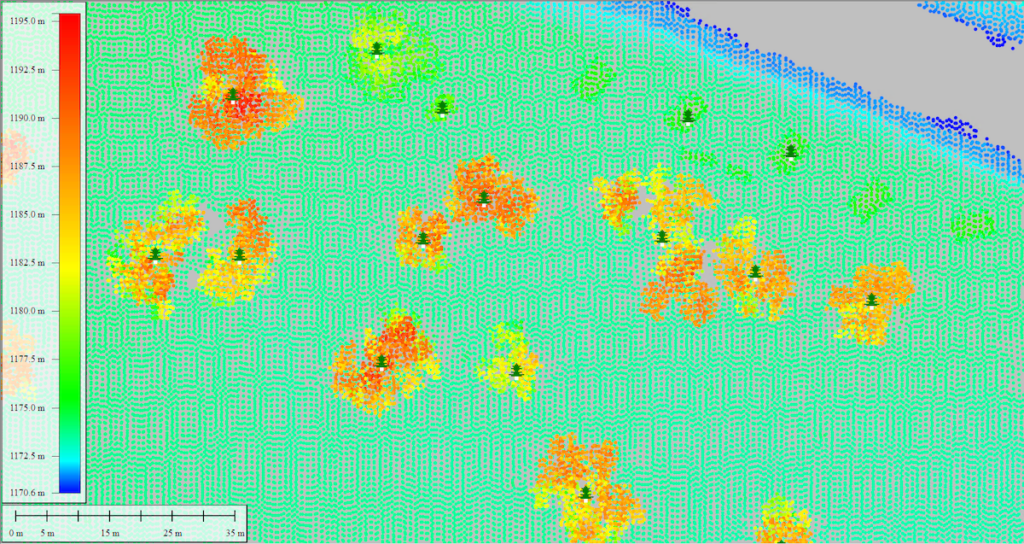
For users interested comparing the vertical difference between a point cloud and a terrain layer, the Compare Point Cloud tool has now been updated for the v25.1 release of Global Mapper Pro.
In the new workflow released by Blue Marble Geographics, the company set out to identify trees that have changed by a specified amount. The study aimed to:
- Identify trees that have changed more than a certain amount.
- Determine their location.
- Enable a field inspection of the trees in person.
The Compare Point Cloud tool allows users to adjust the ground offset between a point cloud and a terrain surface, which is used as a control. The new updates allow users to automatically compare point clouds to raster terrain layers. With a variety of output options, this tool now has a multitude of other applications as well.
Blue Marble Geographics also detail how users can package lidar points and send them off to Global Mapper Mobile in a mobile package file. Users looking to model tree height using a point cloud can also see “Create Canopy Height Models from Lidar in Global Mapper Pro.”
The study goes on to cover the following:
- Visually Comparing the Lidar and Terrain Layers – using the Path Profile tool
- Using the Compare Point Cloud tool
- Automatically Creating One Point Per Tree – using the Automatic Point Cloud Analysis tool
- Sending the Data to Global Mapper Mobile
Interested in more forestry-based lidar workflows? Check out “Measuring Tree Height from Lidar.”
To check out the new functionality in Global Mapper standard and Pro v25.1, download a free 14-day trial today.
Read the full article here or find out more on Blue Marble Geographics’ website.


