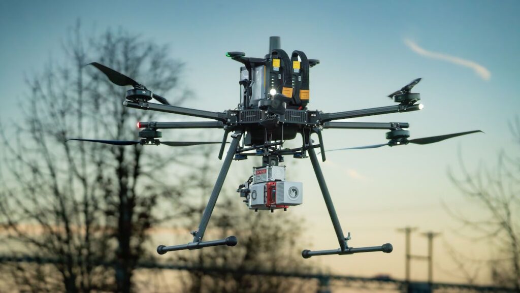
Inspired Flight’s advanced IF1200 drone, paired with the Phoenix miniRANGER-3 LiDAR system, was deployed by Redefined Horizons to ensure high accuracy and efficiency during a detailed land survey for an industrial site along the Willamette River in Portland, Oregon.
The 80-acre site, located between the river and Highway 30, was surveyed to generate high-resolution aerial imagery, LiDAR-derived topography, and a comprehensive GIS dataset cataloging site features.
These deliverables supported engineering design, environmental mitigation, and construction planning. The IF1200’s endurance and payload capacity enabled efficient data acquisition, capturing critical site details including elevation contours and buried infrastructure.
Using UAV-based LiDAR significantly reduced field time and manpower requirements compared to traditional ground-based survey methods.
The entire area was mapped in six flights over five days, producing a dataset that included 114 million LiDAR points and high-resolution imagery from a 61MP Sony ILX-LR1 camera. Data was processed with Phoenix Spatial Explorer and integrated into a structured GIS model for engineering access.
The IF1200 drone provided advantages such as extended flight time, heavy-lift capacity, rotor redundancy for safety, and NDAA compliance. These features allowed Redefined Horizons to maintain data quality while minimizing on-site time.
Final results included survey-grade LiDAR data, orthoimagery, 3D site models, and indexed infrastructure mapping—all structured for future reuse without repeat visits.
Read the full article >>


