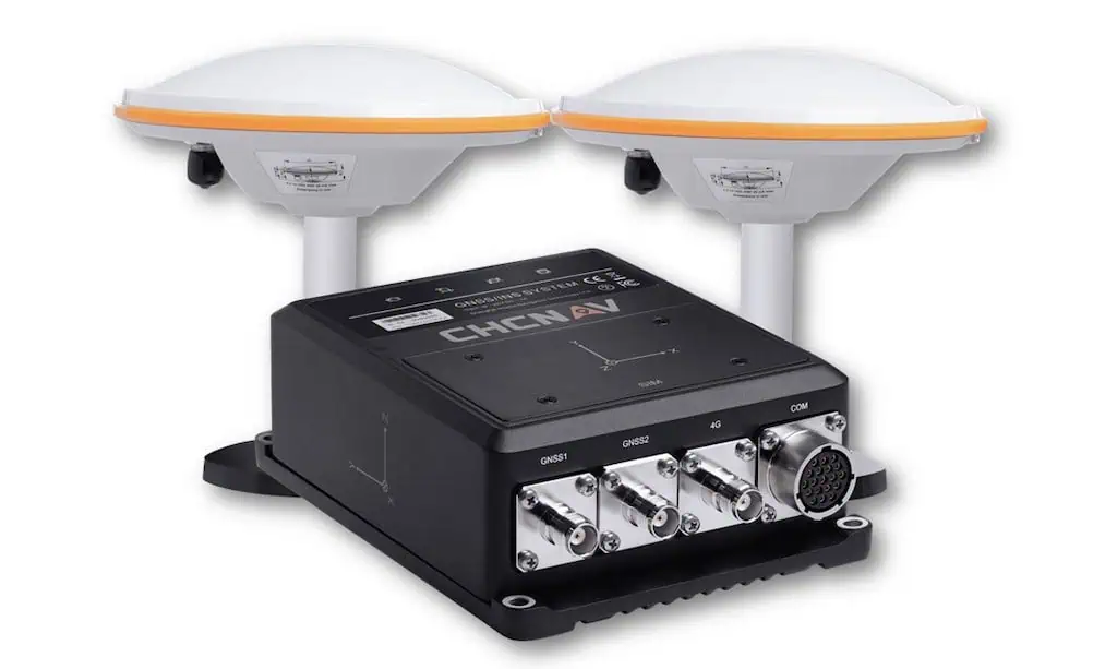
Unveiling the CGI-830: A Cutting-Edge GNSS/IMU Ground Truth System
CHC Navigation (CHCNAV) has introduced the CGI-830, a state-of-the-art GNSS/IMU Ground Truth System that seamlessly integrates GNSS and MEMS technologies.
Precision Navigation for Diverse Applications
This innovative system is engineered to deliver exceptional navigation accuracy for a variety of uses, including autonomous vehicles, Advanced Driver Assistance Systems (ADAS) testing, hydrographic surveys, and post-processed Positioning and Orientation System (POS) tasks across various terrains—urban, rural, and offshore.
Advanced Technology for Reliable Positioning
The CGI-830 features a multi-frequency GNSS module paired with a high-performance MEMS IMU, boasting a bias instability of just 0.1°/h. this tightly integrated system excels in challenging environments such as urban canyons, dense forests, mountainous regions, and underwater settings. It effectively reduces multipath interference and overcomes signal blockages,ensuring precise positioning even in complex electromagnetic environments,making it suitable for smart city initiatives and advanced robotics.
Robust Connectivity and Design
Equipped with various connectivity options—including 4G, Wi-Fi, serial ports, Ethernet, and CAN—the CGI-830 is designed for versatility. Its IP67-rated construction and adherence to MIL-STD-810G standards guarantee dependable performance in field applications such as construction, agriculture, and emergency response.
Durability and Performance in Demanding Conditions
Moreover, the system incorporates an internal shock-absorbing mechanism that safeguards critical components, ensuring longevity and consistent performance in rigorous environments.
High Data output for Dynamic Applications
With data output rates reaching up to 100 Hz, the CGI-830 is well-suited for dynamic applications, including unmanned aerial vehicles (uavs), trains, ground vehicles, and marine crafts. Its specialized post-processing software enhances the accuracy of 3D position, velocity, and attitude data, ensuring optimal performance for real-time navigation and mapping tasks.
Versatile Applications and Enhanced Functionality
The CGI-830 is tailored to accommodate a broad spectrum of applications. Its onboard algorithms are fine-tuned for various scenarios,including automotive operations,construction endeavors,and marine activities.
Precision in GNSS-Denied Environments
Supporting external odometers, Doppler Velocity Logs (DVL), and Ultra-Short Baseline (USBL) systems, the CGI-830 maintains high precision even in GNSS-denied settings, making it ideal for urban mobile mapping, infrastructure monitoring, geospatial analysis, and location-based services.
Expert Insights on the CGI-830
Daniel Yang, Product Manager at CHC Navigation, stated, “The CGI-830 is the perfect solution for sectors that demand accurate positioning and attitude data. Its integrated design, high-performance MEMS IMU, and versatility across multiple applications make it an indispensable tool for improving operational efficiency and accuracy in both terrestrial and maritime environments.”


