This case study features insights from Herman Huitema, VM Product Manager at Nortek, detailing how his team incorporated Advanced Navigation’s GNSS Compass into their surveying technology.
By utilizing the GNSS Compass,Nortek achieved a budget-kind solution that delivers precise heading information,enhancing the functionality of their acoustic Doppler current profiler (ADCP) to meet rigorous standards.
Nortek
specializes in the design and manufacture of instruments that leverage the Doppler effect to analyze underwater acoustics, measuring various water-related phenomena such as currents, velocities, waves, and the movement of aquatic life.These tools are essential for scientists, researchers, and engineers globally, aiding in the comprehension of marine and freshwater dynamics.Their operations frequently enough take place in challenging environments, necessitating both reliability and cutting-edge technology.
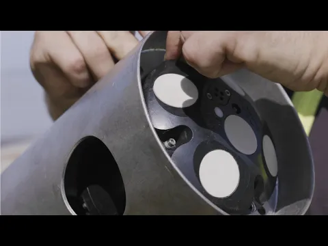
The Signature VM vessel-mounted ADCP system from Nortek presents new possibilities for the surveying sector, offering ease of operation and minimizing complexity. By integrating components at a high level, data quality can be significantly enhanced, while errors and initial setup times can be greatly reduced.
Herman Huitema, the VM Product Manager, shares how his team effectively integrated Advanced Navigation’s GNSS Compass into their surveying framework.
Identifying the Challenge: Ensuring Reliable and Accurate Heading for ADCP
A vessel-mounted ADCP is designed to measure and record water velocity and direction beneath the vessel, creating a detailed profile of underwater conditions. To ensure the accuracy of these measurements, a reliable secondary reference for velocity and heading is essential. This typically involves using an external GNSS receiver alongside a non-magnetic heading source, such as a gyro-compass, in addition to the ADCP’s bottom tracking capabilities.
Historically, interfacing external correction sources with ADCP data has posed challenges. Moreover,the synchronization between these systems must be flawless,as any delays in heading and velocity data can severely compromise the integrity of the ADCP readings. Nortek aimed to find a solution that would not only provide accurate heading assistance for their latest platform but also address current needs while remaining relevant for future applications.
Proposed Solution: GNSS Compass Delivers Seamless Integration and Precision
The GNSS Compass offers essential satellite-derived geographical data for both position and velocity, along with accurate non-magnetic heading through its dual GNSS antennas. All components are housed in a robust, marine-grade enclosure with a standard screw-mount for easy installation.
Issues related to data synchronization that plagued previous serially connected devices are nearly eliminated, thanks to nanosecond accuracy achieved through Ethernet PTP connectivity between the ADCP and the GNSS Compass. Additionally, the common Ethernet-based compatibility simplifies setup and ensures reliable, high-speed data transfer compared to older technologies.
“The GNSS Compass is a straightforward, cost-effective instrument,” stated Herman Huitema, VM Product Manager at Nortek.
Outcome: Advanced Technology Streamlines Integration
The GNSS Compass has emerged as an optimal companion for the Signature VM ADCP. Its ability to replace both a GNSS and a gyro-compass with a single unit featuring one Ethernet connector and supporting a proprietary protocol offers meaningful advantages, including reduced setup time and the elimination of the need for specialized expertise.
By integrating the GNSS Compass into their signature VM package, Nortek has created a high-performance vessel-mounted ADCP/navigation solution. This integration not only facilitates a quick and straightforward setup but also meets the expectations of users seeking the latest technological advancements.


