uAvionix has successfully delivered and received approval of its surface situational awareness systems for manned and unmanned aircraft at two major U.S. airports: Indianapolis International Airport (IND) and Austin-Bergstrom International Airport (AUS).
The completion of the rigorous Service Acceptance Test (SAT) by uAvionix and partner Capital Sciences enables Air Traffic Control (ATC) at these airports to begin operational use of the systems starting June 30, 2024.
Delivery of the FlightLine systems to IND and AUS were completed and accepted within a rapid 90-day timeframe through close collaboration with the FAA, National Air Traffic Control Association (NATCA), Indianapolis Airport Authority, and Austin-Bergstrom International Airport.
Each airport also installed several of uAvionix’s VTU-20 ADS-B Vehicle Movement Area Transmitters (VMATs) on airport vehicles. VTU-20 is an FAA approved system that allows vehicles that operate on runways and taxiways to be electronically seen by the tower and aircraft equipped with ADS-B In technologies, reducing the risk of runway incursions.
The approvals mark a major step forward for the FAA and align with uAvionix’s mission to enhance airspace safety from the airport surface to the stratosphere. Following on the success of the IND and AUS implementations, uAvionix will continue working with the FAA to expand the capability to other airports nationwide.
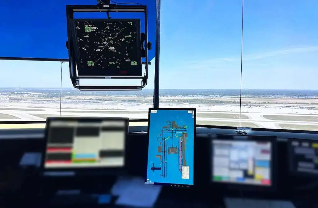
Key benefits of the uAvionix surface situational awareness systems include:
- Enhanced real-time tracking of aircraft and vehicles on the airfield.
- Improved operational efficiency and safety in all weather conditions.
- Reduced risk of runway incursions through timely and accurate data.
The collaboration between uAvionix and the FAA underscores a shared commitment to leveraging advanced technology for safer skies. As part of this initiative, uAvionix continues to work closely with the FAA and airport authorities to ensure the seamless integration and operation of these systems.
Christian Ramsey, Chief Commercial Officer for uAvionix, commented; “This significant milestone marks the first approvals under the FAA’s Surface Awareness Initiative (SAI), part of a broader effort to enhance runway safety across the nation.
“The uAvionix systems employ its cutting-edge Automatic Dependent Surveillance – Broadcast (ADS-B) service called FlightLine, providing controllers with real-time, precise depictions of aircraft and vehicles on the airport surface, thereby improving situational awareness and reducing the risk of runway incursions.”


