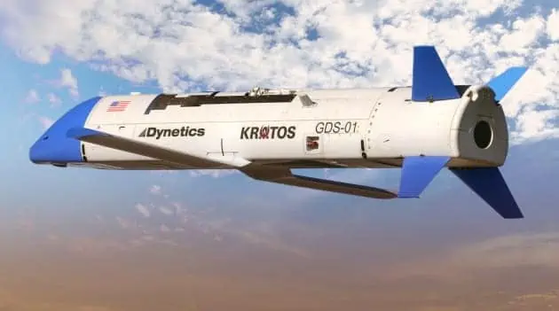
Advanced Navigation has published a case study highlighting the implementation of the Certus Evo (previously known as Spatial Dual) dual antenna GNSS-aided Inertial Navigation System (INS) in Dynetics’ in-flight drone recovery initiative.
The U.S. military is actively pursuing a method to deploy and retrieve numerous small unmanned aerial systems (UAS) from compatible combat aircraft while remaining beyond the reach of enemy defenses. given the nature of in-flight drone recovery operations,the system must exhibit exceptional coordination,accuracy,and safety.
This initiative, referred to as the Gremlins program, seeks to enhance operational adaptability and reduce costs by enabling the launch and retrieval of UAS drones mid-flight. This approach allows for deployment closer to mission areas,thereby minimizing flight duration and fuel requirements. Following mission completion, the UAS drones can be retrieved, significantly lowering the risk of equipment loss. The system is anticipated to facilitate the redeployment of Gremlin drones within 24 hours after their previous mission.
Addressing the Challenge: Ensuring safe and Accurate In-Flight Retrieval
Coordinating multiple unmanned aircraft and safely retrieving them from a moving platform presents notable challenges. It is indeed crucial to minimize risks to the “mother” aircraft, its crew, and the UAS drones through precise flight control and navigation accuracy. A highly reliable INS is essential for such critical missions.
“Upon mission completion,the drones return to manned airborne platforms for recovery at a forward operating base,where they can be swiftly refurbished and redeployed. The ability to continuously engage an adversary with multiple strikes is immensely advantageous,” stated Tim Keeter, Deputy Program Manager and Chief Engineer for the Gremlins project at Dynetics.
To support this endeavor, the Defense Advanced Research projects Agency (DARPA) has chosen Dynetics to showcase its capabilities in this domain.
Proposed Solution: Dual Antenna MEMS GNSS/INS Delivers Outstanding Results
Precise positioning is critical for the safe retrieval of drones in-flight. given the defense request, high reliability was a key factor in Dynetics’ choice of navigation technology.
“The unmanned aerial vehicles involved in thes future operations will be equipped with various sensors and payloads, collaborating to execute complex, adaptive missions in contested environments,” explained Keeter.
While there was no strict accuracy requirement, Bill martin, lead engineer at Dynetics, noted, “We aimed for relative position accuracy within 10 cm (4 inches). the Spatial Dual strikes an ideal balance between performance, size, power efficiency, and cost for our initial R&D flight test instrumentation on the Gremlins project.”
The Certus Evo (formerly Spatial Dual) is an innovative dual antenna GNSS-aided Inertial Navigation System (INS) that delivers highly accurate positioning, velocity, acceleration, and orientation data. It combines near Fiber optic Gyro (FOG) performance with the dependability of MEMS sensors. Its low size, Weight, power, and Cost (SWaP-C) profile, along with multiple dialog interfaces, facilitates seamless integration. It is available in both OEM and ruggedized formats.
A significant factor in the INS selection was the potential to achieve high-accuracy positional data through Kinematica post-processing, enabling precise measurements of the relative positions between the gremlins recovery aircraft, UAS, and the deployed recovery system.
Outcome: Exceptional Performance and Comprehensive Post-Flight Data Analysis
Ultimately, Dynetics expressed satisfaction with the performance of the Spatial Dual.
“The Spatial Dual units performed admirably and provided valuable data for post-flight analysis. The performance of the Spatial Dual during initial flight tests, coupled with its low power consumption and compact design, convinced us to incorporate it into the final recovery system architecture,” remarked Bill Martin.
Keeter added, “The rapid development of innovative and complex systems like Gremlins compels us to identify and utilize components with a proven track record of reliability and performance. We are proud to collaborate once again with Advanced Navigation on another of our priority exhibition initiatives.”


