
YellowScan Surveyor Ultra integrated with DeltaQuad drone technology
Revolutionizing UAV LiDAR Mapping: The YellowScan and DeltaQuad Partnership
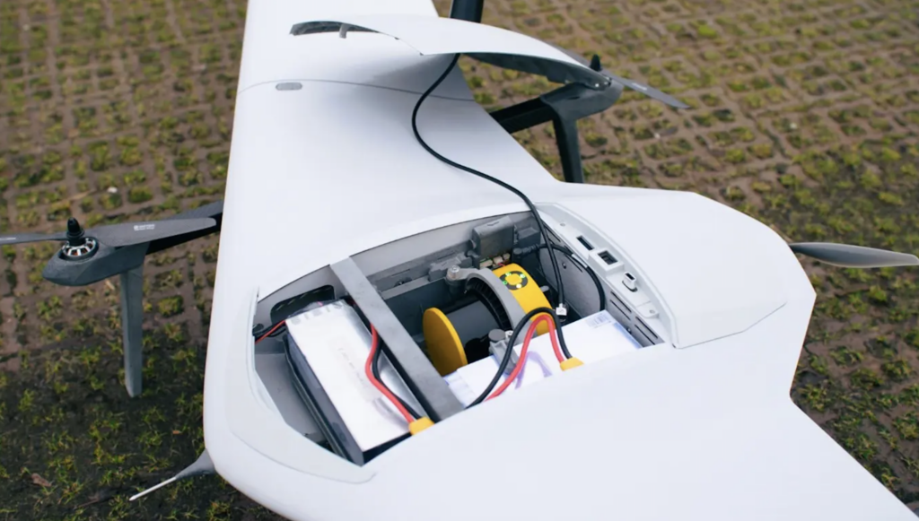
yellowscan has partnered with DeltaQuad to seamlessly integrate its Surveyor Ultra UAV LiDAR system into DeltaQuad’s drone technology.
This strategic alliance aims to significantly boost efficiency in UAV-based LiDAR mapping, providing unparalleled productivity for extensive mapping initiatives.
Enhanced Data Collection Capabilities
The collaboration between YellowScan’s Surveyor Ultra and the DeltaQuad Evo platform introduces remarkable advancements in data collection.Users can now cover up to 1200 hectares in a single flight, gathering high-precision, high-density data more swiftly than ever. The inclusion of an integrated RGB camera allows for simultaneous collection of LiDAR and RGB data, enabling operators to survey larger areas in reduced timeframes, thereby minimizing project durations and costs while maintaining high-quality outputs.
Optimized for Large-Scale Mapping
With its long-range flight capabilities and efficient Vertical Take-Off and Landing (VTOL) design,the DeltaQuad Evo is perfectly suited for mapping vast terrains. When combined with the Surveyor Ultra’s state-of-the-art LiDAR technology,which produces dense point clouds even from elevated altitudes,users can significantly enhance their workflows,cutting down on both airborne time and post-processing efforts.
Expert Insights on the Integration
Julien BO, Senior Buisness Development Europe at YellowScan, remarked, “The integration of the YellowScan Surveyor Ultra with DeltaQuad’s Evo platform is engineered to optimize field productivity. Users can now achieve quicker and more detailed outcomes,whether engaged in large infrastructure projects,forestry assessments,or environmental monitoring. Our clients can effortlessly deliver georeferenced LiDAR point clouds, enrich them with RGB data, and generate Digital Terrain Models in just a few clicks. Additionally, they can create orthophotos from a single 2.5-hour flight with the Evo, which is essential for enhancing productivity.”
benji Pauly, Solution Specialist at DeltaQuad, added, <em“Integrating YellowScan’s Surveyor Ultra with our DeltaQuad Evo platform marks a critically important advancement in aerial surveying efficiency. by merging long-range flight capabilities with high-precision LiDAR,we have developed a solution that enables professionals to accomplish more in less time. This partnership is focused on empowering users to work smarter, not harder.”
Broad Industry Applications
The collaboration between YellowScan and DeltaQuad presents a solution that not only improves operational efficiency but also accelerates project turnaround times. This innovation is poised to benefit a diverse array of sectors, including surveying, construction, forestry, and environmental research.


