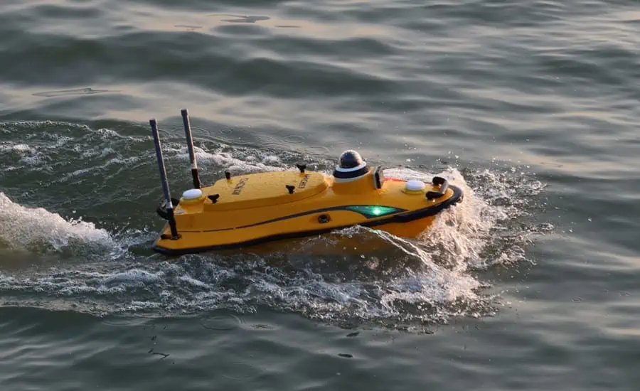
Introducing the Apache 3 Pro: A Revolutionary Hydrographic USV
CHC Navigation (CHCNAV) has unveiled the Apache 3 Pro, a state-of-the-art uncrewed surface vessel (USV) tailored for autonomous bathymetric surveys in shallow aquatic environments. Constructed with a lightweight carbon fiber hull and boasting an IP67 ingress protection rating, this vessel is designed for both durability and agility.
Advanced Navigation and Depth Measurement Capabilities
Equipped with CHCNAV’s cutting-edge GNSS RTK and inertial navigation sensor, the Apache 3 Pro ensures precise positioning and heading data, even in challenging environments such as under bridges or areas with limited satellite visibility. The integrated CHCNAV D270 echosounder allows for accurate depth measurements ranging from 0.2 to 40 meters, making it a reliable tool for underwater exploration.
Obstacle Detection and Autonomous Navigation
The Apache 3 Pro features a sophisticated millimeter-wave radar system that identifies obstacles within a broad 110° field of view. Upon detecting an obstruction,the USV autonomously recalibrates its course to navigate safely around it,enhancing operational safety.
Lightweight and Resilient Design
Weighing in at just 10 kg, the Apache 3 Pro is constructed from a robust macromolecular polyester carbon fiber and Kevlar composite, ensuring extraordinary durability. This lightweight design allows for easy deployment and operation by a single individual, even in diverse environmental conditions.
reliable Interaction and Remote Monitoring
The vessel guarantees dependable communication through its built-in SIM and network bridge, which features automatic switching capabilities. Additionally, the Apache 3 Pro supports cloud-based remote monitoring, providing real-time updates on operational status, thereby enhancing both control and security. Utilizing both 4G and 2.4GHz networks, it effectively overcomes range limitations for seamless data transfer.
Enhanced Propulsion System
The semi-recessed brushless internal rotor motors of the apache 3 Pro are designed to minimize drafts, significantly improving maneuverability across varying water depths.This advanced propulsion system not only enhances protection but also prolongs motor lifespan by reducing the risk of damage.
Expert Insights on Performance
Taxiya Wang, Product Manager at CHC Navigation, stated: “The Apache 3 pro redefines standards for shallow water bathymetric surveys. Its lightweight yet robust design, integrated navigation features, and superior obstacle avoidance capabilities facilitate efficient and high-precision data collection, even in demanding conditions. With the D270 echosounder and seamless data connectivity,the Apache 3 Pro exemplifies exceptional performance and efficiency in bathymetric surveying.”


