
YellowScan Unveils Cutting-edge Bathymetric LiDAR System at CES 2024
At CES 2024,held from January 8th to 12th,YellowScan introduced its latest innovation in LiDAR technology,the YellowScan navigator,designed for both manned and unmanned applications.
The urgent Need for Accurate environmental Mapping
As we continue to confront the realities of climate change—characterized by prolonged droughts, intense heat, and sudden flooding—there is an increasing necessity for precise environmental monitoring. These climatic shifts pose meaningful risks to human activities and infrastructure.
Accurate mapping of both aquatic and terrestrial environments is essential for effectively managing coastal erosion, assessing flood risks, and understanding diverse ecosystems.
YellowScan’s Legacy in LiDAR Technology
As its inception in 2012, YellowScan has been at the forefront of drone-based LiDAR mapping, providing high-precision tools that enhance the efficiency of surveyors. The company is committed to innovating products that meet the dynamic demands of the industry.
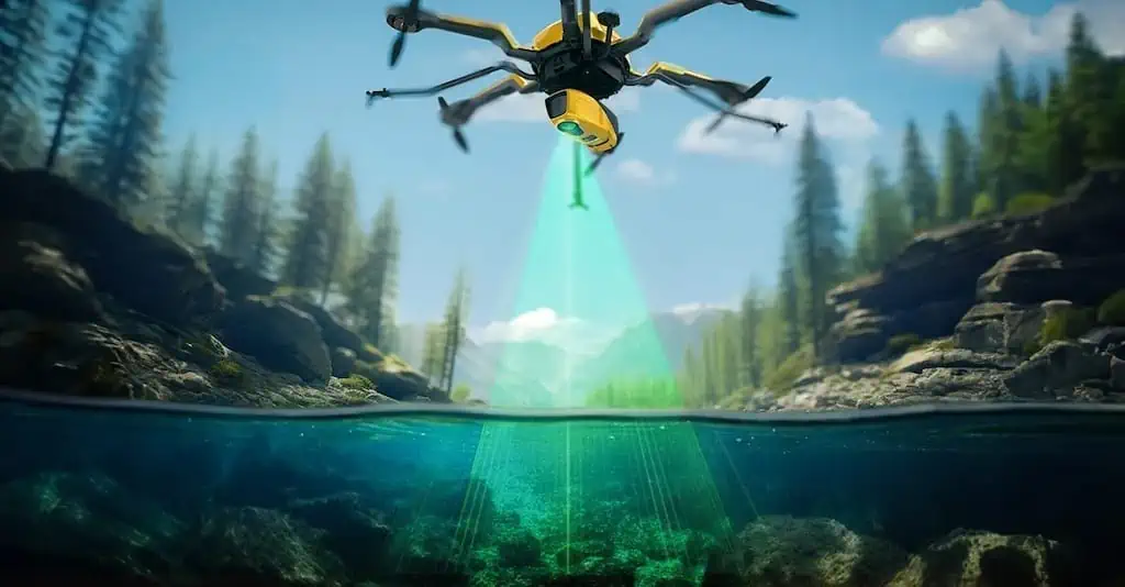
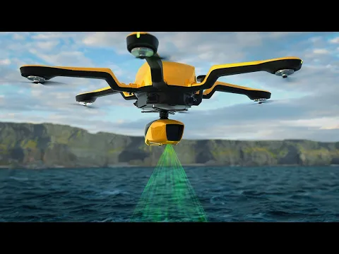
Introducing the YellowScan Navigator
This year, YellowScan is proud to launch the YellowScan Navigator, a specialized tool aimed at fulfilling the critical requirements of surveyors for mapping underwater landscapes in rivers, lakes, and coastal regions.
The YellowScan navigator represents a significant advancement in bathymetric LiDAR technology.It incorporates a laser scanning system developed internally over the past five years, rigorously tested to ensure peak performance.
Key Features and Capabilities
This compact system is optimized for mapping waterbeds at depths ranging from 0 to 3 meters, with the capability to reach depths of up to 18 meters in exceptionally clear water. It can be operated from altitudes of up to 100 meters above the water surface, delivering measurements with an extraordinary accuracy of 3 centimeters. Additionally, it includes an integrated camera for true-colour data visualization.
Expert Insights on the Navigator
Tristan Allouis, Chief Technical Officer at YellowScan, expressed his enthusiasm: “I am excited to see the YellowScan Navigator addressing a significant gap in the mapping sector and aiding society in confronting environmental challenges.”
“Having begun my career focused on bathymetric LiDAR data, I have always envisioned creating my own system. Our expertise in hardware design has empowered us to develop elegant processing algorithms, enhancing the system’s performance beyond current standards.”


