RIEGL Unveils Enhanced RiPROCESS Software for lidar Data Management
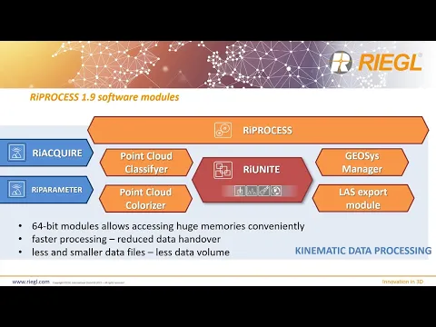
RIEGL has introduced a new iteration of its project-focused software, RiPROCESS, designed for the management and processing of LiDAR data collected from airborne, mobile, and UAV (unmanned aerial vehicle) sources. The latest version, 1.9, incorporates a novel RiUNITE software module that leverages 64-bit processing capabilities, enabling the handling of larger datasets and considerably speeding up operations through an optimized file structure and minimized data transfer times.
Enhanced Processing speed and Efficiency
With the advancements in RiPROCESS, users equipped with high-performance PCs can now process one hour of continuous scanning data in just 1.5 hours. This update has also led to a remarkable reduction in storage needs, with requirements dropping by 50-75%. Furthermore, the adjustment of scan data is now three times quicker, and the colorization of georeferenced point clouds has been streamlined to require only 25% of the previous time. Exporting these colorized point clouds as LAS 1.2 and 1.4 files can be accomplished six to ten times faster than before.
Flexible Licensing for Cloud Processing
The revamped licensing model for RiPROCESS allows users to link their licenses directly to the serial number of a RIEGL LiDAR device, eliminating limitations on the number of instances. This feature is especially beneficial for extensive data processing tasks in cloud environments, making it easier for users to manage large volumes of data efficiently.
Discover More About RiPROCESS 1.9
For further insights into the capabilities of RiPROCESS 1.9, check out RIEGL’s detailed presentation below.