
EMCORE Corporation achieves Milestone in High-Altitude Flight simulation
EMCORE Corporation, a prominent name in advanced mixed-signal technologies for the aerospace, defense, and broadband sectors, has recently marked a significant achievement in ultra-high-altitude flight simulation.
Highlighting the Simulation in Industry Publications
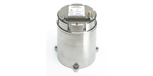
This groundbreaking simulation was highlighted in the September-October edition of Inside GNSS, in an article titled “A True Reference.” The piece focuses on CAST Navigation, a company specializing in simulators designed for testing and validating GNSS/INS performance in sophisticated navigation systems. EMCORE’s SDN500 Inertial Navigation System (INS) was a key component in this simulation.
Importance of GNSS/INS Simulators
EMCORE utilizes GNSS/INS simulators for hardware-in-the-loop testing, which is essential for confirming the anticipated performance of their algorithms.The simulation aimed to validate the velocity and altitude thresholds of a new GNSS receiver, alongside assessing the algorithm’s performance within the tactical-grade SDN500 system. The results indicated that the GNSS receiver and navigation algorithm functioned as intended across all three dynamic scenarios presented by the customer.
Insights from EMCORE Leadership
David Hoyh, EMCORE’s Director of Sales & Marketing for navigation products, expressed satisfaction with the results, stating, “We are thrilled to showcase how EMCORE leverages the capabilities of the CAST simulator to validate our product performance in real-world customer environments. I extend my gratitude to Inside GNSS and CAST navigation for allowing us to highlight the SDN500.”
Technical Specifications of the Simulation
This simulation required replicating performance at altitudes exceeding 24,000 meters and speeds surpassing 600 m/s. Only a select few aircraft, such as the SR-71 Blackbird, possess such capabilities, making actual test flights impractical. Rather, simulating the SDN500 INS test flight on a CAST system is both efficient and cost-effective. The testing process began with the SDN500 in a stationary state on the ground, transitioning into air navigation mode before executing a series of maneuvers, speed adjustments, and altitude changes to gather data on various parameters.
Maintaining Accuracy During GNSS Signal Loss
Andy Williams, Senior Field Application Engineer at EMCORE, who led the project, elaborated, “During periods when the GNSS receiver was unable to provide a valid solution, the algorithm successfully maintained an accurate navigation solution using solely the IMU (Inertial Measurement Unit) data. Moreover, there was no instability or discontinuity in the algorithm when the GNSS receiver resumed, ensuring a seamless transition. Throughout the entire profile, even during GNSS signal loss, the SDN500 consistently delivered an accurate navigation solution. This level of testing would not be feasible without the synchronized GNSS radio frequency and trajectory-matching IMU data provided by the CAST system.”
For further details, you can access the full article on the EMCORE website.


