Sonardyne’s Role in the Finding of Shackleton’s Endurance
Sonardyne has announced that its advanced underwater navigation and positioning solutions played a crucial role in the successful search for the wreck of Ernest Shackleton’s Endurance. This historic vessel was located over 3,000 meters beneath the ice in the Weddell Sea of Antarctica, after being lost for more than a century.
Innovative Search Techniques
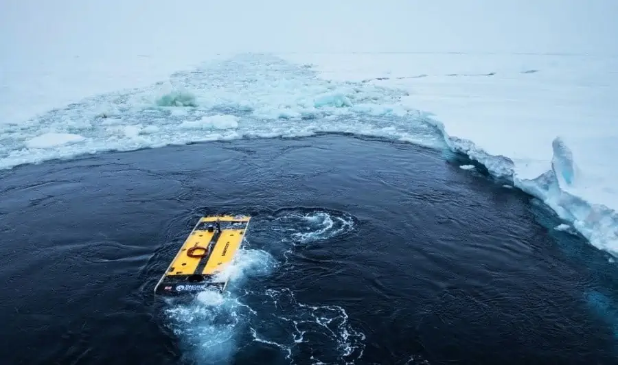
The groundbreaking expedition, known as Endurance22, utilized Saab Seaeye Sabertooth hybrid autonomous underwater vehicles (AUVs) launched from the icebreaking research vessel S.A. Agulhas II. As the team meticulously searched the seabed near the site where the 1914-1917 expedition concluded, the AUVs relied on Sonardyne’s SPRINT-Nav hybrid acoustic-inertial navigation system (INS) to chart their courses.Additionally, they employed the AvTrak 6 tracking and telemetry transceiver, which communicated commands and positional updates via a Ranger 2 Ultra-Short BaseLine (USBL) system, also provided by Sonardyne, aboard the S.A. Agulhas II.
Efficient Deployment Strategies
To facilitate deployment, the Ranger 2 was equipped with a Gyro USBL transceiver, which includes an integrated attitude, heading, and reference sensor (AHRS) and is pre-calibrated for easy use on various vessels. A secondary ranger 2 Gyro USBL system was also prepared for deployment from the ice surface, should the S.A. agulhas II encounter difficulties navigating through the sea ice.both systems operated on Low Mid Frequency (LMF), allowing for tracking capabilities exceeding 7,000 meters, which met the Endurance22 team’s under-ice tracking needs.
Collaboration with Sister Companies
Sonardyne’s sister company, Voyis, contributed essential equipment for the mission. Their Insight Pro and Observer still cameras were integrated into the Saab Sabertooth, enabling the creation of 3D models and capturing high-resolution, true-color images of the wreck, all accurately geolocated using Sonardyne’s navigation data. Additionally, EIVA, another sister company, supplied the data visualization software necessary for the project.
Reflections on the Discovery
Geraint West, Head of Science at Sonardyne, expressed his admiration for the team’s accomplishments, stating, “The achievements of the team are remarkable, especially considering the extreme depths and challenging under-ice conditions they faced. The remarkable preservation of the Endurance, resting on the seabed as if frozen in time, is truly astonishing and exceeds our expectations.”
He added, “we are proud that our positioning and navigation technology was selected to support this remarkable scientific mission, and we extend our congratulations to the Endurance22 team for their historic find. This discovery is likely just the beginning as we delve deeper into the history of this iconic ship.”


