Trakka Systems is a leading developer of state-of-the-art vision systems for C5ISR and counter-UAS missions. Our gyro-stabilized imaging gimbals, high-intensity searchlights, and video management solutions provide active and passive vision capabilities for a wide range of mission-critical applications in the air, on land and at sea, ensuring success and providing superior situational awareness for military personnel, law enforcement, first responders, mappers and surveyors, and more.
TrakkaCam – Multi-Sensor & Multi-Spectral Imaging Systems
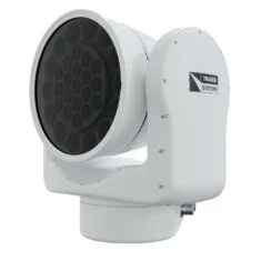
Rugged gyro-stabilized gimbals for aerial, land and maritime surveillance

Our TrakkaCam gyro-stabilized multi-sensor imaging gimbals deliver unrivalled imaging performance in a rugged weatherproof package. Built to withstand the most challenging of operating conditions, the lightweight and compact systems provide long-range daytime and night-time surveillance capabilities, with options for aerial, ground-based and maritime platforms.
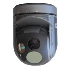
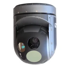
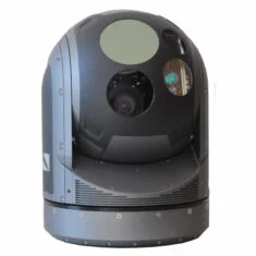
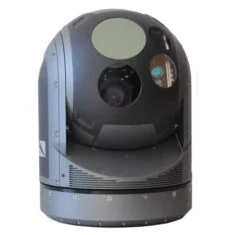
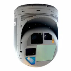 TC-375
Longest-range aerial surveillance solution with Full HD multispectral imaging
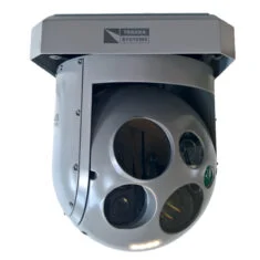
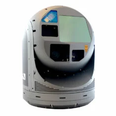
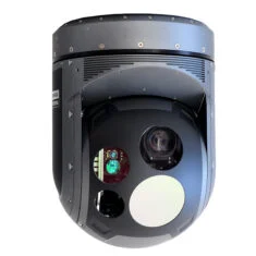 TC-300
Lightweight EO/IR aerial imaging system for fixed-wing and helicopter UAVs
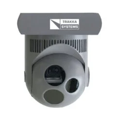
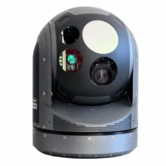
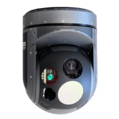 TC-300-S
Medium-range multispectral imaging system for day and night missions
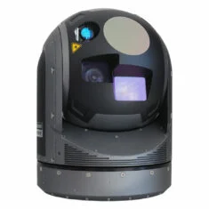
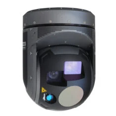 TC-300-SWIR
Multispectral drone camera gimbal with HD & SWIR capabilities
 TC-300-UC
Airborne multi-sensor surveillance system with LWIR thermal imaging
 TC-300-R
Radiometric thermal imaging & video system for real-time temperature measurement
 SWE-400-QUAD
Multispectral UAV imaging system for inspection & environmental monitoring
 SWE-200-LE
Ultra-lightweight multispectral drone camera with continuous zoom
 TC-300G
Compact long-range imaging system for ground-based military & security applications
 TC-300G-SWIR
EO & SWIR imaging system for challenging weather & atmospheric conditions
 TC-300G-S
Lightweight medium-range surveillance system for UGVs & ground-based platforms
 TC-375M
Longest-range maritime surveillance solution with Full HD multispectral imaging
 TC-300M
MIL-STD & IP66 multi-sensor imaging system for naval & maritime operations
 TC-300M-SWIR
Maritime EO & SWIR imaging system for harsh weather & smoky conditions
 TC-300M-S
Medium-range surveillance system for USVs & marine platforms
 TC-300M-UC
Maritime surveillance system with continuous zoom LWIR capabilities
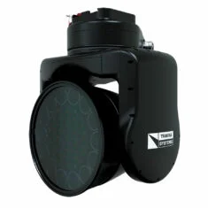
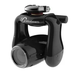
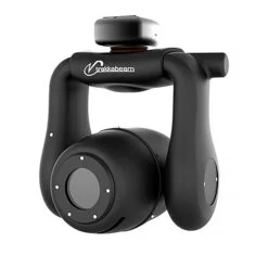
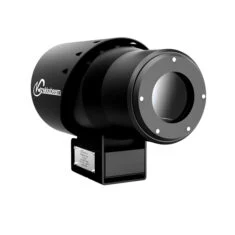
TrakkaBeam High-Intensity Searchlights (HISL)
Multi-spectral searchlights for a wide range of fixed-wing, helicopter, and unmanned systems
Our revolutionary TrakkaBeam searchlight solutions deliver enhanced visibility and operational efficiency in highly challenging conditions, with significantly lower power consumption than other systems on the market. The high-intensity searchlights are ideal for a variety of unmanned missions, and feature advanced Xenon and LED/LEP hybrid technologies, multi-spectral filter options including Covert-IR (visible with NVG’s) and are certified to DO-160 standards.
 TL-360
Lightweight hybrid LED/LEP searchlight for 360-degree illumination
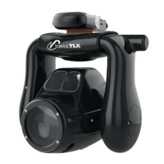
 TLX
TLX
High-intensity aerial searchlight with real-time filter selection
 TLXc
TLXc
Combined high-intensity searchlight & EO/IR camera system
 A800
A800
Rugged tactical illumination solution for UAVs
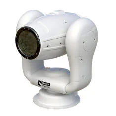 TLX-M
TLX-M
Rugged maritime searchlight for all-weather operation
 TLXc-M
Combined maritime searchlight & EO/IR camera system
 TL-360-M
360-degree hybrid LED/LEP searchlight for maritime applications
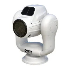
 M800
M800
Remotely-controlled multi-mission searchlight with real-time filter selection
TrakkaMaps – Video Management System
Mission mapping & video management software for GCS
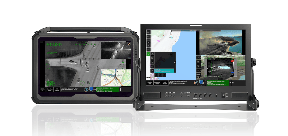
TrakkaMaps is an advanced drone mission mapping and video management platform that can be installed on a wide variety of ground control station (GCS) and computer hardware such as tablets and ruggedized laptops.
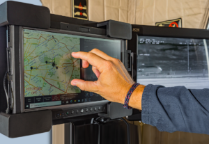
Featuring highly intuitive touchscreen controls, the powerful software provides tools for mission planning, recording, analysis and reporting. Full-featured mapping capabilities include augmented reality (AR) overlays of geographic information and points of interest on the live video display.
TrakkaMaps is an ideal complement to our advanced camera and searchlight systems, which can be slaved to anywhere on the map to ensure reduced workload and cognitive burden for sensor operators.
Total Mission Solutions
Integrated vision systems for UAV mission support
Trakka Total Mission Solutions combine our TrakkaCam surveillance systems, TrakkaMaps video management system, and TrakkaBeam spotlights into seamlessly integrated and fully customizable packages that enhance mission effectiveness and provide a complete and unmatched operating picture.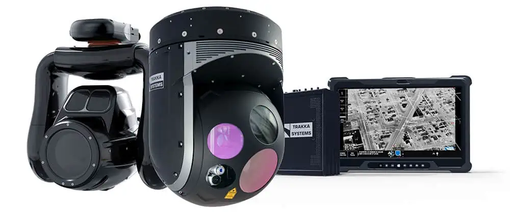
Suitable for a wide range of fixed-wing and helicopter UAV platforms, Total Mission Solutions reduce integration and delivery times and interfacing issues, making them ideal for systems integrators and OEMs. All systems can be thoroughly tested before delivery, offering you complete confidence and peace of mind.
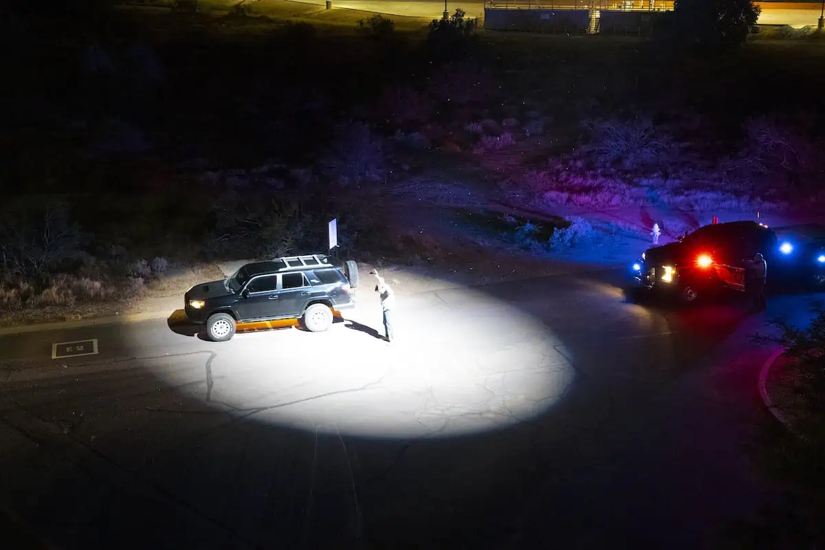
Trakka Interceptor Protection Systems – CUAS & C5ISR
Mobile counter-UAS & C5ISR mission management systems

Our Trakka Interceptor Protection Systems (TIPS) are next-generation mobile mission management solutions, designed for counter-drone and C5ISR applications and customizable to your exact requirements. Based around our leading surveillance systems, searchlights, and mapping and management software, they can be easily integrated with third-party detection and defeat equipment such as radars, acoustic detectors, RF detectors and jammers. 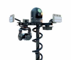
TIPS-C is a specialized and highly mobile CUAS solution designed to deal with the rise in rogue drone threats. Capable of detecting and defeating single aircraft as well as swarms, the versatile drone detection system features integrated slew-to-cue camera operations for visual threat assessment, and can be easily installed into land vehicles such as pickup trucks.
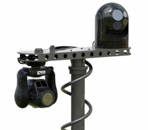 TIPS-I is a powerful intelligence, surveillance and reconnaissance solution that allows operators to share mission-critical C5ISR information in real time.
Capable of detecting vehicles at distances of up to 26 kilometers and humans at up to 18 kilometers, the mobile command and control center is ideal for border control, force protection, infrastructure protection, route clearance and more.


