
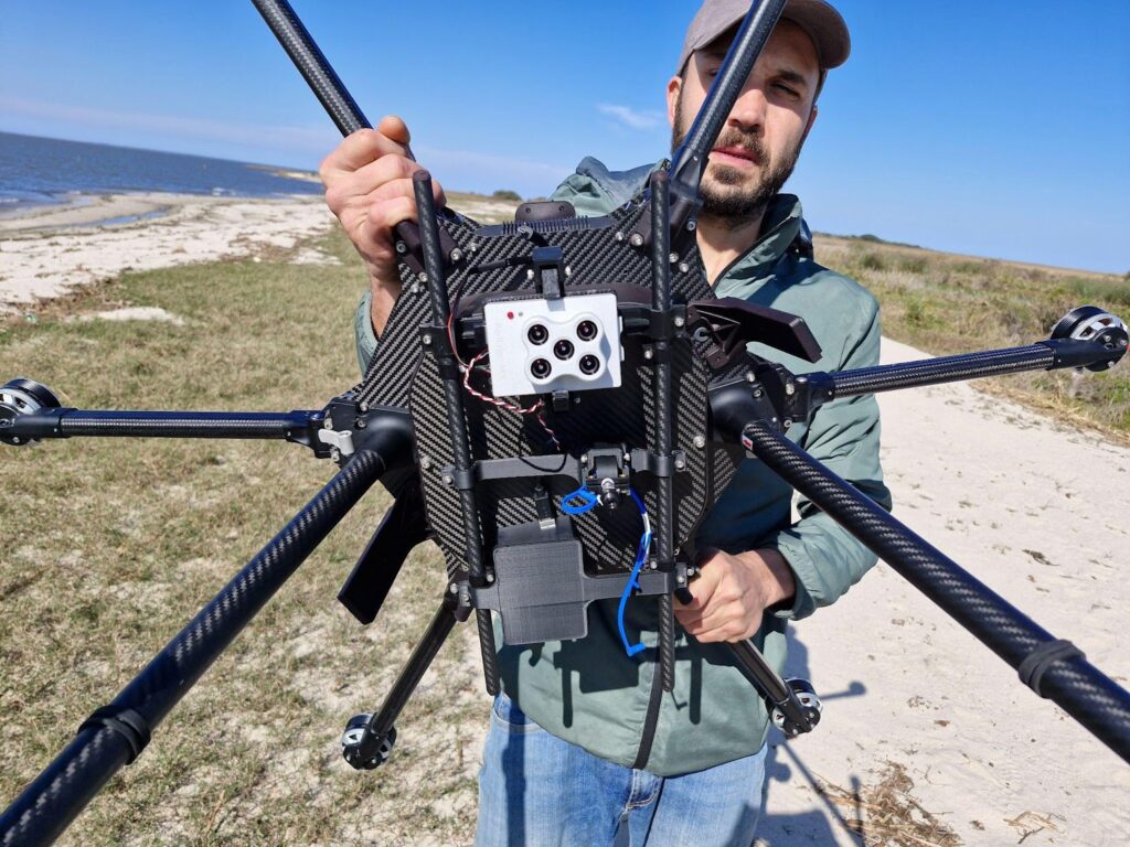
IF1200 outfitted with RedEdge-MX,OceanOptics USB-650,and DLS2 sensors.
Utilizing uavs for Enhanced Water Quality Monitoring
The article Mapping Water Quality from Above by Inspired Flight explores a significant study in southern Brazil, where the Inspired Flight IF1200 drone was employed for effective water quality assessment.
Innovative Data Collection Techniques
Researchers from various Brazilian institutions utilized the drone in the São Gonçalo Channel to gather high-resolution spectral data, overcoming the challenges posed by conventional satellite imagery and manual sampling methods. Key locations for monitoring included river discharge points, industrial zones, and estuarine regions.
Advanced Sensor Technology
The UAV was fitted with cutting-edge sensors, such as the RedEdge-MX multispectral camera, the OceanOptics USB-650 hyperspectral radiometer, and the DLS2 downwelling light sensor, facilitating near real-time data acquisition. Operating at altitudes between 50 and 80 meters,the spectral data collected by the IF1200 was validated against Sentinel-2 satellite imagery and in-situ radiometer measurements,demonstrating comparable accuracy levels. The research team highlighted the benefit of obtaining timely water quality information without reliance on satellite availability.
Data Processing and Validation
To maintain data integrity and precision, a systematic workflow was employed using the DroneWQ Python package.This process included sun-glint removal through the Hedley Method, atmospheric correction via ACOLITE, and the submission of algorithms such as those developed by Dogliotti et al. (2015) for turbidity and CDOM evaluations. cross-validation with satellite and in-situ data resulted in a mean absolute percentage error of only 15%.
Broader Implications and Applications
The article also discusses the practical implications of this UAV-driven methodology in fields like environmental monitoring, industrial compliance, and emergency response. By integrating drone technology with multisensor payloads and algorithmic data analysis,the study introduces a versatile and adaptive approach to water quality evaluation. As the demand for environmental data continues to rise, this method serves as a valuable resource for informed decision-making across research, industry, and policy sectors.
Explore the original article >>


