Engineered for Professionals. Supported by Excellence.
Established in 2016 in Mississippi,WISPR systems set out with a clear mission: to create drones that professionals can depend on consistently. No frills, no foreign components—just robust, American-manufactured drones designed to perform reliably in the field. We focus on durable, ready-to-use drone solutions tailored for experts in surveying, mapping, telecommunications, utilities, public safety, and other hands-on sectors. When the task is tough,WISPR is already on the scene.
Our origins in Mississippi instill a sense of hard work and dedication in every drone we produce. From the initial design phase to customer service, we embody the values of our home state: resilience, creativity, and a commitment to excellence.
Collaboration is key. WISPR teams up with industry leaders like Sony,Teledyne,YellowScan,Gremsy,and Inertial Labs to provide integrated,job-ready drone systems.These alliances keep us at the forefront of payload and sensor technology while ensuring our products remain rugged,scalable,and focused on professional needs.
Each WISPR drone adheres to NDAA compliance standards—without exception. This commitment goes beyond mere compliance; it reflects our dedication to security and performance. We offer both NDAA-compliant (blue) and non-compliant (black) Herelink controller options, but all our drones maintain full NDAA compliance, regardless of the controller selected.
WISPR skyscout™
Compact Quadcopter Drone – Portable, Accurate, and Airworthy
The SkyScout is a lightweight quadcopter that packs a punch.Designed for professionals who need to act quickly and require high performance in the field—be it for surveying, inspecting, or mapping.


Next
Key Features:
- Hot-swappable batteries – No downtime between flights
- Advanced dampening mount – Stable imaging, even in turbulence
- Dual-band RTK – Achieve centimeter-level precision consistently
- Integrated collision avoidance – Enhanced safety and operational efficiency
- Automatic geotagging – Effortless data capture, ready for processing
Payload Options:
- Gremsy Vio – EO/IR with 4K zoom, 640×512 thermal, 2400m laser rangefinder
- Sony ILX-LR1 – 61MP full-frame powerhouse for photogrammetry
- WISPR 24MP Mapper – RTK/PPK enabled with Sony APS-C sensor
- RESEPI Lite M2X – Lightweight lidar for extensive coverage
- RESEPI Ultra Lite XT32 – Compact LiDAR with high-density output
- Teledyne Echo One – NDAA-compliant, 8 returns, a game-changer
- YellowScan Surveyor ultra / Mapper+ – High-performance mapping, field-tested
Discover more: WISPR SkyScout – Professional Quadcopter Drone
WISPR Ranger Pro™
Heavy-duty Quadcopter Drone – High Payload Capacity, Exceptional Durability.
The Ranger Pro is a robust carbon fiber quadcopter designed to withstand harsh environments and unpredictable conditions. Facing winds over 50 mph? It will fly. Encounter a system anomaly? It will safely land itself. This drone is bright,resilient,and built to accomplish your tasks effectively.


Standard Features:
- Omnidirectional LiDAR obstacle detection
- Autonomous fail-safes (return-to-home, low battery, vibration alerts)
- Payload flexibility without compromise
- quick deployment in the field, even under pressure
Payload Capabilities:
- Gremsy Vio – Combines thermal and visual data in one compact unit
- Sony ILX-LR1 – High-resolution 61MP camera for precise mapping
- WISPR 24MP Mapper – Lightweight, powerful, and RTK-ready
- RESEPI Gen-II M2X – Extended-range LiDAR compatible with Sony ILX-LR1
- RESEPI XT32 – Merges accuracy with versatility
- Teledyne Echo One – Compact, NDAA compliant, and highly accurate
- YellowScan Surveyor Ultra / Explorer – Long-range, pinpoint accuracy
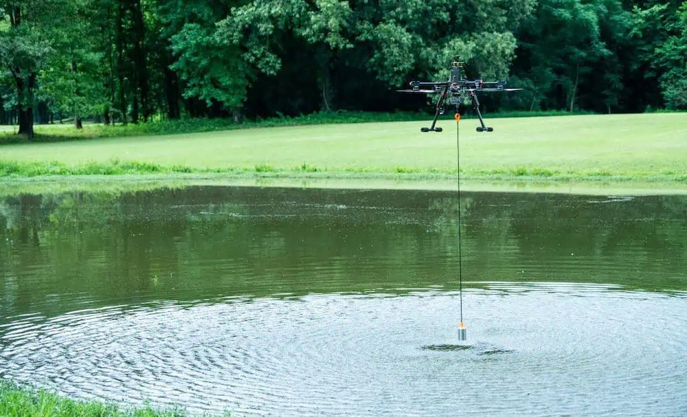
- Dual-Frequency EchoSounder – Enables drone-based bathymetry without a boat
- Laser Falcon methane Detector – Accurately identifies gas leaks using IR spectroscopy
Discover more: WISPR Ranger Pro – Industrial Quadcopter Drone
Designed for Industry. Not Just Hype.
The SkyScout and Ranger Pro are straightforward, high-function drones designed for the demanding tasks that consumer-grade equipment simply cannot handle. They excel in challenging environments—on-site,in the elements,delivering real results.
Use cases
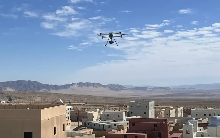
Surveying & Mapping Transform raw landscapes into detailed 3D maps using high-resolution imaging and LiDAR technology. Whether navigating rugged terrain or dense foliage, WISPR drones are equipped to handle the task.
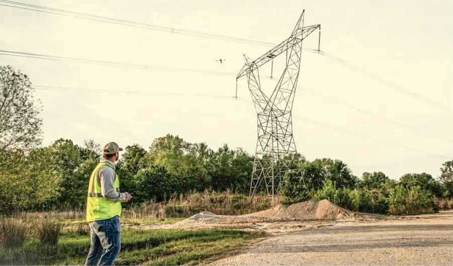
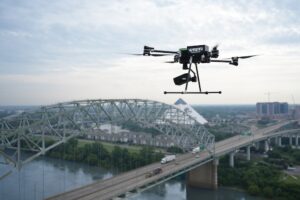
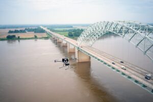
Infrastructure Inspection Need to inspect bridges, towers, or substations? Obtain close-up visuals without risking personnel. Safe,quick,and detailed.
Public Safety & Emergency Response For search and rescue, fire monitoring, or disaster response, the SkyScout and Ranger Pro provide thermal imaging and real-time data when it matters most.
Environmental Monitoring Evaluate vegetation, track wildlife, or monitor emissions with payloads designed for environmental research and data accuracy.
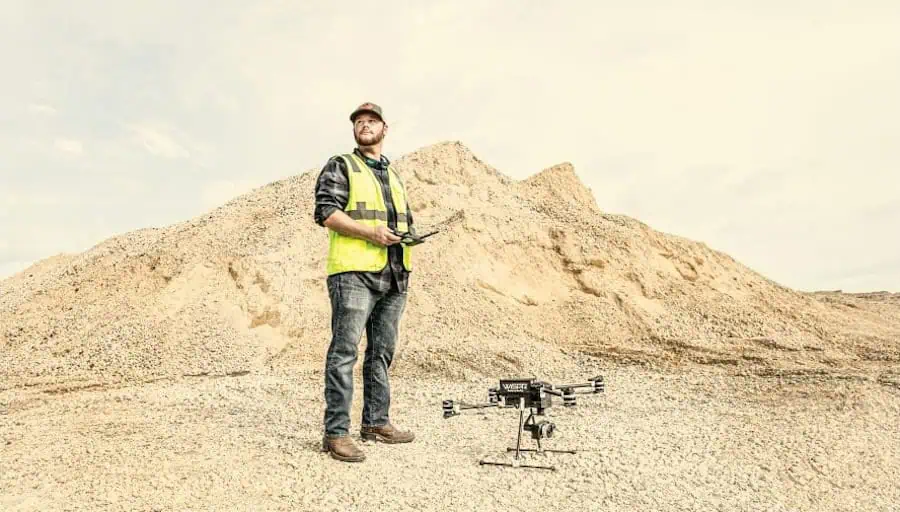
Agriculture Cover more area in less time. From crop health assessments to soil condition mapping, our drones empower agricultural professionals to make informed decisions swiftly.
And it doesn’t end there – our open payload architecture ensures your drone evolves with your needs. As new tools become available,your WISPR is ready to adapt.
American-Made. NDAA Compliant. Empowering professionals.
This is not just a generic quadcopter dressed up as an industrial tool. WISPR creates instruments, not toys. Every system is designed and assembled in the U.S.A. by a team that values personal interaction and product support.
When you choose WISPR, you’re investing in more than just hardware; you’re gaining access to ongoing training, U.S.-based support, and a strategic roadmap that keeps you ahead of the competition. From the job site to mission-critical operations, we stand by you every step of the way.
Ready to enhance your efficiency, elevate your operations, and leave compromises behind? Let’s connect >