Unlocking precision: The Impact of Trimble’s CenterPoint RTX on UAV Technology
Experts from Trimble Applanix delve into the transformative benefits of CenterPoint RTX technology for UAV applications,highlighting it’s ability to facilitate high-accuracy positioning without the need for base stations,optimize drone workflows,and adapt to the changing landscape of regulatory requirements for BVLOS and autonomous operations.
Understanding CenterPoint RTX: A Leap Beyond Conventional GNSS
CenterPoint RTX stands apart from conventional GNSS correction techniques such as RTK or PPK, which rely on nearby base stations or RTK networks. Instead, RTX operates as a global service, providing centimeter-level corrections through satellite or internet connectivity, eliminating the necessity for local infrastructure. This capability allows UAVs to achieve precise GNSS positioning anywhere on the globe, bypassing the complexities of base station setup and maintenance.
This feature is notably beneficial in remote regions lacking cellular service or in environments where establishing a base station is impractical, such as over oceans, dense forests, or international borders. Since RTX does not depend on a fixed base location, UAVs can efficiently cover extensive areas without the risk of losing correction coverage. The positioning accuracy consistently ranges from 2 to 5 centimeters worldwide, making it ideal for high-precision tasks like large-scale mapping.
Real-World Applications: Success Stories of RTX in Action
While specific case studies remain confidential, numerous instances demonstrate RTX’s significant enhancements in various UAV applications. For example, in large-scale mapping and surveying, RTX enables operators to cover vast areas without relocating base stations, resulting in substantial time and cost efficiencies.
In infrastructure inspections, such as monitoring power lines or pipelines, RTX ensures consistent positional accuracy throughout the entire route, thereby enhancing data quality. Additionally, in precision agriculture, accurate GNSS positioning bolsters the reliability of drone-based crop monitoring and resource management. In challenging or remote locations where base stations are difficult to establish, RTX’s global coverage proves invaluable, facilitating accurate data collection without local GNSS infrastructure.
Integrating RTX: The role of Trimble Applanix Software in UAV Workflows
trimble Applanix plays a crucial role in incorporating RTX corrections into UAV mapping workflows. The APX RTX GNSS-inertial solution utilizes CenterPoint RTX corrections to provide real-time position and orientation data with centimeter-level accuracy. Following the flight, the POSPac UAV post-processing software refines this data further using RTX corrections, all without the need for base stations.
This configuration allows UAVs to produce accurate mapping-grade data in real time, supporting the creation of geospatial products such as LiDAR point clouds or orthophotos while still airborne. It also automates aspects of the mapping process, as high-accuracy positioning reduces the necessity for extensive ground control points.Furthermore, by eliminating base stations from the workflow, issues like datum inconsistencies and setup-related errors are minimized, streamlining and accelerating data delivery.
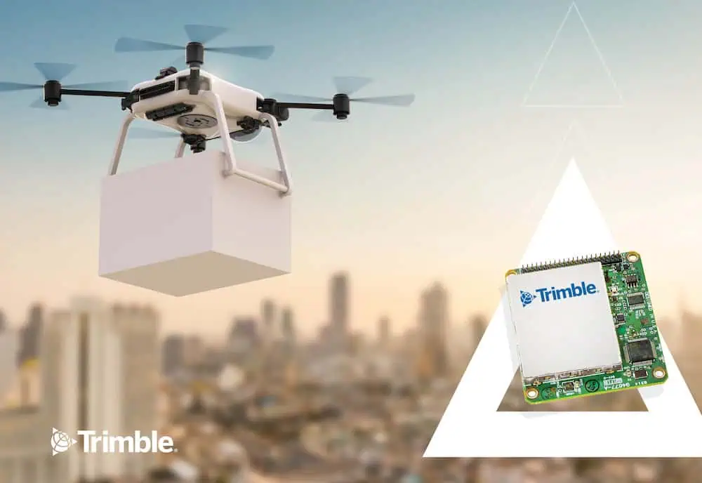
Enhancing Autonomous Drone Delivery: The Precision of RTX corrections
In the realm of autonomous drone delivery, precise positioning is paramount, particularly for the final step of accurately placing packages. RTX substantially contributes by providing drones with real-time, centimeter-level accuracy within a fixed global reference frame, ensuring they always know their exact location relative to the Earth.
Unlike standard GNSS, which can experience drift over time, RTX continuously corrects these errors, maintaining the drone’s position stability throughout the flight. This level of accuracy enables drones to adhere to their pre-programmed flight paths with high confidence, landing precisely at designated drop-off points, even in complex or constrained environments. This capability not only facilitates successful deliveries but also enhances operational safety by minimizing the risk of navigation errors during critical flight phases.
Future Directions: Trimble’s Vision for Advancing RTX in UAV Operations
Trimble is committed to evolving RTX to meet the demands of changing UAV regulations and Beyond Visual Line of Sight (BVLOS) operations. A primary focus is on enhancing the reliability and robustness of the correction service, including the introduction of redundancy to ensure continuous and dependable positioning, particularly in scenarios lacking direct human oversight.
Additionally,efforts are underway to reduce convergence times,allowing for quicker attainment of full accuracy—an essential advantage when UAVs need to launch rapidly or operate in dynamic environments. Improving integration with other onboard navigation systems, such as Inertial Measurement Units (IMUs), is also a priority, enhancing positioning performance in challenging conditions like urban settings or under dense canopies.
Concurrently, trimble is ensuring that RTX meets or exceeds regulatory accuracy and integrity standards for BVLOS and other advanced UAV operations. As urban air mobility becomes increasingly feasible, RTX is poised to deliver the precision and reliability necessary for navigation and collision avoidance in crowded, complex airspace.


