trimble Applanix specializes in cutting-edge GNSS-inertial systems, software, and solutions that deliver extraordinary accuracy and efficiency across airborne, terrestrial, and maritime applications. With over 30 years of pioneering advancements, Applanix has established itself as a leader in the industry.
Direct georeferencing Solutions by Applanix
Optimize Costs and Improve Mapping and Navigation Efficiency
For aerial mapping, Trimble Applanix offers precise solutions tailored for both unmanned and manned aircraft.
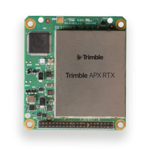
- The innovative APX RTX for unmanned surveys: This system provides top-tier direct georeferencing solutions for UAV mapping sensors, allowing OEMs and drone payload integrators to achieve high-accuracy mapping in diverse environments. with both real-time and post-mission georeferencing, the APX RTX ensures centimeter-level accuracy automatically, eliminating the need for base stations.
- AP+ Air board sets
- APX UAV product range
Discover more: Applanix Direct Georeferencing for UAVs
Trimble PX-1 RTX
OEM GNSS/INS System for UAV Navigation 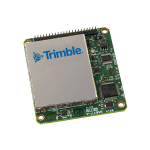
Experience reliable precision in every surroundings with the Trimble PX-1 RTX, which guarantees dependable positioning and heading, enabling drones to perform accurate mapping and navigation tasks.
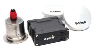
Applanix POS LV
GNSS-Aided Inertial System for Land-Based Mobile Mapping
The Applanix POS LV provides stable and reliable positioning for land vehicles. Our GNSS-aided inertial systems (combining GNSS and INS) facilitate autonomous vehicle navigation in intricate scenarios. Key offerings include:
- Applanix AP+ Land: A robust GNSS-inertial OEM system
- Trimble RT 200: A high-precision positioning system designed for autonomous applications
Explore Our Accurate and Precise Positioning Solutions for Vehicle Automation
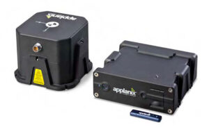
Applanix POS MV
Positioning, Heading & Attitude Measurement System for Marine Applications
Applanix POS MV serves as a comprehensive positioning, heading, and attitude measurement system for Unmanned Surface Vehicles (USVs) and remote sensing platforms, delivering precise data for hydrographic surveys, including seafloor and coastline mapping.
Comprehensive Solutions for All Applications
Trimble Applanix provides tailored solutions for terrestrial, aerial, and marine applications. Rely on Trimble Applanix for your positioning needs.
For further details, visit Trimble Applanix.


