UAV Navigation stands at teh forefront of developing advanced guidance, navigation, and control (GNC) systems for drones and unmanned aerial vehicles (UAVs). Our dependable autopilots and navigation solutions have been chosen by top-tier aerospace manufacturers for integration into various platforms, including high-performance tactical UAS, VTOL fixed-wing aircraft, aerial targets, and unmanned helicopters.
As a member of Grupo Oesía,a fully Spanish-owned private consortium,UAV Navigation is committed to pioneering innovative technologies for the aerospace,defense,and security sectors. the Group boasts a proven history of supplying avionics for platforms like the Eurofighter EF-2000, F-18 fighter jets, and Airbus A400M Atlas, and is actively engaged in cutting-edge unmanned aircraft initiatives such as Eurodrone and the Future Combat Air System.
explore our products:
- Autopilots
- Navigation Systems
- Ground Control station Hardware & Software
- Mission Control Computers
- Simulators
- Peripherals
Autopilot Systems
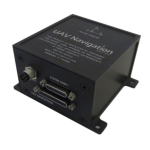
VECTOR-600
State-of-the-art flight control system for fixed-wing and VTOL UAVs
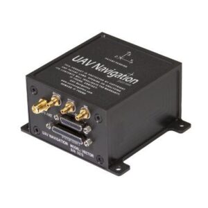
The VECTOR-600 represents UAV navigation’s pinnacle of autopilot technology, featuring integrated physical and logical redundancy that ensures precise attitude and position estimates, even in the event of sensor failures. Built to DO-178C standards, it’s user-friendly software allows for rapid configuration of diverse autonomous tasks.
This system’s hardware complies with stringent standards, including MIL-STD-810F for environmental resilience and MIL-STD-461F for electromagnetic interference and compatibility.
VECTOR-400
Military-grade autopilot tailored for aerial target applications
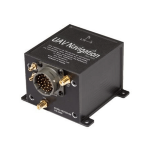
the VECTOR-400 is a complex autopilot engineered for aerial target operations, designed to endure the challenges of high-speed maneuvers. It excels even in GNSS-denied environments, such as during jamming, and supports fully autonomous functionality with built-in redundancy.
This compact autopilot integrates seamlessly with various avionics systems and offers built-in datalink capabilities. It adheres to military standards,including MIL-STD-461 for EMI/EMC compliance.
Discover more: UAV Autopilot Solutions
Navigation Solutions
GNSS-Denied Navigation Kit
Integrated AHRS and visual navigation for reliable dead reckoning
The GNSS-Denied navigation Kit merges our POLAR-300 AHRS with the VNS01 Visual Navigation System and a dependable Air Data System (ADS) to ensure accurate and stable dead reckoning navigation in GNSS-denied scenarios. It effectively counters advanced jamming and spoofing threats, maintaining error rates as low as 1% over extended distances.
This lightweight and compact system features simplified wiring for effortless integration, making it ideal for Class I and II UAVs.
POLAR-300
Comprehensive air data, AHRS & INS unit for UAVs
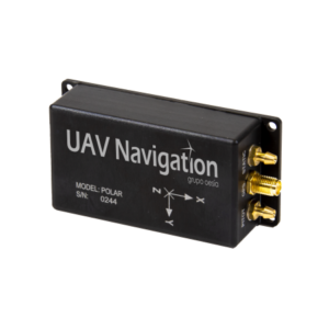
The POLAR-300 integrates an air data system with MEMS-based AHRS and INS,featuring redundant IMUs for a high-performance solution in precision attitude estimation and dead reckoning navigation. It is compatible with UAV Navigation’s DGC01 Dual GNSS Compass for enhanced accuracy in static applications.
The unit is housed in a robust aerospace-grade anodized aluminum enclosure, facilitating easy integration across various platforms.
POLAR-500
AHRS-IMU system with dual GNSS compassing
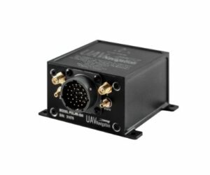
The POLAR-500 combines an Air Data and Attitude Heading Reference System with a dual GNSS compass, offering precise attitude and heading estimation and delivering azimuth and elevation angles via ARINC 429 standard output. This system is perfect for stabilizing and directing UAV SATCOM antennas.
The compact,low-power unit is encased in a durable aluminum housing,ensuring easy integration into a variety of platforms.
VNS01
Visual navigation system for environments without GNSS
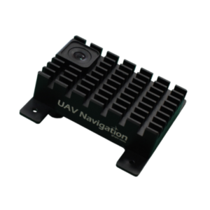
The Visual Navigation System (VNS01) employs an onboard camera along with advanced visual odometry and pattern recognition to construct an internal map for continuous positioning and navigation in GNSS-denied environments. By integrating with other onboard sensors, it provides the flight computer with high-precision absolute positioning, orientation, and relative movement data.
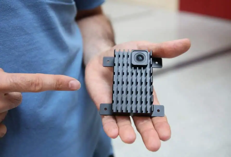
This compact and lightweight unit features straightforward wiring and is specifically designed for NATO Category I and II UAS.
DGC01
Dual GNSS compass for precise heading estimation
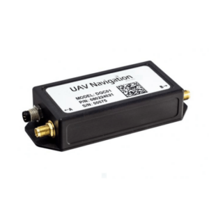
The DGC01 delivers high-precision heading estimation without relying on magnetic sensors, achieving accuracy of up to 0.3 degrees in both static and dynamic conditions. Utilizing GNSS interferometry,it can enhance the heading estimation from existing systems or serve as a backup when magnetometer performance is compromised by electromagnetic interference.
MG01
Self-contained magnetometer for dynamic UAV operations
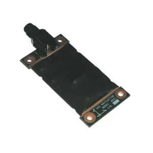
The MG01 is a self-contained magnetometer designed to deliver accurate 3D magnetic field measurements in highly dynamic environments. It can be easily mounted on UAV wings or fuselages, positioning it away from other onboard systems that may disrupt magnetic readings. With advanced algorithms, the MG01 enhances the autopilot’s heading facts and attitude calculations.
Learn more: UAV Navigation Systems
Ground Control Station Solutions
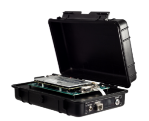
GHU-100
ground control hardware hub for multi-device networking
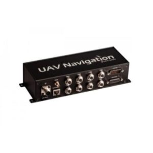
The GHU-100 Ground Hub Unit is engineered to provide a cohesive networking solution for complex ground control setups, linking computers, multiple datalinks, joysticks, and various essential hardware. It offers a wide array of I/O options, including serial, Ethernet, CAN, and adcs, and features a proprietary RTOS for enhanced safety and security.
With an IP66 rating, this rugged unit is perfect for maritime USV operations as well as UAV and UGV control stations.
Visionair
Ground control software for mission planning and analysis
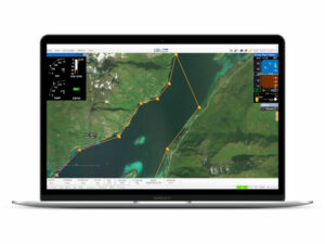
UAV Navigation’s Visionair ground control station software provides a user-friendly, all-in-one solution for UAV mission planning, execution, and post-mission analysis. Its highly customizable interface allows users to design and adjust flight plans with optimal waypoint distribution, along with a variety of useful features such as gauges, alarms, and 3D visualizations via Google Earth.
Find out more: UAV Ground Control Station Solutions
Mission Control Computers
VECTOR-MCC
mission control computer for independent payload management
The VECTOR-MCC is a UAV mission control computer that enables separate management of payloads and mission tasks, independent of the autopilot.This design allows developers to create a segregated architecture that mitigates flight safety risks in the event of MCC failure, facilitating the development of drivers for non-critical payloads and simplifying DAL certification.
The VECTOR-MCC also enhances the I/O capabilities of the VECTOR autopilot,allowing for integration with a variety of third-party hardware.
Learn more: UAV Mission Control Computers
Simulation Tools
VECTOR-HIL
hardware-in-the-loop UAV training simulator
VECTOR-HIL is a sophisticated hardware-in-the-loop UAV simulator, perfect for operator training and product demonstrations. Utilizing advanced software models, it realistically simulates various environmental conditions and sensor inputs, providing a comprehensive 3D visualization of the UAV and its surroundings.
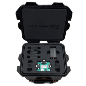
VECTOR-SIL
Software-in-the-loop UAV simulator for foundational testing and training
The VECTOR-SIL software-in-the-loop simulator allows pilots to train with simulated missions based on the Visionair GCS software, enabling them to review flight plans and safety conditions while testing new functionalities.
This compact unit connects directly to a laptop or PC, allowing users to quickly set up and engage in safe, realistic training scenarios.
Explore further: UAV Simulation Tools
Peripheral Devices
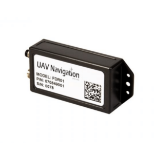
FDR01
Flight data recorder for uavs and unmanned systems
The FDR01 Flight Data Recorder captures and stores telemetry, sensor data, and control commands via a serial interface, boasting over 4000 hours of recording capacity. With a compact design and IP66-rated enclosure, it is well-suited for USVs, UGVs, and drones.
Discover more: UAV Peripheral Devices


